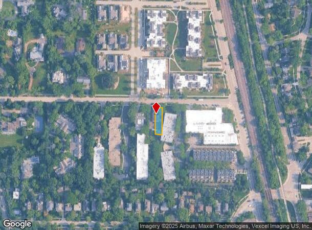
Property Record
133 E Laurel Ave, Lake Forest, IL 60045


NEARBY LISTINGS FOR SALE OR LEASE
Property Detail
133 E Laurel Ave
Chicago-Naperville-Elgin, IL-IN
Western Addn.
12-28-307-008
WESTERN ADDN. W 40 FT OF E 190.86 FT OF N 150 FT LOT 5
Commercialbuilding
Lake
X
Illinois
17097C0189L
5
2023
0.14 AC
2024
Central North
863500
Chicago
6,492 SF
DEMOGRAPHICS near 133 E Laurel Ave
1 Mile
3 Mile
5 Mile
2024 Total Population
5,282
26,115
69,232
2029 Population
5,272
26,122
68,868
Pop Growth 2024-2029
(0.19%)
+ 0.03%
(0.53%)
Average Age
44
42
39
2024 Total Households
2,093
9,346
22,591
HH Growth 2024-2029
(0.33%)
(0.02%)
(0.60%)
Median Household Inc
$135,037
$158,738
$113,616
Avg Household Size
2.30
2.60
2.60
2024 Avg HH Vehicles
2.00
2.00
2.00
Median Home Value
$674,081
$767,989
$644,559
Median Year Built
1966
1973
1974
Nearby Places
Map Layers
Map Styles
 Street
 Aerial
- Restaurants
- Banks
- Shops
- Fitness
- Groceries
PUBLIC TRANSPORTATION
COMMUTER RAIL
Lake Forest Station (Up-North) (Union Pacific North Line - Northeast Illinois Regional Commuter Railroad (Metra))
DRIVE
WALK
Distance
Lake Forest Station (Up-North) (Union Pacific North Line - Northeast Illinois Regional Commuter Railroad (Metra))
1 min
14 min
0.6 mi
Lake Bluff Station (Union Pacific North Line - Northeast Illinois Regional Commuter Railroad (Metra))
DRIVE
WALK
Distance
Lake Bluff Station (Union Pacific North Line - Northeast Illinois Regional Commuter Railroad (Metra))
5 min
2.0 mi
AIRPORT
Chicago O'Hare International
DRIVE
WALK
Distance
Chicago O'Hare International
37 min
25.3 mi
Freight Ports
Port Milwaukee
DRIVE
WALK
Distance
Port Milwaukee
68 min
55.7 mi
SALE & LEASE HISTORY
LISTING DATE
SALE/LEASE

Feb 22, 2022
For Lease
Nearby Properties
Address
Land Use
TOTAL SIZE
Lot Size
Zoning
Address
Land Use
TOTAL SIZE
Lot Size
Zoning
296.29 AC
Address
Land Use
TOTAL SIZE
Lot Size
Zoning
51,750 SF
48.98 AC
Address
Land Use
TOTAL SIZE
Lot Size
Zoning
13.85 AC
Address
Land Use
TOTAL SIZE
Lot Size
Zoning
17.35 AC
Address
Land Use
TOTAL SIZE
Lot Size
Zoning
253,218 SF
2.88 AC
Address
Land Use
TOTAL SIZE
Lot Size
Zoning
7.98 AC
Address
Land Use
TOTAL SIZE
Lot Size
Zoning
70,404 SF
0.65 AC
Address
Land Use
TOTAL SIZE
Lot Size
Zoning
25.66 AC
Address
Land Use
TOTAL SIZE
Lot Size
Zoning
10.68 AC
Address
Land Use
TOTAL SIZE
Lot Size
Zoning
15.47 AC
Address
Land Use
TOTAL SIZE
Lot Size
Zoning
16.06 AC
Address
Land Use
TOTAL SIZE
Lot Size
Zoning
7.99 AC
Address
Land Use
TOTAL SIZE
Lot Size
Zoning
225,626 SF
4.11 AC
Address
Land Use
TOTAL SIZE
Lot Size
Zoning
68,100 SF
1.28 AC
Address
Land Use
TOTAL SIZE
Lot Size
Zoning
32,017 SF
1.83 AC
Address
Land Use
TOTAL SIZE
Lot Size
Zoning
9.04 AC
Address
Land Use
TOTAL SIZE
Lot Size
Zoning
248,232 SF
18.91 AC
Address
Land Use
TOTAL SIZE
Lot Size
Zoning
94,995 SF
7.67 AC
Address
Land Use
TOTAL SIZE
Lot Size
Zoning
93,489 SF
0.36 AC
Address
Land Use
TOTAL SIZE
Lot Size
Zoning
78,466 SF
13.34 AC
Address
Land Use
TOTAL SIZE
Lot Size
Zoning
12.61 AC
Address
Land Use
TOTAL SIZE
Lot Size
Zoning
Address
Land Use
TOTAL SIZE
Lot Size
Zoning
7.42 AC
Address
Land Use
TOTAL SIZE
Lot Size
Zoning
1,513,503 SF
32.43 AC
Address
Land Use
TOTAL SIZE
Lot Size
Zoning
167,664 SF
2.91 AC
Address
Land Use
TOTAL SIZE
Lot Size
Zoning
168,628 SF
1.11 AC
Address
Land Use
TOTAL SIZE
Lot Size
Zoning
65,228 SF
7.70 AC
Address
Land Use
TOTAL SIZE
Lot Size
Zoning
51,564 SF
1.67 AC
Address
Land Use
TOTAL SIZE
Lot Size
Zoning
10.90 AC
Address
Land Use
TOTAL SIZE
Lot Size
Zoning
183,110 SF
7.53 AC
The World's #1 Commercial Real Estate Marketplace
Connect with us
© 2026 CoStar Group
The information above has been obtained from sources believed reliable. While we do not doubt its accuracy we have not verified it and make no guarantee, warranty or representation about it. It is your responsibility to independently confirm its accuracy and completeness. Any projections, opinions, assumptions, or estimates used are for example only and do not represent the current or future performance of the property. The value of this transaction to you depends on tax and other factors which should be evaluated by your tax, financial, and legal advisors. You and your advisors should conduct a careful, independent investigation of the property to determine to your satisfaction the suitability of the property for your needs.