Property Record
133 E Main St, Azle, TX 76020
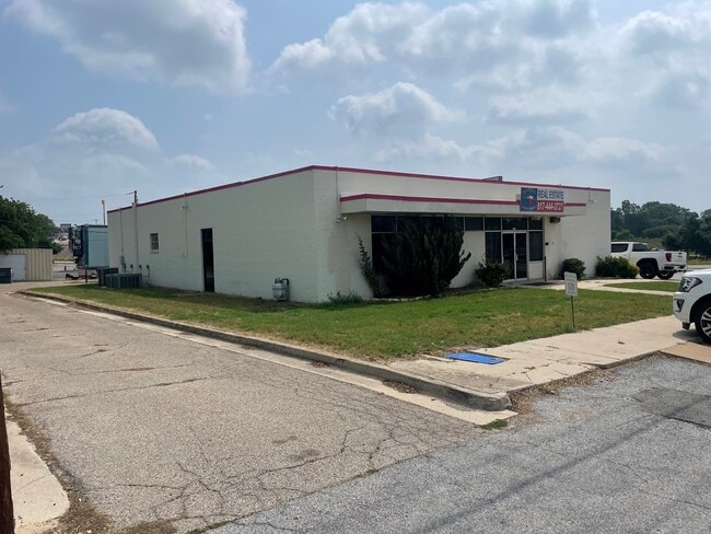

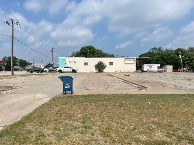
Property Detail
133 E Main St
03829766
CURTIS, BENJAMIN F SURVEY ABSTRACT 344 TRACT 1K
Commercialnec
Tarrant
AE The base floodplain where base flood elevations are provided. AE Zones are now used on new format FIRMs instead of A1-A30 Zones.
Texas
2025
0.87 AC
2025
Northwest Ft Worth
114205
Dallas/Ft Worth
4,200 SF
Dallas-Fort Worth-Arlington, TX
NEARBY LISTINGS FOR SALE OR LEASE
DEMOGRAPHICS near 133 E Main St
1 mile
3 mile
5 mile
2025 Total Population
5,572
25,614
44,187
2030 Population
6,060
28,257
49,105
Pop Growth 2025-2030
+ 8.76%
+ 10.32%
+ 11.13%
Average Age
40
41
41
2025 Total Households
2,135
9,606
16,476
HH Growth 2025-2030
+ 8.76%
+ 10.15%
+ 10.83%
Median Household Inc
$68,357
$77,960
$92,327
Avg Household Size
2.50
2.60
2.60
2025 Avg HH Vehicles
2.00
2.00
2.00
Median Home Value
$281,362
$318,185
$384,920
Median Year Built
1986
1989
1995
Nearby Places
Map Layers
Map Styles
 Street
 Aerial
Layers
 Traffic
 Biking
Places
Listings with unknown addresses are not visible on the map
- Restaurants
- Banks
- Shops
- Fitness
- Groceries
PUBLIC TRANSPORTATION
AIRPORT
Dallas-Fort Worth International
Drive
Walk
Distance
Dallas-Fort Worth International
49 min
37.9 mi
Freight Ports
Port of Shreveport
Drive
Walk
Distance
Port of Shreveport
270 min
245.9 mi
SALE & LEASE HISTORY
LISTING DATE
SALE/LEASE

May 31, 2023
For Sale
Nearby Properties
Address
Land Use
TOTAL SIZE
Lot Size
Zoning
Address
Land Use
TOTAL SIZE
Lot Size
Zoning
504.76 AC
Address
Land Use
TOTAL SIZE
Lot Size
Zoning
281,946 SF
16.01 AC
Address
Land Use
TOTAL SIZE
Lot Size
Zoning
228,201 SF
9.96 AC
Address
Land Use
TOTAL SIZE
Lot Size
Zoning
208,984 SF
14.42 AC
Address
Land Use
TOTAL SIZE
Lot Size
Zoning
262,793 SF
67.85 AC
Address
Land Use
TOTAL SIZE
Lot Size
Zoning
185,807 SF
14.03 AC
Address
Land Use
TOTAL SIZE
Lot Size
Zoning
43,610 SF
15.02 AC
Address
Land Use
TOTAL SIZE
Lot Size
Zoning
Address
Land Use
TOTAL SIZE
Lot Size
Zoning
28,901 SF
14.03 AC
Address
Land Use
TOTAL SIZE
Lot Size
Zoning
62,068 SF
18.93 AC
Address
Land Use
TOTAL SIZE
Lot Size
Zoning
384.71 AC
Address
Land Use
TOTAL SIZE
Lot Size
Zoning
119.88 AC
Address
Land Use
TOTAL SIZE
Lot Size
Zoning
36,452 SF
10 AC
Address
Land Use
TOTAL SIZE
Lot Size
Zoning
221.50 AC
Address
Land Use
TOTAL SIZE
Lot Size
Zoning
105,385 SF
20 AC
Address
Land Use
TOTAL SIZE
Lot Size
Zoning
50,103 SF
11.48 AC
Address
Land Use
TOTAL SIZE
Lot Size
Zoning
32,091 SF
117.44 AC
Address
Land Use
TOTAL SIZE
Lot Size
Zoning
1,728 SF
17.73 AC
Address
Land Use
TOTAL SIZE
Lot Size
Zoning
32,334 SF
3.52 AC
Address
Land Use
TOTAL SIZE
Lot Size
Zoning
Address
Land Use
TOTAL SIZE
Lot Size
Zoning
69,227 SF
19.02 AC
Address
Land Use
TOTAL SIZE
Lot Size
Zoning
62,538 SF
9.19 AC
Address
Land Use
TOTAL SIZE
Lot Size
Zoning
Address
Land Use
TOTAL SIZE
Lot Size
Zoning
21,141 SF
4.14 AC
Address
Land Use
TOTAL SIZE
Lot Size
Zoning
90,949 SF
5.32 AC
Address
Land Use
TOTAL SIZE
Lot Size
Zoning
33,930 SF
18.70 AC
Address
Land Use
TOTAL SIZE
Lot Size
Zoning
71,740 SF
1.75 AC
Address
Land Use
TOTAL SIZE
Lot Size
Zoning
148.37 AC
Address
Land Use
TOTAL SIZE
Lot Size
Zoning
44,264 SF
2.57 AC
Address
Land Use
TOTAL SIZE
Lot Size
Zoning
41,371 SF
1.62 AC
The World's #1 Commercial Real Estate Marketplace
Connect with us
© 2026 CoStar Group
The information above has been obtained from sources believed reliable. While we do not doubt its accuracy we have not verified it and make no guarantee, warranty or representation about it. It is your responsibility to independently confirm its accuracy and completeness. Any projections, opinions, assumptions, or estimates used are for example only and do not represent the current or future performance of the property. The value of this transaction to you depends on tax and other factors which should be evaluated by your tax, financial, and legal advisors. You and your advisors should conduct a careful, independent investigation of the property to determine to your satisfaction the suitability of the property for your needs.