Property Record
133 E Main St, Lamoni, IA 50140

NEARBY LISTINGS FOR SALE OR LEASE
-
-
View all Lamoni listings for sale on LoopNet.com
Property Detail
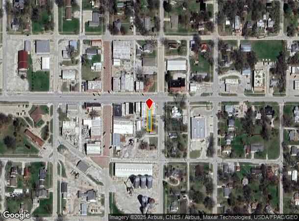
133 E Main St
1311129013
O.T. W 26' OF E 1/2 LOT 1,2,3 IN BLK 12
Realpropertynec
Decatur
X
Iowa
19053C0406C
1-3
2024
0.09 AC
2024
Iowa West Area
960200
Other Market Areas
1,950 SF
DEMOGRAPHICS near 133 E Main St
1 Mile
3 Mile
5 Mile
2024 Total Population
2,000
2,259
2,512
2029 Population
1,999
2,255
2,505
Pop Growth 2024-2029
(0.05%)
(0.18%)
(0.28%)
Average Age
37
38
38
2024 Total Households
733
830
929
HH Growth 2024-2029
0.00%
(0.12%)
(0.32%)
Median Household Inc
$41,714
$42,987
$44,148
Avg Household Size
2.20
2.20
2.20
2024 Avg HH Vehicles
2.00
2.00
2.00
Median Home Value
$102,333
$100,893
$99,134
Median Year Built
1971
1971
1971
Nearby Places
Map Layers
Map Styles
 Street
 Aerial
- Restaurants
- Banks
- Shops
- Fitness
- Groceries
SALE & LEASE HISTORY
LISTING DATE
SALE/LEASE

Oct 01, 2018
For Sale
Jul 16, 2018
For Sale
Feb 22, 2021
For Sale
Nearby Properties
Address
Land Use
TOTAL SIZE
Lot Size
Zoning
Address
Land Use
TOTAL SIZE
Lot Size
Zoning
2,520 SF
7.77 AC
Address
Land Use
TOTAL SIZE
Lot Size
Zoning
5,123 SF
1.92 AC
Address
Land Use
TOTAL SIZE
Lot Size
Zoning
17,042 SF
1.94 AC
Address
Land Use
TOTAL SIZE
Lot Size
Zoning
34,470 SF
3.72 AC
Address
Land Use
TOTAL SIZE
Lot Size
Zoning
9,360 SF
4.81 AC
Address
Land Use
TOTAL SIZE
Lot Size
Zoning
3,952 SF
0.56 AC
Address
Land Use
TOTAL SIZE
Lot Size
Zoning
3,270 SF
1.06 AC
Address
Land Use
TOTAL SIZE
Lot Size
Zoning
10,500 SF
0.55 AC
Address
Land Use
TOTAL SIZE
Lot Size
Zoning
67,500 SF
16 AC
Address
Land Use
TOTAL SIZE
Lot Size
Zoning
3,536 SF
0.89 AC
Address
Land Use
TOTAL SIZE
Lot Size
Zoning
1,512 SF
0.53 AC
Address
Land Use
TOTAL SIZE
Lot Size
Zoning
25,988 SF
1.53 AC
Address
Land Use
TOTAL SIZE
Lot Size
Zoning
16,444 SF
4.96 AC
Address
Land Use
TOTAL SIZE
Lot Size
Zoning
1,602 SF
0.86 AC
Address
Land Use
TOTAL SIZE
Lot Size
Zoning
8,640 SF
0.63 AC
Address
Land Use
TOTAL SIZE
Lot Size
Zoning
4,900 SF
2.88 AC
Address
Land Use
TOTAL SIZE
Lot Size
Zoning
1.17 AC
Address
Land Use
TOTAL SIZE
Lot Size
Zoning
7,160 SF
2.27 AC
Address
Land Use
TOTAL SIZE
Lot Size
Zoning
7,674 SF
2.60 AC
Address
Land Use
TOTAL SIZE
Lot Size
Zoning
15,756 SF
0.43 AC
Address
Land Use
TOTAL SIZE
Lot Size
Zoning
8,000 SF
1 AC
Address
Land Use
TOTAL SIZE
Lot Size
Zoning
7,380 SF
2.55 AC
Address
Land Use
TOTAL SIZE
Lot Size
Zoning
7,820 SF
1.20 AC
Address
Land Use
TOTAL SIZE
Lot Size
Zoning
16,016 SF
1.99 AC
Address
Land Use
TOTAL SIZE
Lot Size
Zoning
5.71 AC
Address
Land Use
TOTAL SIZE
Lot Size
Zoning
3,723 SF
0.07 AC
Address
Land Use
TOTAL SIZE
Lot Size
Zoning
2,436 SF
0.23 AC
Address
Land Use
TOTAL SIZE
Lot Size
Zoning
2,688 SF
0.53 AC
Address
Land Use
TOTAL SIZE
Lot Size
Zoning
4,160 SF
0.51 AC
Address
Land Use
TOTAL SIZE
Lot Size
Zoning
2,544 SF
0.72 AC
The World's #1 Commercial Real Estate Marketplace
Connect with us
© 2026 CoStar Group
The information above has been obtained from sources believed reliable. While we do not doubt its accuracy we have not verified it and make no guarantee, warranty or representation about it. It is your responsibility to independently confirm its accuracy and completeness. Any projections, opinions, assumptions, or estimates used are for example only and do not represent the current or future performance of the property. The value of this transaction to you depends on tax and other factors which should be evaluated by your tax, financial, and legal advisors. You and your advisors should conduct a careful, independent investigation of the property to determine to your satisfaction the suitability of the property for your needs.