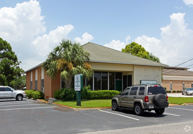
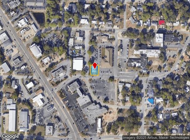
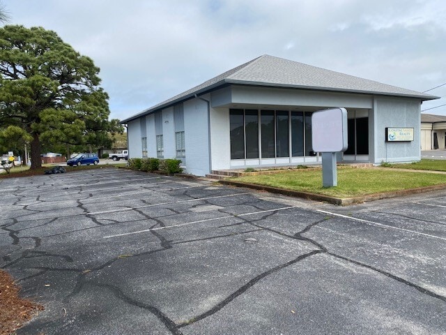
Property Record
133 Hospital Dr Ne, Fort Walton Beach, FL 32548
Current Lease Availabilities
NEARBY LISTINGS FOR SALE OR LEASE
Property Detail
133 Hospital Dr Ne
Crestview-Fort Walton Beach-Destin, FL
Park Place 2Nd Add
13-2S-24-195B-000E-0030
PARK PLACE 2ND ADD LOT 3 BLK E
Officebuilding
Okaloosa
X
Florida
12091C0461J
3
2023
0.23 AC
2024
Fort Walton Beach
022400
Other Market Areas
3,010 SF
DEMOGRAPHICS near 133 Hospital Dr Ne
1 Mile
3 Mile
5 Mile
2024 Total Population
7,970
47,606
74,788
2029 Population
8,248
50,246
78,530
Pop Growth 2024-2029
+ 3.49%
+ 5.55%
+ 5.00%
Average Age
41
41
40
2024 Total Households
3,526
21,002
31,980
HH Growth 2024-2029
+ 3.29%
+ 5.86%
+ 5.18%
Median Household Inc
$51,260
$57,766
$61,089
Avg Household Size
2.20
2.20
2.30
2024 Avg HH Vehicles
2.00
2.00
2.00
Median Home Value
$282,308
$287,733
$280,393
Median Year Built
1968
1978
1981
Nearby Places
- Restaurants
- Banks
- Shops
- Fitness
- Groceries
PUBLIC TRANSPORTATION
AIRPORT
Eglin AFB/Destin-Ft Walton Beach
DRIVE
WALK
Distance
Eglin AFB/Destin-Ft Walton Beach
29 min
10.4 mi
Freight Ports
Port of Panama City
DRIVE
WALK
Distance
Port of Panama City
93 min
58.3 mi
Nearby Properties
Address
Land Use
TOTAL SIZE
Lot Size
Zoning
Address
Land Use
TOTAL SIZE
Lot Size
Zoning
131,351 SF
17.07 AC
Address
Land Use
TOTAL SIZE
Lot Size
Zoning
71,584 SF
3 AC
Address
Land Use
TOTAL SIZE
Lot Size
Zoning
157,835 SF
11.52 AC
Address
Land Use
TOTAL SIZE
Lot Size
Zoning
117,852 SF
13.39 AC
Address
Land Use
TOTAL SIZE
Lot Size
Zoning
11,666 SF
21.29 AC
Address
Land Use
TOTAL SIZE
Lot Size
Zoning
67,370 SF
21.31 AC
Address
Land Use
TOTAL SIZE
Lot Size
Zoning
295,771 SF
18.52 AC
Address
Land Use
TOTAL SIZE
Lot Size
Zoning
135,326 SF
9.12 AC
Address
Land Use
TOTAL SIZE
Lot Size
Zoning
48,449 SF
3.99 AC
Address
Land Use
TOTAL SIZE
Lot Size
Zoning
60,223 SF
2.73 AC
Address
Land Use
TOTAL SIZE
Lot Size
Zoning
55,566 SF
5.40 AC
Address
Land Use
TOTAL SIZE
Lot Size
Zoning
73,434 SF
2.40 AC
Address
Land Use
TOTAL SIZE
Lot Size
Zoning
227,975 SF
24.24 AC
Address
Land Use
TOTAL SIZE
Lot Size
Zoning
128,844 SF
4.86 AC
Address
Land Use
TOTAL SIZE
Lot Size
Zoning
26,816 SF
38.21 AC
Address
Land Use
TOTAL SIZE
Lot Size
Zoning
26,525 SF
1.41 AC
Address
Land Use
TOTAL SIZE
Lot Size
Zoning
51,030 SF
1.82 AC
Address
Land Use
TOTAL SIZE
Lot Size
Zoning
182,844 SF
20.62 AC
Address
Land Use
TOTAL SIZE
Lot Size
Zoning
108,284 SF
5.47 AC
Address
Land Use
TOTAL SIZE
Lot Size
Zoning
75,892 SF
1.72 AC
Address
Land Use
TOTAL SIZE
Lot Size
Zoning
50,294 SF
0.94 AC
Address
Land Use
TOTAL SIZE
Lot Size
Zoning
70,119 SF
2.98 AC
Address
Land Use
TOTAL SIZE
Lot Size
Zoning
32,792 SF
11.79 AC
Address
Land Use
TOTAL SIZE
Lot Size
Zoning
60,684 SF
2.51 AC
Address
Land Use
TOTAL SIZE
Lot Size
Zoning
51,195 SF
6.10 AC
Address
Land Use
TOTAL SIZE
Lot Size
Zoning
287,257 SF
13.86 AC
Address
Land Use
TOTAL SIZE
Lot Size
Zoning
34,385 SF
0.30 AC
Address
Land Use
TOTAL SIZE
Lot Size
Zoning
51,698 SF
0.25 AC
Address
Land Use
TOTAL SIZE
Lot Size
Zoning
78,958 SF
7.88 AC
Address
Land Use
TOTAL SIZE
Lot Size
Zoning
56,833 SF
1.37 AC
The World's #1 Commercial Real Estate Marketplace
Connect with us
© 2025 CoStar Group
The information above has been obtained from sources believed reliable. While we do not doubt its accuracy we have not verified it and make no guarantee, warranty or representation about it. It is your responsibility to independently confirm its accuracy and completeness. Any projections, opinions, assumptions, or estimates used are for example only and do not represent the current or future performance of the property. The value of this transaction to you depends on tax and other factors which should be evaluated by your tax, financial, and legal advisors. You and your advisors should conduct a careful, independent investigation of the property to determine to your satisfaction the suitability of the property for your needs.