Property Record
133 Lexington Pkwy, Lexington, NC 27295


NEARBY LISTINGS FOR SALE OR LEASE
Property Detail
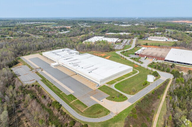
133 Lexington Pkwy
11-350-0-000-0013-A-0-0
PB56-62 L13A BK2647-240 TRACT A B C
Publicstorage
Davidson
X
North Carolina
3710670400J
99.83 AC
2025
South Davidson County
2025
Greensboro/Winston-Salem
061701
Winston-Salem, NC
223,743 SF
DEMOGRAPHICS near 133 Lexington Pkwy
1 Mile
3 Mile
5 Mile
2024 Total Population
900
8,068
30,433
2029 Population
954
8,510
32,244
Pop Growth 2024-2029
+ 6.00%
+ 5.48%
+ 5.95%
Average Age
40
40
41
2024 Total Households
337
3,178
12,136
HH Growth 2024-2029
+ 5.93%
+ 5.38%
+ 5.85%
Median Household Inc
$56,551
$53,726
$46,044
Avg Household Size
2.50
2.50
2.40
2024 Avg HH Vehicles
2.00
2.00
2.00
Median Home Value
$161,702
$158,534
$156,961
Median Year Built
1982
1985
1982
Nearby Places
Map Layers
Map Styles
 Street
 Aerial
- Restaurants
- Banks
- Shops
- Fitness
- Groceries
SALE & LEASE HISTORY
LISTING DATE
SALE/LEASE

Feb 23, 2023
For Lease
Nearby Properties
Address
Land Use
TOTAL SIZE
Lot Size
Zoning
Address
Land Use
TOTAL SIZE
Lot Size
Zoning
35,214 SF
149.11 AC
HI
Address
Land Use
TOTAL SIZE
Lot Size
Zoning
187,540 SF
26.94 AC
PD
Address
Land Use
TOTAL SIZE
Lot Size
Zoning
22,560 SF
204.19 AC
I
Address
Land Use
TOTAL SIZE
Lot Size
Zoning
3,600 SF
198.35 AC
EC
Address
Land Use
TOTAL SIZE
Lot Size
Zoning
3,156 SF
332.28 AC
HI
Address
Land Use
TOTAL SIZE
Lot Size
Zoning
2,821 SF
32.06 AC
TN
Address
Land Use
TOTAL SIZE
Lot Size
Zoning
9,728 SF
40.03 AC
RA1
Address
Land Use
TOTAL SIZE
Lot Size
Zoning
114,109 SF
20.39 AC
I
Address
Land Use
TOTAL SIZE
Lot Size
Zoning
116,842 SF
20.04 AC
I
Address
Land Use
TOTAL SIZE
Lot Size
Zoning
101,475 SF
108.36 AC
I
Address
Land Use
TOTAL SIZE
Lot Size
Zoning
6,000 SF
33.27 AC
HI
Address
Land Use
TOTAL SIZE
Lot Size
Zoning
97,176 SF
40.63 AC
RA1
Address
Land Use
TOTAL SIZE
Lot Size
Zoning
66,594 SF
6.59 AC
OI
Address
Land Use
TOTAL SIZE
Lot Size
Zoning
68,288 SF
23.30 AC
LI
Address
Land Use
TOTAL SIZE
Lot Size
Zoning
100,830 SF
51.38 AC
LI
Address
Land Use
TOTAL SIZE
Lot Size
Zoning
103,720 SF
21.05 AC
I
Address
Land Use
TOTAL SIZE
Lot Size
Zoning
131,100 SF
17.78 AC
I
Address
Land Use
TOTAL SIZE
Lot Size
Zoning
214,592 SF
20.01 AC
I
Address
Land Use
TOTAL SIZE
Lot Size
Zoning
49,578 SF
7.74 AC
I
Address
Land Use
TOTAL SIZE
Lot Size
Zoning
201,600 SF
9.90 AC
I
Address
Land Use
TOTAL SIZE
Lot Size
Zoning
131,250 SF
14.30 AC
I
Address
Land Use
TOTAL SIZE
Lot Size
Zoning
23,572 SF
36.39 AC
I
Address
Land Use
TOTAL SIZE
Lot Size
Zoning
313,535 SF
107.06 AC
I
Address
Land Use
TOTAL SIZE
Lot Size
Zoning
100,490 SF
18.18 AC
I
Address
Land Use
TOTAL SIZE
Lot Size
Zoning
29,925 SF
2.81 AC
OI
Address
Land Use
TOTAL SIZE
Lot Size
Zoning
157,650 SF
28.11 AC
LI
Address
Land Use
TOTAL SIZE
Lot Size
Zoning
115,838 SF
57.83 AC
I
Address
Land Use
TOTAL SIZE
Lot Size
Zoning
13,924 SF
5.35 AC
B
Address
Land Use
TOTAL SIZE
Lot Size
Zoning
14,700 SF
21.52 AC
LI
The World's #1 Commercial Real Estate Marketplace
Connect with us
© 2026 CoStar Group
The information above has been obtained from sources believed reliable. While we do not doubt its accuracy we have not verified it and make no guarantee, warranty or representation about it. It is your responsibility to independently confirm its accuracy and completeness. Any projections, opinions, assumptions, or estimates used are for example only and do not represent the current or future performance of the property. The value of this transaction to you depends on tax and other factors which should be evaluated by your tax, financial, and legal advisors. You and your advisors should conduct a careful, independent investigation of the property to determine to your satisfaction the suitability of the property for your needs.