Property Record
133 Main St, Phoenix, OR 97535
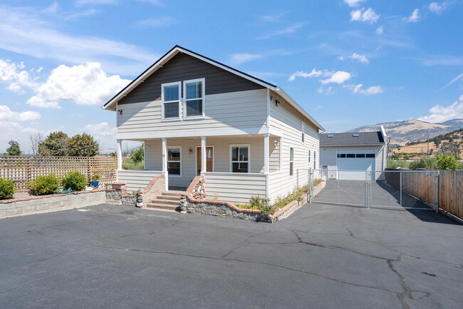

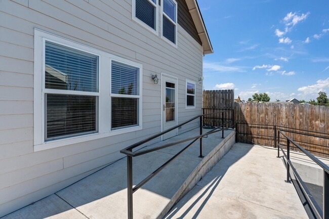
Property Detail
133 Main St
10206812
Jackson
Commercialbuilding
Oregon
C-1
7
B and X Area of moderate flood hazard, usually the area between the limits of the 100-year and 500-year floods.
0.34 AC
2025
Medford/Grants Pass
2026
Other Market Areas
001403
Medford, OR
3,079 SF
NEARBY LISTINGS FOR SALE OR LEASE
DEMOGRAPHICS near 133 Main St
1 mile
3 mile
5 mile
2025 Total Population
5,080
19,740
62,258
2030 Population
4,849
19,194
60,929
Pop Growth 2025-2030
(4.55%)
(2.77%)
(2.13%)
Average Age
45
46
43
2025 Total Households
2,242
8,979
25,783
HH Growth 2025-2030
(4.95%)
(2.90%)
(2.30%)
Median Household Inc
$60,169
$62,184
$71,650
Avg Household Size
2.20
2.10
2.30
2025 Avg HH Vehicles
2.00
2.00
2.00
Median Home Value
$354,112
$392,621
$444,584
Median Year Built
1978
1989
1983
Nearby Places
Map Layers
Map Styles
 Street
 Aerial
Transit
 Traffic
 Biking
Places
Listings with unknown addresses are not visible on the map
- Restaurants
- Banks
- Shops
- Fitness
- Groceries
PUBLIC TRANSPORTATION
AIRPORT
Rogue Valley International - Medford
Drive
Walk
Distance
Rogue Valley International - Medford
14 min
8.8 mi
SALE & LEASE HISTORY
LISTING DATE
SALE/LEASE

Sep 09, 2025
For Sale
Nearby Properties
Address
Land Use
TOTAL SIZE
Lot Size
Zoning
Address
Land Use
TOTAL SIZE
Lot Size
Zoning
674,760 SF
104.26 AC
SFR-4
Address
Land Use
TOTAL SIZE
Lot Size
Zoning
124.05 AC
C-R
Address
Land Use
TOTAL SIZE
Lot Size
Zoning
Address
Land Use
TOTAL SIZE
Lot Size
Zoning
30.50 AC
SFR-4
Address
Land Use
TOTAL SIZE
Lot Size
Zoning
81.70 AC
LI
Address
Land Use
TOTAL SIZE
Lot Size
Zoning
11,850 SF
3.19 AC
RS-7
Address
Land Use
TOTAL SIZE
Lot Size
Zoning
212,477 SF
13.74 AC
I-L
Address
Land Use
TOTAL SIZE
Lot Size
Zoning
12.55 AC
RM-22
Address
Land Use
TOTAL SIZE
Lot Size
Zoning
130,599 SF
9.43 AC
C-H
Address
Land Use
TOTAL SIZE
Lot Size
Zoning
92,000 SF
3.39 AC
MFR-30
Address
Land Use
TOTAL SIZE
Lot Size
Zoning
37,997 SF
14.47 AC
SFR-4
Address
Land Use
TOTAL SIZE
Lot Size
Zoning
81.69 AC
LI
Address
Land Use
TOTAL SIZE
Lot Size
Zoning
1,543 SF
3.51 AC
RS-MH
Address
Land Use
TOTAL SIZE
Lot Size
Zoning
1,660 SF
4.65 AC
C-H
Address
Land Use
TOTAL SIZE
Lot Size
Zoning
5.46 AC
RS-7
Address
Land Use
TOTAL SIZE
Lot Size
Zoning
71,475 SF
6.18 AC
C-H
Address
Land Use
TOTAL SIZE
Lot Size
Zoning
64,250 SF
8.13 AC
UR-30
Address
Land Use
TOTAL SIZE
Lot Size
Zoning
31,000 SF
2.31 AC
RM-22
Address
Land Use
TOTAL SIZE
Lot Size
Zoning
1 AC
RR-5
Address
Land Use
TOTAL SIZE
Lot Size
Zoning
4.12 AC
R-1
Address
Land Use
TOTAL SIZE
Lot Size
Zoning
15.32 AC
SFR-4
Address
Land Use
TOTAL SIZE
Lot Size
Zoning
29,070 SF
10.62 AC
C-H
Address
Land Use
TOTAL SIZE
Lot Size
Zoning
1.77 AC
C-H
Address
Land Use
TOTAL SIZE
Lot Size
Zoning
35,592 SF
4.08 AC
C-C
Address
Land Use
TOTAL SIZE
Lot Size
Zoning
98,521 SF
8.60 AC
CH
Address
Land Use
TOTAL SIZE
Lot Size
Zoning
5.02 AC
SFR-4
Address
Land Use
TOTAL SIZE
Lot Size
Zoning
71,253 SF
3.34 AC
IL
Address
Land Use
TOTAL SIZE
Lot Size
Zoning
5.15 AC
RM-22
Address
Land Use
TOTAL SIZE
Lot Size
Zoning
57,364 SF
1.58 AC
SFR-10
Address
Land Use
TOTAL SIZE
Lot Size
Zoning
3,099 SF
27.44 AC
SFR-10
The World's #1 Commercial Real Estate Marketplace
Connect with us
© 2026 CoStar Group
The information above has been obtained from sources believed reliable. While we do not doubt its accuracy we have not verified it and make no guarantee, warranty or representation about it. It is your responsibility to independently confirm its accuracy and completeness. Any projections, opinions, assumptions, or estimates used are for example only and do not represent the current or future performance of the property. The value of this transaction to you depends on tax and other factors which should be evaluated by your tax, financial, and legal advisors. You and your advisors should conduct a careful, independent investigation of the property to determine to your satisfaction the suitability of the property for your needs.