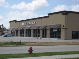
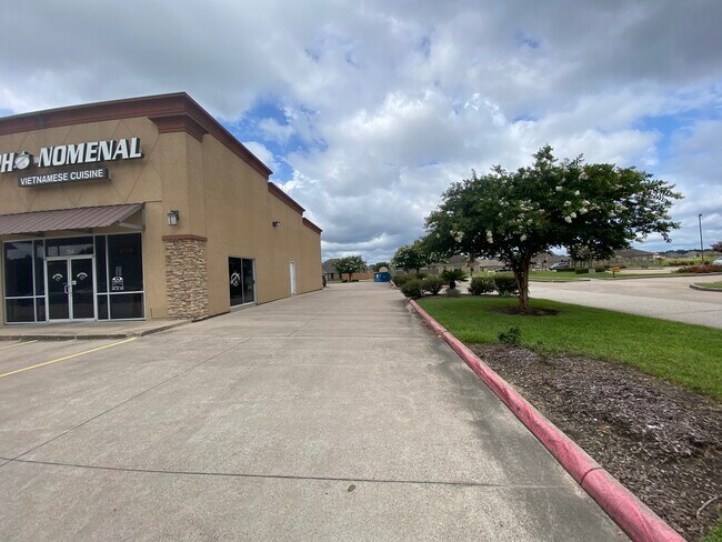
Property Record
133 N Lhs Dr, Lumberton, TX 77657

Property Detail
133 N Lhs Dr
Beaumont-Port Arthur, TX
S02072 WESTWOOD HEIGHTS, LOT C1, ACRES 1.006 SEC 1 SEC 1
002072-000010
HARDIN
Commercialnec
Texas
B and X Area of moderate flood hazard, usually the area between the limits of the 100-year and 500-year floods.
c1
2025
1.01 AC
2025
Hardin County
030302
Beaumont/Port Arthur
9,108 SF
NEARBY LISTINGS FOR SALE OR LEASE
DEMOGRAPHICS near 133 N Lhs Dr
1 mile
3 mile
5 mile
2025 Total Population
5,026
19,099
25,175
2030 Population
5,229
19,769
26,099
Pop Growth 2025-2030
+ 4.04%
+ 3.51%
+ 3.67%
Average Age
37
39
39
2025 Total Households
1,920
7,263
9,565
HH Growth 2025-2030
+ 4.06%
+ 3.57%
+ 3.72%
Median Household Inc
$97,349
$94,410
$91,529
Avg Household Size
2.60
2.60
2.60
2025 Avg HH Vehicles
2.00
2.00
2.00
Median Home Value
$314,750
$267,648
$261,570
Median Year Built
2006
2002
2000
Nearby Places
Map Layers
Map Styles
 Street
 Aerial
Layers
 Traffic
 Biking
Places
Listings with unknown addresses are not visible on the map
- Restaurants
- Banks
- Shops
- Fitness
- Groceries
SALE & LEASE HISTORY
LISTING DATE
SALE/LEASE

Jul 19, 2024
For Lease
Nearby Properties
Address
Land Use
TOTAL SIZE
Lot Size
Zoning
Address
Land Use
TOTAL SIZE
Lot Size
Zoning
45,616 SF
2.02 AC
Address
Land Use
TOTAL SIZE
Lot Size
Zoning
158,978 SF
17.64 AC
Address
Land Use
TOTAL SIZE
Lot Size
Zoning
87,020 SF
4.09 AC
Address
Land Use
TOTAL SIZE
Lot Size
Zoning
117,639 SF
11.96 AC
Address
Land Use
TOTAL SIZE
Lot Size
Zoning
26,470 SF
1.55 AC
Address
Land Use
TOTAL SIZE
Lot Size
Zoning
60.02 AC
Address
Land Use
TOTAL SIZE
Lot Size
Zoning
28,229 SF
6.20 AC
Address
Land Use
TOTAL SIZE
Lot Size
Zoning
32,265 SF
6.88 AC
Address
Land Use
TOTAL SIZE
Lot Size
Zoning
57,530 SF
3.46 AC
Address
Land Use
TOTAL SIZE
Lot Size
Zoning
11,696 SF
2.64 AC
Address
Land Use
TOTAL SIZE
Lot Size
Zoning
6,976 SF
3.03 AC
Address
Land Use
TOTAL SIZE
Lot Size
Zoning
18,355 SF
5.45 AC
Address
Land Use
TOTAL SIZE
Lot Size
Zoning
5,544 SF
19.99 AC
Address
Land Use
TOTAL SIZE
Lot Size
Zoning
56,240 SF
5.38 AC
Address
Land Use
TOTAL SIZE
Lot Size
Zoning
8,420 SF
4.99 AC
Address
Land Use
TOTAL SIZE
Lot Size
Zoning
11,879 SF
1.42 AC
Address
Land Use
TOTAL SIZE
Lot Size
Zoning
10,600 SF
1.14 AC
Address
Land Use
TOTAL SIZE
Lot Size
Zoning
14,980 SF
1.73 AC
Address
Land Use
TOTAL SIZE
Lot Size
Zoning
13,072 SF
1.83 AC
Address
Land Use
TOTAL SIZE
Lot Size
Zoning
3,388 SF
1.32 AC
Address
Land Use
TOTAL SIZE
Lot Size
Zoning
13,905 SF
1.58 AC
Address
Land Use
TOTAL SIZE
Lot Size
Zoning
8,480 SF
2.90 AC
Address
Land Use
TOTAL SIZE
Lot Size
Zoning
24,740 SF
5.77 AC
Address
Land Use
TOTAL SIZE
Lot Size
Zoning
10,902 SF
2.25 AC
Address
Land Use
TOTAL SIZE
Lot Size
Zoning
6,200 SF
3 AC
Address
Land Use
TOTAL SIZE
Lot Size
Zoning
21,516 SF
4.56 AC
Address
Land Use
TOTAL SIZE
Lot Size
Zoning
29,584 SF
4.13 AC
Address
Land Use
TOTAL SIZE
Lot Size
Zoning
12,587 SF
1.78 AC
Address
Land Use
TOTAL SIZE
Lot Size
Zoning
6,330 SF
5 AC
Address
Land Use
TOTAL SIZE
Lot Size
Zoning
1,664 SF
1,009.88 AC
The World's #1 Commercial Real Estate Marketplace
Connect with us
© 2026 CoStar Group
The information above has been obtained from sources believed reliable. While we do not doubt its accuracy we have not verified it and make no guarantee, warranty or representation about it. It is your responsibility to independently confirm its accuracy and completeness. Any projections, opinions, assumptions, or estimates used are for example only and do not represent the current or future performance of the property. The value of this transaction to you depends on tax and other factors which should be evaluated by your tax, financial, and legal advisors. You and your advisors should conduct a careful, independent investigation of the property to determine to your satisfaction the suitability of the property for your needs.