Property Record
133 Serramonte Ctr, Daly City, CA 94015


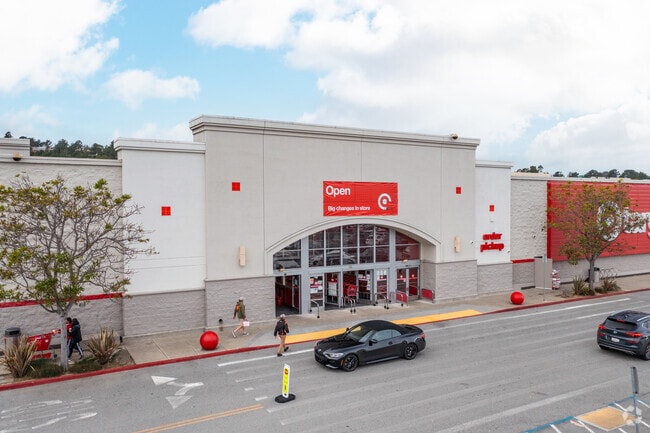
Property Detail
133 Serramonte Ctr
091-240-090
3.049 AC MOL BEING PTN OF BLK 36 SERRAMONTE NO 7 RSM 66/8 11
Storebuilding
San Mateo
CH00C2
California
B and X Area of moderate flood hazard, usually the area between the limits of the 100-year and 500-year floods.
3.05 AC
2024
Brisbane/Daly City
2025
San Francisco
601604
San Francisco-San Mateo-Redwood City, CA
160,346 SF
NEARBY LISTINGS FOR SALE OR LEASE
DEMOGRAPHICS near 133 Serramonte Ctr
1 mile
3 mile
5 mile
2025 Total Population
27,218
180,369
383,482
2030 Population
27,277
180,182
382,812
Pop Growth 2025-2030
+ 0.22%
(0.10%)
(0.17%)
Average Age
43
43
43
2025 Total Households
8,423
57,194
123,410
HH Growth 2025-2030
+ 0.24%
(0.13%)
(0.12%)
Median Household Inc
$123,836
$130,688
$127,866
Avg Household Size
3.10
3.00
3.00
2025 Avg HH Vehicles
2.00
2.00
2.00
Median Home Value
$1,033,762
$1,051,761
$1,071,145
Median Year Built
1970
1965
1958
Nearby Places
Map Layers
Map Styles
 Street
 Aerial
Layers
 Traffic
 Biking
Places
Listings with unknown addresses are not visible on the map
- Restaurants
- Banks
- Shops
- Fitness
- Groceries
PUBLIC TRANSPORTATION
COMMUTER RAIL
South San Francisco Caltrain Station Northbound (Express - Caltrain (Caltrain), Limited - Caltrain (Caltrain), Local Weekday - Caltrain (Caltrain), Local Weekend - Caltrain (Caltrain))
Drive
Walk
Distance
South San Francisco Caltrain Station Northbound (Express - Caltrain (Caltrain), Limited - Caltrain (Caltrain), Local Weekday - Caltrain (Caltrain), Local Weekend - Caltrain (Caltrain))
10 min
4.9 mi
San Bruno Caltrain Station Southbound (Local Weekday - Caltrain (Caltrain), Local Weekend - Caltrain (Caltrain))
Drive
Walk
Distance
San Bruno Caltrain Station Southbound (Local Weekday - Caltrain (Caltrain), Local Weekend - Caltrain (Caltrain))
9 min
5.3 mi
AIRPORT
San Francisco International
Drive
Walk
Distance
San Francisco International
15 min
7.9 mi
Metro Oakland International
Drive
Walk
Distance
Metro Oakland International
43 min
30.0 mi
Freight Ports
Port of San Francisco
Drive
Walk
Distance
Port of San Francisco
19 min
12.6 mi
Nearby Properties
Address
Land Use
TOTAL SIZE
Lot Size
Zoning
Address
Land Use
TOTAL SIZE
Lot Size
Zoning
53.85 AC
Address
Land Use
TOTAL SIZE
Lot Size
Zoning
312,191 SF
2.74 AC
Address
Land Use
TOTAL SIZE
Lot Size
Zoning
167,105 SF
2.07 AC
C10000
Address
Land Use
TOTAL SIZE
Lot Size
Zoning
42.95 AC
Address
Land Use
TOTAL SIZE
Lot Size
Zoning
447,674 SF
21.51 AC
Address
Land Use
TOTAL SIZE
Lot Size
Zoning
178,110 SF
1.67 AC
Address
Land Use
TOTAL SIZE
Lot Size
Zoning
Address
Land Use
TOTAL SIZE
Lot Size
Zoning
10.62 AC
Address
Land Use
TOTAL SIZE
Lot Size
Zoning
187,865 SF
3.54 AC
Address
Land Use
TOTAL SIZE
Lot Size
Zoning
209,692 SF
8.20 AC
R30000
Address
Land Use
TOTAL SIZE
Lot Size
Zoning
2,011 SF
2.49 AC
Address
Land Use
TOTAL SIZE
Lot Size
Zoning
12.83 AC
PD0000
Address
Land Use
TOTAL SIZE
Lot Size
Zoning
175,618 SF
2.44 AC
Address
Land Use
TOTAL SIZE
Lot Size
Zoning
181,172 SF
2.11 AC
Address
Land Use
TOTAL SIZE
Lot Size
Zoning
108,917 SF
4.61 AC
PD0004
Address
Land Use
TOTAL SIZE
Lot Size
Zoning
153,054 SF
15.13 AC
Address
Land Use
TOTAL SIZE
Lot Size
Zoning
141,956 SF
1.74 AC
Address
Land Use
TOTAL SIZE
Lot Size
Zoning
73.91 AC
Address
Land Use
TOTAL SIZE
Lot Size
Zoning
128,506 SF
2.17 AC
Address
Land Use
TOTAL SIZE
Lot Size
Zoning
206.09 AC
Address
Land Use
TOTAL SIZE
Lot Size
Zoning
67,432 SF
4.55 AC
CL00C1
Address
Land Use
TOTAL SIZE
Lot Size
Zoning
113,136 SF
9.09 AC
G10000
Address
Land Use
TOTAL SIZE
Lot Size
Zoning
113,782 SF
2.90 AC
Address
Land Use
TOTAL SIZE
Lot Size
Zoning
257,754 SF
1.37 AC
Address
Land Use
TOTAL SIZE
Lot Size
Zoning
63,943 SF
0.77 AC
Address
Land Use
TOTAL SIZE
Lot Size
Zoning
75,559 SF
2.48 AC
R30000
Address
Land Use
TOTAL SIZE
Lot Size
Zoning
410,683 SF
9.76 AC
R30000
Address
Land Use
TOTAL SIZE
Lot Size
Zoning
6.73 AC
CL00C1
Address
Land Use
TOTAL SIZE
Lot Size
Zoning
58,775 SF
3.04 AC
R30000
Address
Land Use
TOTAL SIZE
Lot Size
Zoning
136,892 SF
0.96 AC
The World's #1 Commercial Real Estate Marketplace
Connect with us
© 2026 CoStar Group
The information above has been obtained from sources believed reliable. While we do not doubt its accuracy we have not verified it and make no guarantee, warranty or representation about it. It is your responsibility to independently confirm its accuracy and completeness. Any projections, opinions, assumptions, or estimates used are for example only and do not represent the current or future performance of the property. The value of this transaction to you depends on tax and other factors which should be evaluated by your tax, financial, and legal advisors. You and your advisors should conduct a careful, independent investigation of the property to determine to your satisfaction the suitability of the property for your needs.