Property Record
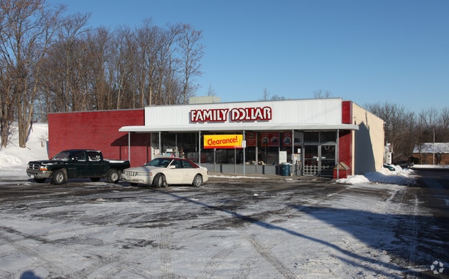
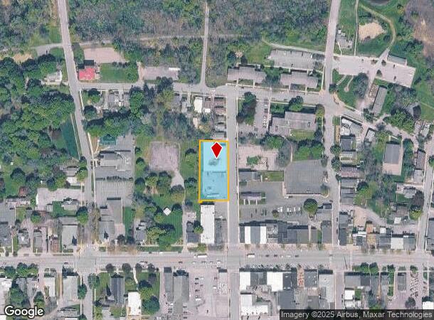
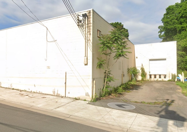
133 William St, Palmyra, NY 14522
NEARBY LISTINGS FOR SALE OR LEASE
Property Detail
133 William St
Rochester, NY
FAMILY DOLLAR - 1998 32111-11-663724
543601-064-111-0011-691-731-0000
Wayne
Storesoffices
New York
2025
691.731
2024
0.61 AC
020700
Wayne County
9,000 SF
Rochester
DEMOGRAPHICS near 133 William St
1 Mile
3 Mile
5 Mile
2024 Total Population
4,321
7,999
14,183
2029 Population
4,332
7,980
14,109
Pop Growth 2024-2029
+ 0.25%
(0.24%)
(0.52%)
Average Age
42
43
43
2024 Total Households
1,926
3,430
6,016
HH Growth 2024-2029
+ 0.16%
(0.32%)
(0.57%)
Median Household Inc
$67,833
$73,063
$73,867
Avg Household Size
2.20
2.30
2.30
2024 Avg HH Vehicles
2.00
2.00
2.00
Median Home Value
$140,211
$154,788
$156,816
Median Year Built
1953
1960
1968
Nearby Places
- Restaurants
- Banks
- Shops
- Fitness
- Groceries
PUBLIC TRANSPORTATION
AIRPORT
Frederick Douglass/Greater Rochester International
DRIVE
WALK
Distance
Frederick Douglass/Greater Rochester International
39 min
24.9 mi
Freight Ports
Albany, NY Port
DRIVE
WALK
Distance
Albany, NY Port
245 min
207.2 mi
SALE & LEASE HISTORY
LISTING DATE
SALE/LEASE

Jun 01, 2025
For Sale
Nearby Properties
Address
Land Use
TOTAL SIZE
Lot Size
Zoning
Address
Land Use
TOTAL SIZE
Lot Size
Zoning
Address
Land Use
TOTAL SIZE
Lot Size
Zoning
13,806 SF
137.28 AC
LI
Address
Land Use
TOTAL SIZE
Lot Size
Zoning
126,403 SF
5.86 AC
R1
Address
Land Use
TOTAL SIZE
Lot Size
Zoning
110,254 SF
16.08 AC
R1
Address
Land Use
TOTAL SIZE
Lot Size
Zoning
4.60 AC
02 - SINGL
Address
Land Use
TOTAL SIZE
Lot Size
Zoning
77.84 AC
AR
Address
Land Use
TOTAL SIZE
Lot Size
Zoning
39.40 AC
Address
Land Use
TOTAL SIZE
Lot Size
Zoning
24,484 SF
13.69 AC
R1
Address
Land Use
TOTAL SIZE
Lot Size
Zoning
61,044 SF
3.33 AC
R2
Address
Land Use
TOTAL SIZE
Lot Size
Zoning
10,904 SF
1 AC
C3
Address
Land Use
TOTAL SIZE
Lot Size
Zoning
910 SF
22 AC
RR
Address
Land Use
TOTAL SIZE
Lot Size
Zoning
44.80 AC
Address
Land Use
TOTAL SIZE
Lot Size
Zoning
1,208 SF
3.34 AC
R2-PD
Address
Land Use
TOTAL SIZE
Lot Size
Zoning
6,080 SF
16.15 AC
R1
Address
Land Use
TOTAL SIZE
Lot Size
Zoning
9,298 SF
14.80 AC
R2
Address
Land Use
TOTAL SIZE
Lot Size
Zoning
Address
Land Use
TOTAL SIZE
Lot Size
Zoning
65,195 SF
1.27 AC
C1
Address
Land Use
TOTAL SIZE
Lot Size
Zoning
5,872 SF
187 AC
AR
Address
Land Use
TOTAL SIZE
Lot Size
Zoning
11,600 SF
39.67 AC
Address
Land Use
TOTAL SIZE
Lot Size
Zoning
4,232 SF
3.14 AC
C3
Address
Land Use
TOTAL SIZE
Lot Size
Zoning
0.01 AC
Address
Land Use
TOTAL SIZE
Lot Size
Zoning
Address
Land Use
TOTAL SIZE
Lot Size
Zoning
12,528 SF
1.75 AC
C1
Address
Land Use
TOTAL SIZE
Lot Size
Zoning
5,400 SF
155.32 AC
Address
Land Use
TOTAL SIZE
Lot Size
Zoning
15,400 SF
30.16 AC
R1
Address
Land Use
TOTAL SIZE
Lot Size
Zoning
8,560 SF
1.21 AC
R2
Address
Land Use
TOTAL SIZE
Lot Size
Zoning
5,049 SF
1.57 AC
R1
Address
Land Use
TOTAL SIZE
Lot Size
Zoning
19,947 SF
12.02 AC
AR
Address
Land Use
TOTAL SIZE
Lot Size
Zoning
23,880 SF
3.13 AC
R1
Address
Land Use
TOTAL SIZE
Lot Size
Zoning
1,625 SF
43.99 AC
AR
The World's #1 Commercial Real Estate Marketplace
Connect with us
© 2025 CoStar Group
The information above has been obtained from sources believed reliable. While we do not doubt its accuracy we have not verified it and make no guarantee, warranty or representation about it. It is your responsibility to independently confirm its accuracy and completeness. Any projections, opinions, assumptions, or estimates used are for example only and do not represent the current or future performance of the property. The value of this transaction to you depends on tax and other factors which should be evaluated by your tax, financial, and legal advisors. You and your advisors should conduct a careful, independent investigation of the property to determine to your satisfaction the suitability of the property for your needs.