Property Record
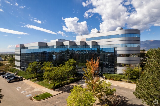
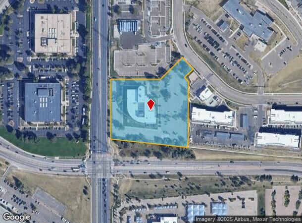
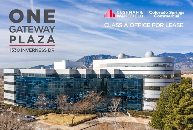
1330 Inverness Dr, Colorado Springs, CO 80910
Current Lease Availabilities
NEARBY LISTINGS FOR SALE OR LEASE
Property Detail
1330 Inverness Dr
Colorado Springs, CO
Gateway Corporate Plaza Fil No 1
64233-06-011
LOT 1 GATEWAY CORPORATE PLAZA FIL NO 1 COLO SPGS
Officebuilding
El Paso
X
Colorado
08041C0734G
1
2024
4.64 AC
2025
Southeast
006302
Colorado Springs
117,631 SF
DEMOGRAPHICS near 1330 Inverness Dr
1 Mile
3 Mile
5 Mile
2024 Total Population
23,690
106,477
244,953
2029 Population
25,155
111,730
255,818
Pop Growth 2024-2029
+ 6.18%
+ 4.93%
+ 4.44%
Average Age
33
35
37
2024 Total Households
9,439
41,529
97,987
HH Growth 2024-2029
+ 6.60%
+ 5.29%
+ 4.75%
Median Household Inc
$48,145
$51,172
$59,619
Avg Household Size
2.40
2.40
2.40
2024 Avg HH Vehicles
2.00
2.00
2.00
Median Home Value
$250,093
$264,285
$320,003
Median Year Built
1987
1979
1977
Nearby Places
Map Layers
Map Styles
 Street
 Aerial
- Restaurants
- Banks
- Shops
- Fitness
- Groceries
PUBLIC TRANSPORTATION
AIRPORT
City of Colorado Springs Municipal
DRIVE
WALK
Distance
City of Colorado Springs Municipal
13 min
5.8 mi
Freight Ports
Tulsa Port Of Catoosa
DRIVE
WALK
Distance
Tulsa Port Of Catoosa
739 min
692.2 mi
Nearby Properties
Address
Land Use
TOTAL SIZE
Lot Size
Zoning
Address
Land Use
TOTAL SIZE
Lot Size
Zoning
1,072,186 SF
15.14 AC
MX-N HR CU
Address
Land Use
TOTAL SIZE
Lot Size
Zoning
309,046 SF
28.95 AC
PF SS
Address
Land Use
TOTAL SIZE
Lot Size
Zoning
326,035 SF
33.75 AC
PCR UV
Address
Land Use
TOTAL SIZE
Lot Size
Zoning
152,977 SF
39.50 AC
MX-M MX-M/
Address
Land Use
TOTAL SIZE
Lot Size
Zoning
229,081 SF
9.87 AC
MX-N CU SS
Address
Land Use
TOTAL SIZE
Lot Size
Zoning
200,642 SF
6.65 AC
MX-M HR AO
Address
Land Use
TOTAL SIZE
Lot Size
Zoning
233,194 SF
30 AC
R-1 6 AO S
Address
Land Use
TOTAL SIZE
Lot Size
Zoning
168,835 SF
33 AC
PF SS
Address
Land Use
TOTAL SIZE
Lot Size
Zoning
162,945 SF
20.05 AC
BP/CR CU A
Address
Land Use
TOTAL SIZE
Lot Size
Zoning
117,648 SF
3,971.89 AC
APD
Address
Land Use
TOTAL SIZE
Lot Size
Zoning
75,831 SF
3.37 AC
R-5 P
Address
Land Use
TOTAL SIZE
Lot Size
Zoning
109,739 SF
18.61 AC
BP/CR CU
Address
Land Use
TOTAL SIZE
Lot Size
Zoning
123,644 SF
74.14 AC
GI PF SS
Address
Land Use
TOTAL SIZE
Lot Size
Zoning
113,594 SF
1.65 AC
R-5 HR
Address
Land Use
TOTAL SIZE
Lot Size
Zoning
704,240 SF
41.99 AC
BP/CR UV A
Address
Land Use
TOTAL SIZE
Lot Size
Zoning
65,400 SF
13.65 AC
PF CU
Address
Land Use
TOTAL SIZE
Lot Size
Zoning
98,638 SF
7.22 AC
MX-M AO
Address
Land Use
TOTAL SIZE
Lot Size
Zoning
152,517 SF
12.17 AC
MX-L
Address
Land Use
TOTAL SIZE
Lot Size
Zoning
23,535 SF
15.91 AC
BP/CR AO
Address
Land Use
TOTAL SIZE
Lot Size
Zoning
226,448 SF
16.80 AC
MX-N/CR
Address
Land Use
TOTAL SIZE
Lot Size
Zoning
69,078 SF
0.03 AC
Address
Land Use
TOTAL SIZE
Lot Size
Zoning
76,203 SF
8.15 AC
PF
Address
Land Use
TOTAL SIZE
Lot Size
Zoning
55,432 SF
4.78 AC
R-5
Address
Land Use
TOTAL SIZE
Lot Size
Zoning
60,324 SF
1.72 AC
R-5
Address
Land Use
TOTAL SIZE
Lot Size
Zoning
55,821 SF
2.13 AC
MX-N/CR
Address
Land Use
TOTAL SIZE
Lot Size
Zoning
92,568 SF
11.08 AC
MX-M/CR
Address
Land Use
TOTAL SIZE
Lot Size
Zoning
42,129 SF
185.93 AC
PK
Address
Land Use
TOTAL SIZE
Lot Size
Zoning
185,508 SF
16.48 AC
BP/CR AO S
Address
Land Use
TOTAL SIZE
Lot Size
Zoning
76,047 SF
5.74 AC
PF
Address
Land Use
TOTAL SIZE
Lot Size
Zoning
72,105 SF
11.32 AC
MX-T AO
The World's #1 Commercial Real Estate Marketplace
Connect with us
© 2026 CoStar Group
The information above has been obtained from sources believed reliable. While we do not doubt its accuracy we have not verified it and make no guarantee, warranty or representation about it. It is your responsibility to independently confirm its accuracy and completeness. Any projections, opinions, assumptions, or estimates used are for example only and do not represent the current or future performance of the property. The value of this transaction to you depends on tax and other factors which should be evaluated by your tax, financial, and legal advisors. You and your advisors should conduct a careful, independent investigation of the property to determine to your satisfaction the suitability of the property for your needs.