Property Record
1330 Le Mar Dr, Cincinnati, OH 45238
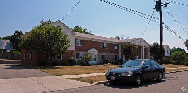


Property Detail
1330 Le Mar Dr
550-0041-0481
LE MAR DR 218.90 X 120 IRR PRO LEDERMEIERS 2ND SUB R2 -T2 -S7
Municipalproperty
Hamilton
C
Ohio
B and X Area of moderate flood hazard, usually the area between the limits of the 100-year and 500-year floods.
0.65 AC
2025
Covedale
2025
Cincinnati/Dayton
021202
Cincinnati, OH-KY-IN
9,136 SF
NEARBY LISTINGS FOR SALE OR LEASE
DEMOGRAPHICS near 1330 Le Mar Dr
1 mile
3 mile
5 mile
2025 Total Population
13,763
116,228
214,842
2030 Population
13,593
116,992
217,900
Pop Growth 2025-2030
(1.24%)
+ 0.66%
+ 1.42%
Average Age
39
38
38
2025 Total Households
5,432
46,867
88,808
HH Growth 2025-2030
(1.23%)
+ 0.68%
+ 1.47%
Median Household Inc
$69,285
$58,971
$59,191
Avg Household Size
2.50
2.40
2.30
2025 Avg HH Vehicles
2.00
2.00
2.00
Median Home Value
$181,220
$180,060
$209,431
Median Year Built
1954
1958
1961
Nearby Places
Map Layers
Map Styles
 Street
 Aerial
Layers
 Traffic
 Biking
Places
Listings with unknown addresses are not visible on the map
- Restaurants
- Banks
- Shops
- Fitness
- Groceries
PUBLIC TRANSPORTATION
COMMUTER RAIL
Cincinnati Union Terminal (Cardinal - Amtrak)
Drive
Walk
Distance
Cincinnati Union Terminal (Cardinal - Amtrak)
14 min
5.9 mi
AIRPORT
Cincinnati/Northern Kentucky International
Drive
Walk
Distance
Cincinnati/Northern Kentucky International
37 min
19.3 mi
Freight Ports
Port of Toledo
Drive
Walk
Distance
Port of Toledo
250 min
209.1 mi
Nearby Properties
Address
Land Use
TOTAL SIZE
Lot Size
Zoning
Address
Land Use
TOTAL SIZE
Lot Size
Zoning
30.43 AC
AA
Address
Land Use
TOTAL SIZE
Lot Size
Zoning
9.52 AC
B
Address
Land Use
TOTAL SIZE
Lot Size
Zoning
17,857 SF
26.60 AC
CGA
Address
Land Use
TOTAL SIZE
Lot Size
Zoning
23.05 AC
Address
Land Use
TOTAL SIZE
Lot Size
Zoning
12.28 AC
AA
Address
Land Use
TOTAL SIZE
Lot Size
Zoning
8.18 AC
SF4
Address
Land Use
TOTAL SIZE
Lot Size
Zoning
13.44 AC
Address
Land Use
TOTAL SIZE
Lot Size
Zoning
6,537 SF
12.55 AC
Address
Land Use
TOTAL SIZE
Lot Size
Zoning
1,873 SF
12.20 AC
Address
Land Use
TOTAL SIZE
Lot Size
Zoning
25,795 SF
31.93 AC
DD
Address
Land Use
TOTAL SIZE
Lot Size
Zoning
12.72 AC
DD
Address
Land Use
TOTAL SIZE
Lot Size
Zoning
125,405 SF
16.69 AC
SF6
Address
Land Use
TOTAL SIZE
Lot Size
Zoning
6,000 SF
11.92 AC
G
Address
Land Use
TOTAL SIZE
Lot Size
Zoning
62,160 SF
13.70 AC
RM20
Address
Land Use
TOTAL SIZE
Lot Size
Zoning
4.60 AC
SF6
Address
Land Use
TOTAL SIZE
Lot Size
Zoning
55,572 SF
6.12 AC
C
Address
Land Use
TOTAL SIZE
Lot Size
Zoning
14.01 AC
CGA
Address
Land Use
TOTAL SIZE
Lot Size
Zoning
1,329 SF
3.16 AC
SF4
Address
Land Use
TOTAL SIZE
Lot Size
Zoning
30.39 AC
A2
Address
Land Use
TOTAL SIZE
Lot Size
Zoning
19,730 SF
0.16 AC
SF2
Address
Land Use
TOTAL SIZE
Lot Size
Zoning
3,654 SF
10.82 AC
E
Address
Land Use
TOTAL SIZE
Lot Size
Zoning
40,080 SF
4.14 AC
SF6
Address
Land Use
TOTAL SIZE
Lot Size
Zoning
76,739 SF
11.44 AC
SF6
Address
Land Use
TOTAL SIZE
Lot Size
Zoning
24,222 SF
3.91 AC
CGA
Address
Land Use
TOTAL SIZE
Lot Size
Zoning
47,504 SF
14.37 AC
RM20
Address
Land Use
TOTAL SIZE
Lot Size
Zoning
11.81 AC
RM20
Address
Land Use
TOTAL SIZE
Lot Size
Zoning
15,998 SF
13.71 AC
SF10
Address
Land Use
TOTAL SIZE
Lot Size
Zoning
32,990 SF
9.98 AC
RM20
Address
Land Use
TOTAL SIZE
Lot Size
Zoning
9.43 AC
CGA
Address
Land Use
TOTAL SIZE
Lot Size
Zoning
13,068 SF
16.75 AC
RM20
The World's #1 Commercial Real Estate Marketplace
Connect with us
© 2026 CoStar Group
The information above has been obtained from sources believed reliable. While we do not doubt its accuracy we have not verified it and make no guarantee, warranty or representation about it. It is your responsibility to independently confirm its accuracy and completeness. Any projections, opinions, assumptions, or estimates used are for example only and do not represent the current or future performance of the property. The value of this transaction to you depends on tax and other factors which should be evaluated by your tax, financial, and legal advisors. You and your advisors should conduct a careful, independent investigation of the property to determine to your satisfaction the suitability of the property for your needs.