Property Record
1330 Main St R St, Dickson City, PA 18519

Save to a Folder
{{folder.Name}}
{{folder.ListingIds.length}} Properties
{{folder.ListingIds.length}} Property
Create a New Folder
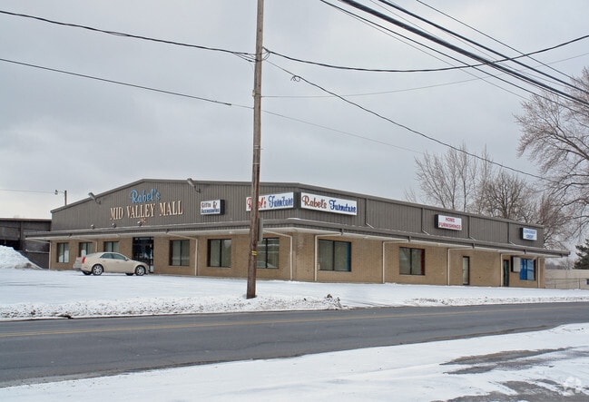
Property Detail
1330 Main St R St
Scranton--Wilkes-Barre, PA
400X221X360X203 RABELS MID VALLEY MALL 3 BLDGS W-03 B-018 L-038 P-000
11409080014
LACKAWANNA
Vacantlandnec
Pennsylvania
AE The base floodplain where base flood elevations are provided. AE Zones are now used on new format FIRMs instead of A1-A30 Zones.
38
2026
1.77 AC
2026
I-81 Corridor
111500
Philadelphia
NEARBY LISTINGS FOR SALE OR LEASE
DEMOGRAPHICS near 1330 Main St R St
1 mile
3 mile
5 mile
2025 Total Population
10,102
37,050
102,583
2030 Population
10,106
36,977
102,507
Pop Growth 2025-2030
+ 0.04%
(0.20%)
(0.07%)
Average Age
43
43
42
2025 Total Households
4,582
15,982
41,871
HH Growth 2025-2030
+ 0.02%
(0.22%)
(0.10%)
Median Household Inc
$54,665
$53,688
$53,972
Avg Household Size
2.20
2.20
2.20
2025 Avg HH Vehicles
2.00
2.00
2.00
Median Home Value
$180,571
$182,957
$193,231
Median Year Built
1951
1950
1950
Nearby Places
Map Layers
Map Styles
 Street
 Aerial
Layers
 Traffic
 Biking
Places
Listings with unknown addresses are not visible on the map
- Restaurants
- Banks
- Shops
- Fitness
- Groceries
PUBLIC TRANSPORTATION
AIRPORT
Wilkes-Barre/Scranton International
Drive
Walk
Distance
Wilkes-Barre/Scranton International
24 min
15.5 mi
Freight Ports
Maher Terminal
Drive
Walk
Distance
Maher Terminal
147 min
116.5 mi
Nearby Properties
Address
Land Use
TOTAL SIZE
Lot Size
Zoning
Address
Land Use
TOTAL SIZE
Lot Size
Zoning
43.66 AC
Address
Land Use
TOTAL SIZE
Lot Size
Zoning
43.89 AC
Address
Land Use
TOTAL SIZE
Lot Size
Zoning
32.49 AC
Address
Land Use
TOTAL SIZE
Lot Size
Zoning
112.27 AC
Address
Land Use
TOTAL SIZE
Lot Size
Zoning
7.81 AC
Address
Land Use
TOTAL SIZE
Lot Size
Zoning
3.12 AC
Address
Land Use
TOTAL SIZE
Lot Size
Zoning
26.40 AC
Address
Land Use
TOTAL SIZE
Lot Size
Zoning
37.77 AC
Address
Land Use
TOTAL SIZE
Lot Size
Zoning
30.60 AC
Address
Land Use
TOTAL SIZE
Lot Size
Zoning
Address
Land Use
TOTAL SIZE
Lot Size
Zoning
97.16 AC
Address
Land Use
TOTAL SIZE
Lot Size
Zoning
25.62 AC
Address
Land Use
TOTAL SIZE
Lot Size
Zoning
38.12 AC
Address
Land Use
TOTAL SIZE
Lot Size
Zoning
Address
Land Use
TOTAL SIZE
Lot Size
Zoning
28.20 AC
Address
Land Use
TOTAL SIZE
Lot Size
Zoning
21.11 AC
Address
Land Use
TOTAL SIZE
Lot Size
Zoning
91.39 AC
Address
Land Use
TOTAL SIZE
Lot Size
Zoning
20.23 AC
Address
Land Use
TOTAL SIZE
Lot Size
Zoning
Address
Land Use
TOTAL SIZE
Lot Size
Zoning
Address
Land Use
TOTAL SIZE
Lot Size
Zoning
43.10 AC
Address
Land Use
TOTAL SIZE
Lot Size
Zoning
28.89 AC
Address
Land Use
TOTAL SIZE
Lot Size
Zoning
Address
Land Use
TOTAL SIZE
Lot Size
Zoning
17.15 AC
Address
Land Use
TOTAL SIZE
Lot Size
Zoning
14.20 AC
Address
Land Use
TOTAL SIZE
Lot Size
Zoning
3.73 AC
Address
Land Use
TOTAL SIZE
Lot Size
Zoning
12.62 AC
Address
Land Use
TOTAL SIZE
Lot Size
Zoning
29.58 AC
Address
Land Use
TOTAL SIZE
Lot Size
Zoning
4.91 AC
Address
Land Use
TOTAL SIZE
Lot Size
Zoning
195.20 AC
The World's #1 Commercial Real Estate Marketplace
Connect with us
© 2026 CoStar Group
The information above has been obtained from sources believed reliable. While we do not doubt its accuracy we have not verified it and make no guarantee, warranty or representation about it. It is your responsibility to independently confirm its accuracy and completeness. Any projections, opinions, assumptions, or estimates used are for example only and do not represent the current or future performance of the property. The value of this transaction to you depends on tax and other factors which should be evaluated by your tax, financial, and legal advisors. You and your advisors should conduct a careful, independent investigation of the property to determine to your satisfaction the suitability of the property for your needs.