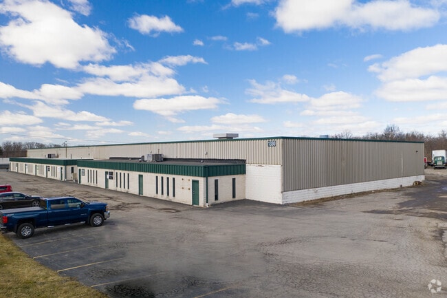
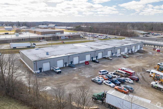
Property Record
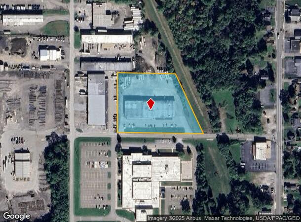
1330 Seaborn St, Mineral Ridge, OH 44440
Current Lease Availabilities
NEARBY LISTINGS FOR SALE OR LEASE
Property Detail
1330 Seaborn St
Youngstown-Warren-Boardman, OH-PA
Mineral Ridge
21-153163
1 2.88A MET WRHSE CO LTD PL 1 MIN RIDGE SEABORN ST WEAT
Officebuilding
Trumbull
X
Ohio
39155C0394D
1
2024
2.88 AC
2024
Trumbull County
933301
Youngstown/Warren/Boardman
34,000 SF
DEMOGRAPHICS near 1330 Seaborn St
1 Mile
3 Mile
5 Mile
2024 Total Population
2,446
21,128
76,257
2029 Population
2,395
20,884
75,221
Pop Growth 2024-2029
(2.09%)
(1.15%)
(1.36%)
Average Age
46
43
43
2024 Total Households
1,018
8,966
34,140
HH Growth 2024-2029
(2.26%)
(1.25%)
(1.46%)
Median Household Inc
$52,536
$54,317
$48,226
Avg Household Size
2.20
2.30
2.20
2024 Avg HH Vehicles
2.00
2.00
2.00
Median Home Value
$112,310
$111,154
$111,994
Median Year Built
1972
1962
1963
Nearby Places
Map Layers
Map Styles
 Street
 Aerial
- Restaurants
- Banks
- Shops
- Fitness
- Groceries
Nearby Properties
Address
Land Use
TOTAL SIZE
Lot Size
Zoning
Address
Land Use
TOTAL SIZE
Lot Size
Zoning
178,531 SF
189.16 AC
Address
Land Use
TOTAL SIZE
Lot Size
Zoning
1,582.88 AC
Address
Land Use
TOTAL SIZE
Lot Size
Zoning
8,642 SF
16.50 AC
Address
Land Use
TOTAL SIZE
Lot Size
Zoning
10.30 AC
Address
Land Use
TOTAL SIZE
Lot Size
Zoning
Address
Land Use
TOTAL SIZE
Lot Size
Zoning
14.92 AC
Address
Land Use
TOTAL SIZE
Lot Size
Zoning
97,754 SF
68.10 AC
Address
Land Use
TOTAL SIZE
Lot Size
Zoning
70,642 SF
34.06 AC
ASER
Address
Land Use
TOTAL SIZE
Lot Size
Zoning
98,609 SF
11.01 AC
Address
Land Use
TOTAL SIZE
Lot Size
Zoning
470,857 SF
18.81 AC
I2
Address
Land Use
TOTAL SIZE
Lot Size
Zoning
58,282 SF
24.96 AC
Address
Land Use
TOTAL SIZE
Lot Size
Zoning
71,678 SF
7.78 AC
Address
Land Use
TOTAL SIZE
Lot Size
Zoning
95,231 SF
37.75 AC
ASER
Address
Land Use
TOTAL SIZE
Lot Size
Zoning
382,202 SF
18.29 AC
I2
Address
Land Use
TOTAL SIZE
Lot Size
Zoning
5,616 SF
23.43 AC
Address
Land Use
TOTAL SIZE
Lot Size
Zoning
58,663 SF
24.53 AC
ASER
Address
Land Use
TOTAL SIZE
Lot Size
Zoning
54,969 SF
6.17 AC
Address
Land Use
TOTAL SIZE
Lot Size
Zoning
58,085 SF
3.31 AC
I2
Address
Land Use
TOTAL SIZE
Lot Size
Zoning
57,318 SF
3.01 AC
B2
Address
Land Use
TOTAL SIZE
Lot Size
Zoning
13,667 SF
7.29 AC
B1
Address
Land Use
TOTAL SIZE
Lot Size
Zoning
148,248 SF
16.95 AC
Address
Land Use
TOTAL SIZE
Lot Size
Zoning
94,096 SF
4.46 AC
I2
Address
Land Use
TOTAL SIZE
Lot Size
Zoning
69,160 SF
22.87 AC
Address
Land Use
TOTAL SIZE
Lot Size
Zoning
20,431 SF
29.41 AC
Address
Land Use
TOTAL SIZE
Lot Size
Zoning
49,570 SF
9.95 AC
I2
Address
Land Use
TOTAL SIZE
Lot Size
Zoning
9,069 SF
15.49 AC
B2
Address
Land Use
TOTAL SIZE
Lot Size
Zoning
98,943 SF
1.48 AC
Address
Land Use
TOTAL SIZE
Lot Size
Zoning
48,638 SF
2.05 AC
B2
Address
Land Use
TOTAL SIZE
Lot Size
Zoning
49,094 SF
2.40 AC
B2
Address
Land Use
TOTAL SIZE
Lot Size
Zoning
160,000 SF
14.66 AC
I2
The World's #1 Commercial Real Estate Marketplace
Connect with us
© 2026 CoStar Group
The information above has been obtained from sources believed reliable. While we do not doubt its accuracy we have not verified it and make no guarantee, warranty or representation about it. It is your responsibility to independently confirm its accuracy and completeness. Any projections, opinions, assumptions, or estimates used are for example only and do not represent the current or future performance of the property. The value of this transaction to you depends on tax and other factors which should be evaluated by your tax, financial, and legal advisors. You and your advisors should conduct a careful, independent investigation of the property to determine to your satisfaction the suitability of the property for your needs.