Property Record
1330 W Mcneese St W, Lake Charles, LA 70605

NEARBY LISTINGS FOR SALE OR LEASE
Property Detail
1330 W Mcneese St W
Lake Charles, LA
Subdivision
01359633
@241009-0000-130001401 0000 COM AT THE NE COR OF SW NE 24-10-9 TH W 608.38 FT ON THE NORTHERLY BANK OF NELSON CANAL TH CONTIN
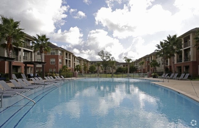
Apartment
Calcasieu
AE
Louisiana
22019C0490F
14
2025
19.57 AC
2024
Lake Charles
001907
Other Market Areas
DEMOGRAPHICS near 1330 W Mcneese St W
1 Mile
3 Mile
5 Mile
2024 Total Population
9,798
49,956
86,650
2029 Population
9,108
46,391
81,029
Pop Growth 2024-2029
(7.04%)
(7.14%)
(6.49%)
Average Age
39
39
39
2024 Total Households
4,296
20,672
35,419
HH Growth 2024-2029
(6.47%)
(6.60%)
(5.92%)
Median Household Inc
$58,259
$61,708
$55,246
Avg Household Size
2.20
2.30
2.40
2024 Avg HH Vehicles
2.00
2.00
2.00
Median Home Value
$266,375
$245,177
$223,709
Median Year Built
1988
1984
1982
Nearby Places
Map Layers
Map Styles
 Street
 Aerial
- Restaurants
- Banks
- Shops
- Fitness
- Groceries
PUBLIC TRANSPORTATION
COMMUTER RAIL
Lake Charles (Sunset Limited - Amtrak)
DRIVE
WALK
Distance
Lake Charles (Sunset Limited - Amtrak)
11 min
5.7 mi
AIRPORT
Lake Charles Regional
DRIVE
WALK
Distance
Lake Charles Regional
11 min
5.5 mi
Freight Ports
Port of Lake Charles
DRIVE
WALK
Distance
Port of Lake Charles
9 min
4.0 mi
Nearby Properties
Address
Land Use
TOTAL SIZE
Lot Size
Zoning
Address
Land Use
TOTAL SIZE
Lot Size
Zoning
Address
Land Use
TOTAL SIZE
Lot Size
Zoning
548.50 AC
Address
Land Use
TOTAL SIZE
Lot Size
Zoning
64.85 AC
Address
Land Use
TOTAL SIZE
Lot Size
Zoning
157.09 AC
Address
Land Use
TOTAL SIZE
Lot Size
Zoning
Address
Land Use
TOTAL SIZE
Lot Size
Zoning
0.01 AC
Address
Land Use
TOTAL SIZE
Lot Size
Zoning
Address
Land Use
TOTAL SIZE
Lot Size
Zoning
Address
Land Use
TOTAL SIZE
Lot Size
Zoning
Address
Land Use
TOTAL SIZE
Lot Size
Zoning
27.73 AC
Address
Land Use
TOTAL SIZE
Lot Size
Zoning
Address
Land Use
TOTAL SIZE
Lot Size
Zoning
46.76 AC
Address
Land Use
TOTAL SIZE
Lot Size
Zoning
Address
Land Use
TOTAL SIZE
Lot Size
Zoning
Address
Land Use
TOTAL SIZE
Lot Size
Zoning
69.07 AC
Address
Land Use
TOTAL SIZE
Lot Size
Zoning
Address
Land Use
TOTAL SIZE
Lot Size
Zoning
Address
Land Use
TOTAL SIZE
Lot Size
Zoning
Address
Land Use
TOTAL SIZE
Lot Size
Zoning
Address
Land Use
TOTAL SIZE
Lot Size
Zoning
19.15 AC
Address
Land Use
TOTAL SIZE
Lot Size
Zoning
Address
Land Use
TOTAL SIZE
Lot Size
Zoning
23.51 AC
Address
Land Use
TOTAL SIZE
Lot Size
Zoning
Address
Land Use
TOTAL SIZE
Lot Size
Zoning
7,920 SF
0.52 AC
MPR2YY
Address
Land Use
TOTAL SIZE
Lot Size
Zoning
2.29 AC
Address
Land Use
TOTAL SIZE
Lot Size
Zoning
Address
Land Use
TOTAL SIZE
Lot Size
Zoning
14.55 AC
Address
Land Use
TOTAL SIZE
Lot Size
Zoning
20.49 AC
Address
Land Use
TOTAL SIZE
Lot Size
Zoning
Address
Land Use
TOTAL SIZE
Lot Size
Zoning
The World's #1 Commercial Real Estate Marketplace
Connect with us
© 2026 CoStar Group
The information above has been obtained from sources believed reliable. While we do not doubt its accuracy we have not verified it and make no guarantee, warranty or representation about it. It is your responsibility to independently confirm its accuracy and completeness. Any projections, opinions, assumptions, or estimates used are for example only and do not represent the current or future performance of the property. The value of this transaction to you depends on tax and other factors which should be evaluated by your tax, financial, and legal advisors. You and your advisors should conduct a careful, independent investigation of the property to determine to your satisfaction the suitability of the property for your needs.