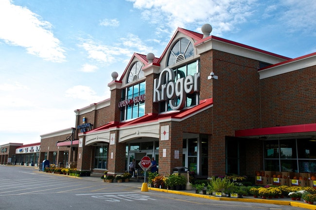
Property Record
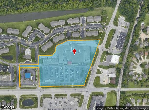
1330 W Southport Rd, Indianapolis, IN 46217
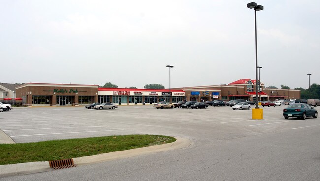
NEARBY LISTINGS FOR SALE OR LEASE
Property Detail
1330 W Southport Rd
49-14-10-118-011.000-500
PT OF SE1/4 S10 T14 R3 BEG 541.92 E & 70 N OFSW 1/4 N 272 E 242.01 N 106.18 E 164.45 NELY692.44 SW 593.62 W 557.12 N 233.91 W 237.01 S233.91W 5 TO BEG 7.708 ACRES
Regionalshoppingcenterormallwithanchorstore
Marion
X
Indiana
18097C0241G
7.71 AC
2023
Edgewood/South County
2024
Indianapolis
380102
Indianapolis-Carmel-Anderson, IN
93,650 SF
DEMOGRAPHICS near 1330 W Southport Rd
1 Mile
3 Mile
5 Mile
2024 Total Population
11,030
56,903
165,729
2029 Population
10,753
56,287
166,050
Pop Growth 2024-2029
(2.51%)
(1.08%)
+ 0.19%
Average Age
36
38
37
2024 Total Households
4,111
21,798
63,426
HH Growth 2024-2029
(2.58%)
(1.12%)
+ 0.21%
Median Household Inc
$73,900
$72,798
$65,881
Avg Household Size
2.60
2.60
2.50
2024 Avg HH Vehicles
2.00
2.00
2.00
Median Home Value
$214,567
$197,274
$190,034
Median Year Built
1991
1981
1977
Nearby Places
- Restaurants
- Banks
- Shops
- Fitness
- Groceries
PUBLIC TRANSPORTATION
COMMUTER RAIL
Indianapolis (Cardinal - Amtrak)
DRIVE
WALK
Distance
Indianapolis (Cardinal - Amtrak)
13 min
7.3 mi
AIRPORT
Indianapolis International
DRIVE
WALK
Distance
Indianapolis International
27 min
15.4 mi
Freight Ports
Port of Toledo
DRIVE
WALK
Distance
Port of Toledo
283 min
235.8 mi
SALE & LEASE HISTORY
LISTING DATE
SALE/LEASE

Sep 25, 2016
For Lease
Jul 24, 2025
For Lease
Aug 02, 2018
For Lease
Nearby Properties
Address
Land Use
TOTAL SIZE
Lot Size
Zoning
Address
Land Use
TOTAL SIZE
Lot Size
Zoning
5,470 SF
35.46 AC
Address
Land Use
TOTAL SIZE
Lot Size
Zoning
5,279 SF
18.07 AC
ZO01
Address
Land Use
TOTAL SIZE
Lot Size
Zoning
3,782 SF
44.43 AC
ZO01
Address
Land Use
TOTAL SIZE
Lot Size
Zoning
23,040 SF
9.28 AC
ZO01
Address
Land Use
TOTAL SIZE
Lot Size
Zoning
3,818 SF
15.24 AC
Address
Land Use
TOTAL SIZE
Lot Size
Zoning
5,779 SF
15.77 AC
Address
Land Use
TOTAL SIZE
Lot Size
Zoning
3,935 SF
36.09 AC
ZO01
Address
Land Use
TOTAL SIZE
Lot Size
Zoning
3,793 SF
23.47 AC
ZO01
Address
Land Use
TOTAL SIZE
Lot Size
Zoning
4,476 SF
12.18 AC
Address
Land Use
TOTAL SIZE
Lot Size
Zoning
1,925 SF
29.98 AC
Address
Land Use
TOTAL SIZE
Lot Size
Zoning
3,337 SF
21.53 AC
ZO01
Address
Land Use
TOTAL SIZE
Lot Size
Zoning
3,701 SF
26 AC
ZO01
Address
Land Use
TOTAL SIZE
Lot Size
Zoning
65,551 SF
12.84 AC
ZO01
Address
Land Use
TOTAL SIZE
Lot Size
Zoning
5,665 SF
25.25 AC
ZO01
Address
Land Use
TOTAL SIZE
Lot Size
Zoning
1,932 SF
19.63 AC
ZO01
Address
Land Use
TOTAL SIZE
Lot Size
Zoning
3,360 SF
14.68 AC
Address
Land Use
TOTAL SIZE
Lot Size
Zoning
151,956 SF
26.26 AC
ZO01
Address
Land Use
TOTAL SIZE
Lot Size
Zoning
2,928 SF
17.76 AC
Address
Land Use
TOTAL SIZE
Lot Size
Zoning
11,326 SF
7.88 AC
Address
Land Use
TOTAL SIZE
Lot Size
Zoning
11,664 SF
22.32 AC
ZO01
Address
Land Use
TOTAL SIZE
Lot Size
Zoning
18,978 SF
9.85 AC
ZO01
Address
Land Use
TOTAL SIZE
Lot Size
Zoning
1,448 SF
5 AC
ZO01
Address
Land Use
TOTAL SIZE
Lot Size
Zoning
1,372 SF
25.27 AC
Address
Land Use
TOTAL SIZE
Lot Size
Zoning
75,167 SF
13.75 AC
Address
Land Use
TOTAL SIZE
Lot Size
Zoning
5,075 SF
8 AC
ZO01
Address
Land Use
TOTAL SIZE
Lot Size
Zoning
3,208 SF
5.22 AC
ZO01
Address
Land Use
TOTAL SIZE
Lot Size
Zoning
199,600 SF
12.31 AC
Address
Land Use
TOTAL SIZE
Lot Size
Zoning
4,308 SF
8.36 AC
ZO01
Address
Land Use
TOTAL SIZE
Lot Size
Zoning
24,398 SF
4.12 AC
ZO01
Address
Land Use
TOTAL SIZE
Lot Size
Zoning
84,966 SF
6.50 AC
ZO01
The World's #1 Commercial Real Estate Marketplace
Connect with us
© 2025 CoStar Group
The information above has been obtained from sources believed reliable. While we do not doubt its accuracy we have not verified it and make no guarantee, warranty or representation about it. It is your responsibility to independently confirm its accuracy and completeness. Any projections, opinions, assumptions, or estimates used are for example only and do not represent the current or future performance of the property. The value of this transaction to you depends on tax and other factors which should be evaluated by your tax, financial, and legal advisors. You and your advisors should conduct a careful, independent investigation of the property to determine to your satisfaction the suitability of the property for your needs.