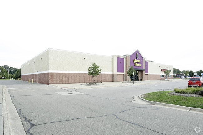
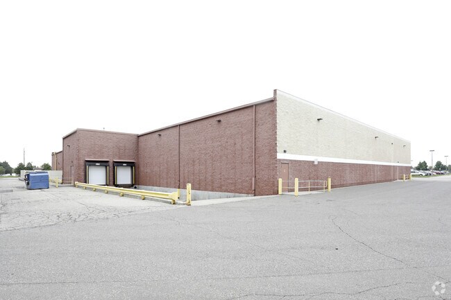
Property Record
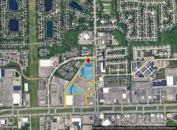
13301 Hall Rd, Utica, MI 48315
NEARBY LISTINGS FOR SALE OR LEASE
Property Detail
13301 Hall Rd
11-07-35-400-032
T3N, R12E, SEC 35; COMM AT SE COR SEC 35; TH S89*40'00" W 1325.00 FT ALG THE S LINE OF SEC 35; TH N00*03'07" E 285.00 FT TO
Commercialnec
Macomb
X
Michigan
26099C0238G
21.43 AC
2025
Macomb West
2025
Detroit
228000
Detroit-Warren-Dearborn, MI
50,577 SF
DEMOGRAPHICS near 13301 Hall Rd
1 Mile
3 Mile
5 Mile
2024 Total Population
8,065
97,408
244,304
2029 Population
7,901
96,067
241,345
Pop Growth 2024-2029
(2.03%)
(1.38%)
(1.21%)
Average Age
45
43
42
2024 Total Households
3,316
40,456
97,158
HH Growth 2024-2029
(2.35%)
(1.41%)
(1.25%)
Median Household Inc
$63,345
$74,929
$80,105
Avg Household Size
2.30
2.40
2.50
2024 Avg HH Vehicles
2.00
2.00
2.00
Median Home Value
$308,757
$241,479
$262,774
Median Year Built
1992
1984
1987
Nearby Places
Map Layers
Map Styles
 Street
 Aerial
- Restaurants
- Banks
- Shops
- Fitness
- Groceries
PUBLIC TRANSPORTATION
AIRPORT
Detroit City
DRIVE
WALK
Distance
Detroit City
42 min
19.7 mi
Freight Ports
Port of Baltimore
DRIVE
WALK
Distance
Port of Baltimore
1 min
406.8 mi
Nearby Properties
Address
Land Use
TOTAL SIZE
Lot Size
Zoning
Address
Land Use
TOTAL SIZE
Lot Size
Zoning
426,076 SF
42.79 AC
B-4
Address
Land Use
TOTAL SIZE
Lot Size
Zoning
20,560 SF
37.09 AC
R2
Address
Land Use
TOTAL SIZE
Lot Size
Zoning
447,434 SF
23.29 AC
LM
Address
Land Use
TOTAL SIZE
Lot Size
Zoning
92.30 AC
MHP
Address
Land Use
TOTAL SIZE
Lot Size
Zoning
401,014 SF
32.54 AC
RML
Address
Land Use
TOTAL SIZE
Lot Size
Zoning
366,656 SF
30.08 AC
RM-2
Address
Land Use
TOTAL SIZE
Lot Size
Zoning
22.52 AC
RMH
Address
Land Use
TOTAL SIZE
Lot Size
Zoning
182,708 SF
10.69 AC
RMH
Address
Land Use
TOTAL SIZE
Lot Size
Zoning
438,578 SF
36.60 AC
MXD
Address
Land Use
TOTAL SIZE
Lot Size
Zoning
25.18 AC
RM-2
Address
Land Use
TOTAL SIZE
Lot Size
Zoning
23.78 AC
RML
Address
Land Use
TOTAL SIZE
Lot Size
Zoning
182,102 SF
11.04 AC
SP-1
Address
Land Use
TOTAL SIZE
Lot Size
Zoning
15.94 AC
RMH
Address
Land Use
TOTAL SIZE
Lot Size
Zoning
10.29 AC
LM
Address
Land Use
TOTAL SIZE
Lot Size
Zoning
237,108 SF
10.30 AC
R-12
Address
Land Use
TOTAL SIZE
Lot Size
Zoning
29.93 AC
RM-2
Address
Land Use
TOTAL SIZE
Lot Size
Zoning
15.90 AC
RML
Address
Land Use
TOTAL SIZE
Lot Size
Zoning
224,323 SF
22.15 AC
C-3
Address
Land Use
TOTAL SIZE
Lot Size
Zoning
79,504 SF
SP-2
Address
Land Use
TOTAL SIZE
Lot Size
Zoning
17.40 AC
CK MAP
Address
Land Use
TOTAL SIZE
Lot Size
Zoning
73.49 AC
CK MAP
Address
Land Use
TOTAL SIZE
Lot Size
Zoning
176,212 SF
16.46 AC
MXD
Address
Land Use
TOTAL SIZE
Lot Size
Zoning
45,000 SF
7.58 AC
B-4
Address
Land Use
TOTAL SIZE
Lot Size
Zoning
15.46 AC
RMH
Address
Land Use
TOTAL SIZE
Lot Size
Zoning
79,942 SF
4.65 AC
M1
Address
Land Use
TOTAL SIZE
Lot Size
Zoning
146,106 SF
6.03 AC
RM-2
Address
Land Use
TOTAL SIZE
Lot Size
Zoning
175,143 SF
22.87 AC
B-4
Address
Land Use
TOTAL SIZE
Lot Size
Zoning
233,584 SF
26.03 AC
C-3
Address
Land Use
TOTAL SIZE
Lot Size
Zoning
171,634 SF
3.90 AC
RM-2
The World's #1 Commercial Real Estate Marketplace
Connect with us
© 2026 CoStar Group
The information above has been obtained from sources believed reliable. While we do not doubt its accuracy we have not verified it and make no guarantee, warranty or representation about it. It is your responsibility to independently confirm its accuracy and completeness. Any projections, opinions, assumptions, or estimates used are for example only and do not represent the current or future performance of the property. The value of this transaction to you depends on tax and other factors which should be evaluated by your tax, financial, and legal advisors. You and your advisors should conduct a careful, independent investigation of the property to determine to your satisfaction the suitability of the property for your needs.