Property Record
13303 E Adam Aircraft Cir, Englewood, CO 80112

This Property Is For Sale
NEARBY LISTINGS FOR SALE OR LEASE
Property Detail
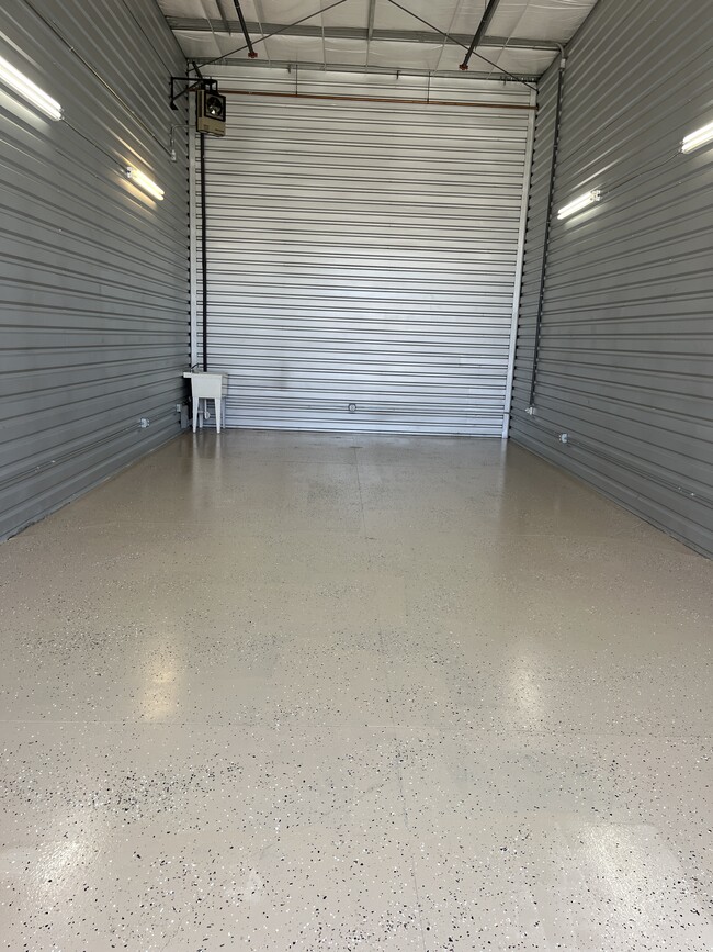
13303 E Adam Aircraft Cir
2075-36-1-24-013
Mancaves Of Dove Valley Condominium
Commercialcondominium
TOWNSHIP T5S MAPPLATB 467 MAPPLATP 12 SUBDIVISIONCD 043352 SUBDIVISIONNAME MANCAVES OF DOVE VALLEY CONDOMINIUM UNIT D60 MANCAVES DOVE VALLEY A CONDOMINIUM AS PER CONDO DECLARATION RECORDED ON RECEPTION #D5060350
X
Arapahoe
08005C0479K
Colorado
2024
0.03 AC
2025
Centennial
006864
Denver
1,407 SF
Denver-Aurora-Lakewood, CO
DEMOGRAPHICS near 13303 E Adam Aircraft Cir
1 Mile
3 Mile
5 Mile
2024 Total Population
2,215
53,471
213,706
2029 Population
2,199
56,314
225,450
Pop Growth 2024-2029
(0.72%)
+ 5.32%
+ 5.50%
Average Age
33
37
39
2024 Total Households
971
22,491
83,808
HH Growth 2024-2029
(0.82%)
+ 5.75%
+ 5.82%
Median Household Inc
$63,588
$98,486
$112,625
Avg Household Size
2.20
2.30
2.50
2024 Avg HH Vehicles
1.00
2.00
2.00
Median Home Value
$312,705
$593,670
$623,957
Median Year Built
2001
2003
1995
Nearby Places
Map Layers
Map Styles
 Street
 Aerial
- Restaurants
- Banks
- Shops
- Fitness
- Groceries
PUBLIC TRANSPORTATION
AIRPORT
Denver International
DRIVE
WALK
Distance
Denver International
37 min
32.4 mi
Freight Ports
Tulsa Port Of Catoosa
DRIVE
WALK
Distance
Tulsa Port Of Catoosa
730 min
712.2 mi
Nearby Properties
Address
Land Use
TOTAL SIZE
Lot Size
Zoning
Address
Land Use
TOTAL SIZE
Lot Size
Zoning
709,725 SF
15.21 AC
Address
Land Use
TOTAL SIZE
Lot Size
Zoning
709,725 SF
29.14 AC
Address
Land Use
TOTAL SIZE
Lot Size
Zoning
234,214 SF
5.23 AC
Address
Land Use
TOTAL SIZE
Lot Size
Zoning
280,586 SF
60.97 AC
RPD
Address
Land Use
TOTAL SIZE
Lot Size
Zoning
637,459 SF
4.94 AC
AMU
Address
Land Use
TOTAL SIZE
Lot Size
Zoning
1,210,850 SF
13.65 AC
AMU
Address
Land Use
TOTAL SIZE
Lot Size
Zoning
29,070 SF
308.89 AC
Address
Land Use
TOTAL SIZE
Lot Size
Zoning
305,198 SF
34.41 AC
PUD
Address
Land Use
TOTAL SIZE
Lot Size
Zoning
284,862 SF
23.37 AC
PUD
Address
Land Use
TOTAL SIZE
Lot Size
Zoning
162,758 SF
11.21 AC
Address
Land Use
TOTAL SIZE
Lot Size
Zoning
246,768 SF
12.37 AC
PUD
Address
Land Use
TOTAL SIZE
Lot Size
Zoning
134,316 SF
26.52 AC
Address
Land Use
TOTAL SIZE
Lot Size
Zoning
247,689 SF
26.15 AC
AMU
Address
Land Use
TOTAL SIZE
Lot Size
Zoning
621,565 SF
32.64 AC
PDU
Address
Land Use
TOTAL SIZE
Lot Size
Zoning
139,291 SF
8.63 AC
AMU
Address
Land Use
TOTAL SIZE
Lot Size
Zoning
216,853 SF
5.42 AC
PUD
Address
Land Use
TOTAL SIZE
Lot Size
Zoning
163,443 SF
14.39 AC
Address
Land Use
TOTAL SIZE
Lot Size
Zoning
650,416 SF
33.37 AC
LI
Address
Land Use
TOTAL SIZE
Lot Size
Zoning
224,978 SF
18.99 AC
Address
Land Use
TOTAL SIZE
Lot Size
Zoning
304,620 SF
23.95 AC
AMU
Address
Land Use
TOTAL SIZE
Lot Size
Zoning
231,715 SF
5.58 AC
Address
Land Use
TOTAL SIZE
Lot Size
Zoning
107,760 SF
5.41 AC
AMU
Address
Land Use
TOTAL SIZE
Lot Size
Zoning
279,884 SF
14.72 AC
Address
Land Use
TOTAL SIZE
Lot Size
Zoning
418,258 SF
14.46 AC
PDU
Address
Land Use
TOTAL SIZE
Lot Size
Zoning
222,000 SF
16.26 AC
AMU
Address
Land Use
TOTAL SIZE
Lot Size
Zoning
355,326 SF
12.27 AC
PUD
Address
Land Use
TOTAL SIZE
Lot Size
Zoning
253,296 SF
16.41 AC
Address
Land Use
TOTAL SIZE
Lot Size
Zoning
441,689 SF
25.31 AC
Address
Land Use
TOTAL SIZE
Lot Size
Zoning
222,931 SF
13 AC
Address
Land Use
TOTAL SIZE
Lot Size
Zoning
632,485 SF
38.43 AC
PDU
The World's #1 Commercial Real Estate Marketplace
Connect with us
© 2026 CoStar Group
The information above has been obtained from sources believed reliable. While we do not doubt its accuracy we have not verified it and make no guarantee, warranty or representation about it. It is your responsibility to independently confirm its accuracy and completeness. Any projections, opinions, assumptions, or estimates used are for example only and do not represent the current or future performance of the property. The value of this transaction to you depends on tax and other factors which should be evaluated by your tax, financial, and legal advisors. You and your advisors should conduct a careful, independent investigation of the property to determine to your satisfaction the suitability of the property for your needs.