Property Record
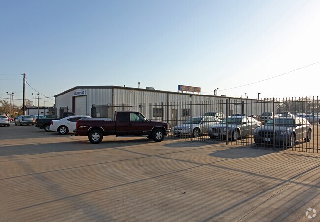
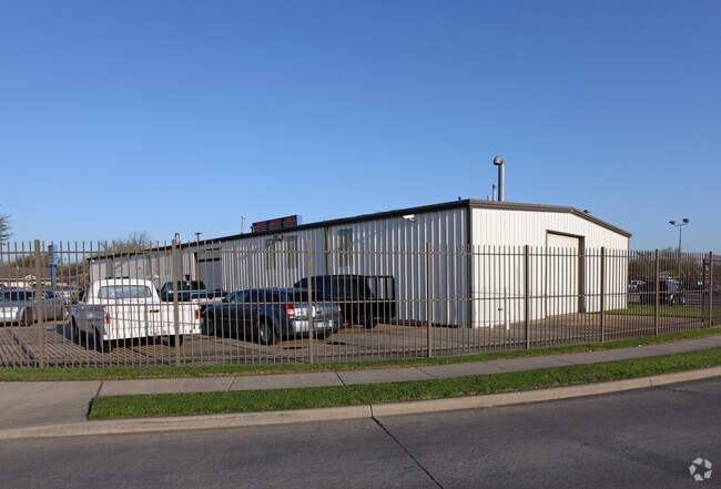
1331 E 6Th St, Irving, TX 75060

Property Detail
1331 E 6Th St
32098500030010000
EAST IRVING BLK C LOT 1 ACS 0.1784 VOL93055/1924 DD031293 CO-DALLAS 0985000300100 13209850003
Autorepair
DALLAS
Z58
Texas
B and X Area of moderate flood hazard, usually the area between the limits of the 100-year and 500-year floods.
1
2024
0.18 AC
2025
Irving
015102
Dallas/Ft Worth
7,200 SF
Dallas-Fort Worth-Arlington, TX
NEARBY LISTINGS FOR SALE OR LEASE
DEMOGRAPHICS near 1331 E 6Th St
1 mile
3 mile
5 mile
2025 Total Population
13,402
92,889
221,984
2030 Population
13,858
95,509
228,094
Pop Growth 2025-2030
+ 3.40%
+ 2.82%
+ 2.75%
Average Age
36
36
36
2025 Total Households
4,215
28,636
75,853
HH Growth 2025-2030
+ 3.46%
+ 2.87%
+ 2.84%
Median Household Inc
$73,773
$69,045
$69,254
Avg Household Size
3.10
3.10
2.80
2025 Avg HH Vehicles
2.00
2.00
2.00
Median Home Value
$229,334
$266,950
$271,897
Median Year Built
1967
1970
1978
Nearby Places
Map Layers
Map Styles
 Street
 Aerial
Transit
 Traffic
 Biking
Places
Listings with unknown addresses are not visible on the map
- Restaurants
- Banks
- Shops
- Fitness
- Groceries
PUBLIC TRANSPORTATION
COMMUTER RAIL
Downtown Irving/Heritage Crossing Station (TRINITY RAILWAY - Dallas Area Rapid Transit (DART))
Drive
Walk
Distance
Downtown Irving/Heritage Crossing Station (TRINITY RAILWAY - Dallas Area Rapid Transit (DART))
3 min
1.2 mi
West Irving Station (TRINITY RAILWAY - Dallas Area Rapid Transit (DART))
Drive
Walk
Distance
West Irving Station (TRINITY RAILWAY - Dallas Area Rapid Transit (DART))
11 min
4.8 mi
AIRPORT
Dallas Love Field
Drive
Walk
Distance
Dallas Love Field
16 min
7.5 mi
Dallas-Fort Worth International
Drive
Walk
Distance
Dallas-Fort Worth International
20 min
11.9 mi
Freight Ports
Port of Shreveport
Drive
Walk
Distance
Port of Shreveport
225 min
207.3 mi
Nearby Properties
Address
Land Use
TOTAL SIZE
Lot Size
Zoning
Address
Land Use
TOTAL SIZE
Lot Size
Zoning
30,000 SF
78.01 AC
Z392
Address
Land Use
TOTAL SIZE
Lot Size
Zoning
1,085,000 SF
88.02 AC
Address
Land Use
TOTAL SIZE
Lot Size
Zoning
253,580 SF
188.04 AC
Z393
Address
Land Use
TOTAL SIZE
Lot Size
Zoning
310,154 SF
10.33 AC
Z393
Address
Land Use
TOTAL SIZE
Lot Size
Zoning
348,013 SF
11.09 AC
Z243
Address
Land Use
TOTAL SIZE
Lot Size
Zoning
168,598 SF
11.33 AC
Z128
Address
Land Use
TOTAL SIZE
Lot Size
Zoning
643,370 SF
22.95 AC
Z393
Address
Land Use
TOTAL SIZE
Lot Size
Zoning
120,000 SF
9.94 AC
Z393
Address
Land Use
TOTAL SIZE
Lot Size
Zoning
268,930 SF
46.40 AC
Z325
Address
Land Use
TOTAL SIZE
Lot Size
Zoning
294,460 SF
14.78 AC
Z392
Address
Land Use
TOTAL SIZE
Lot Size
Zoning
237,472 SF
9.31 AC
Z176
Address
Land Use
TOTAL SIZE
Lot Size
Zoning
327,975 SF
18.46 AC
Z393
Address
Land Use
TOTAL SIZE
Lot Size
Zoning
319,346 SF
15.84 AC
Address
Land Use
TOTAL SIZE
Lot Size
Zoning
242,652 SF
12.31 AC
Z392
Address
Land Use
TOTAL SIZE
Lot Size
Zoning
24,600 SF
108.58 AC
Z128
Address
Land Use
TOTAL SIZE
Lot Size
Zoning
181,389 SF
8.46 AC
Z176
Address
Land Use
TOTAL SIZE
Lot Size
Zoning
81,210 SF
53.19 AC
Z324
Address
Land Use
TOTAL SIZE
Lot Size
Zoning
206,856 SF
10.20 AC
Z177
Address
Land Use
TOTAL SIZE
Lot Size
Zoning
406,496 SF
42.49 AC
Z128
Address
Land Use
TOTAL SIZE
Lot Size
Zoning
121,900 SF
2.60 AC
Z393
Address
Land Use
TOTAL SIZE
Lot Size
Zoning
478,106 SF
23.56 AC
Z116
Address
Land Use
TOTAL SIZE
Lot Size
Zoning
220,762 SF
14.77 AC
Z176
Address
Land Use
TOTAL SIZE
Lot Size
Zoning
143,916 SF
7.22 AC
Z177
Address
Land Use
TOTAL SIZE
Lot Size
Zoning
192,346 SF
9.89 AC
Z392
Address
Land Use
TOTAL SIZE
Lot Size
Zoning
162,612 SF
7.81 AC
Z392
Address
Land Use
TOTAL SIZE
Lot Size
Zoning
97,779 SF
50.53 AC
Z324
Address
Land Use
TOTAL SIZE
Lot Size
Zoning
432,616 SF
47.58 AC
Z128
Address
Land Use
TOTAL SIZE
Lot Size
Zoning
52,570 SF
1.55 AC
Z58
Address
Land Use
TOTAL SIZE
Lot Size
Zoning
127,192 SF
18 AC
SP2
Address
Land Use
TOTAL SIZE
Lot Size
Zoning
319,029 SF
15.91 AC
The World's #1 Commercial Real Estate Marketplace
Connect with us
© 2026 CoStar Group
The information above has been obtained from sources believed reliable. While we do not doubt its accuracy we have not verified it and make no guarantee, warranty or representation about it. It is your responsibility to independently confirm its accuracy and completeness. Any projections, opinions, assumptions, or estimates used are for example only and do not represent the current or future performance of the property. The value of this transaction to you depends on tax and other factors which should be evaluated by your tax, financial, and legal advisors. You and your advisors should conduct a careful, independent investigation of the property to determine to your satisfaction the suitability of the property for your needs.