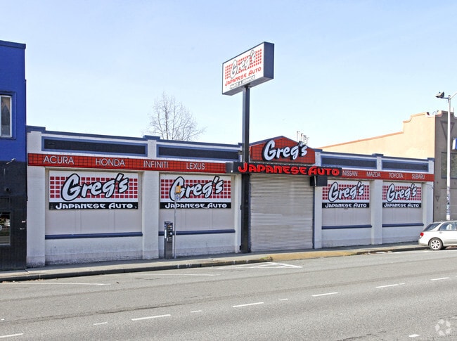
Property Record
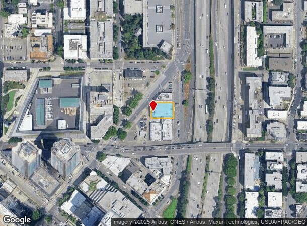
1331 Stewart St, Seattle, WA 98109


NEARBY LISTINGS FOR SALE OR LEASE
Property Detail
1331 Stewart St
Seattle-Tacoma-Bellevue, WA
Pontius 4Th Add
684970-0340
PONTIUS 4TH ADD LESS STS
Commercialnec
King
X
Washington
53033C0630G
13-14
2025
0.21 AC
2024
Lake Union
007301
Seattle/Puget Sound
9,020 SF
DEMOGRAPHICS near 1331 Stewart St
1 Mile
3 Mile
5 Mile
2024 Total Population
101,228
279,418
514,851
2029 Population
104,071
285,867
523,553
Pop Growth 2024-2029
+ 2.81%
+ 2.31%
+ 1.69%
Average Age
37
38
38
2024 Total Households
64,562
151,689
255,879
HH Growth 2024-2029
+ 2.73%
+ 2.34%
+ 1.78%
Median Household Inc
$109,930
$110,741
$117,424
Avg Household Size
1.50
1.70
1.90
2024 Avg HH Vehicles
1.00
1.00
1.00
Median Home Value
$871,852
$997,785
$967,855
Median Year Built
2000
1990
1981
Nearby Places
Map Layers
Map Styles
 Street
 Aerial
- Restaurants
- Banks
- Shops
- Fitness
- Groceries
PUBLIC TRANSPORTATION
TRANSIT/SUBWAY
Westlake & Denny (South Lake Union Streetcar - Seattle Streetcar)
DRIVE
WALK
Distance
Westlake & Denny (South Lake Union Streetcar - Seattle Streetcar)
2 min
8 min
0.4 mi
Terry & Thomas (South Lake Union Streetcar - Seattle Streetcar)
DRIVE
WALK
Distance
Terry & Thomas (South Lake Union Streetcar - Seattle Streetcar)
2 min
9 min
0.5 mi
Broadway And Denny (First Hill Streetcar - City of Seattle)
DRIVE
WALK
Distance
Broadway And Denny (First Hill Streetcar - City of Seattle)
2 min
10 min
0.6 mi
Westlake & Thomas (South Lake Union Streetcar - Seattle Streetcar)
DRIVE
WALK
Distance
Westlake & Thomas (South Lake Union Streetcar - Seattle Streetcar)
2 min
11 min
0.6 mi
Capitol Hill Station (Lynnwood - Angle Lake - Sound Transit, Northgate - Angle Lake - Sound Transit)
DRIVE
WALK
Distance
Capitol Hill Station (Lynnwood - Angle Lake - Sound Transit, Northgate - Angle Lake - Sound Transit)
2 min
11 min
0.6 mi
COMMUTER RAIL
King Street (Seattle) Station (Everett - Seattle - Sound Transit, Seattle - Tacoma/Lakewood - Sound Transit, Sounder South Line - Sound Transit)
DRIVE
WALK
Distance
King Street (Seattle) Station (Everett - Seattle - Sound Transit, Seattle - Tacoma/Lakewood - Sound Transit, Sounder South Line - Sound Transit)
5 min
1.8 mi
AIRPORT
Seattle-Tacoma International
DRIVE
WALK
Distance
Seattle-Tacoma International
23 min
15.0 mi
Seattle Paine Field International
DRIVE
WALK
Distance
Seattle Paine Field International
34 min
23.2 mi
Freight Ports
Port of Seattle
DRIVE
WALK
Distance
Port of Seattle
11 min
5.5 mi
Nearby Properties
Address
Land Use
TOTAL SIZE
Lot Size
Zoning
Address
Land Use
TOTAL SIZE
Lot Size
Zoning
800,000 SF
8.57 AC
SM-UP 95 (
Address
Land Use
TOTAL SIZE
Lot Size
Zoning
471.20 AC
MIO-37-LR1
Address
Land Use
TOTAL SIZE
Lot Size
Zoning
2.84 AC
DMC 340/29
Address
Land Use
TOTAL SIZE
Lot Size
Zoning
793,990 SF
30.81 AC
UI U/85
Address
Land Use
TOTAL SIZE
Lot Size
Zoning
946,212 SF
1.58 AC
DMC 340/29
Address
Land Use
TOTAL SIZE
Lot Size
Zoning
686,722 SF
1.26 AC
SM-SLU 240
Address
Land Use
TOTAL SIZE
Lot Size
Zoning
36,864 SF
8.02 AC
SM-UP 95 (
Address
Land Use
TOTAL SIZE
Lot Size
Zoning
992,925 SF
4.28 AC
MIO-240-HR
Address
Land Use
TOTAL SIZE
Lot Size
Zoning
1,526,621 SF
1.36 AC
DOC1 U/450
Address
Land Use
TOTAL SIZE
Lot Size
Zoning
716,128 SF
1.41 AC
SM-SLU 175
Address
Land Use
TOTAL SIZE
Lot Size
Zoning
1,062,251 SF
1.47 AC
DOC2 500/3
Address
Land Use
TOTAL SIZE
Lot Size
Zoning
763,898 SF
2.03 AC
DOC2 500/3
Address
Land Use
TOTAL SIZE
Lot Size
Zoning
1,137,666 SF
2.07 AC
DOC1 U/450
Address
Land Use
TOTAL SIZE
Lot Size
Zoning
7,930 SF
4.14 AC
MIO-240-HR
Address
Land Use
TOTAL SIZE
Lot Size
Zoning
6,379 SF
127.60 AC
MML U/85
Address
Land Use
TOTAL SIZE
Lot Size
Zoning
1,128,575 SF
1.30 AC
DOC1 U/450
Address
Land Use
TOTAL SIZE
Lot Size
Zoning
615,000 SF
0.88 AC
DOC2 500/3
Address
Land Use
TOTAL SIZE
Lot Size
Zoning
861,221 SF
1.30 AC
DMC 340/29
Address
Land Use
TOTAL SIZE
Lot Size
Zoning
565,110 SF
29.11 AC
II U/85
Address
Land Use
TOTAL SIZE
Lot Size
Zoning
377,813 SF
1.65 AC
DOC2 500/3
Address
Land Use
TOTAL SIZE
Lot Size
Zoning
1,011,547 SF
0.35 AC
DOC1 U/450
Address
Land Use
TOTAL SIZE
Lot Size
Zoning
1,478,612 SF
0.80 AC
DOC2 500/3
Address
Land Use
TOTAL SIZE
Lot Size
Zoning
67,235 SF
0.45 AC
DOC2 500/3
Address
Land Use
TOTAL SIZE
Lot Size
Zoning
922,344 SF
1.33 AC
DRC 85-170
Address
Land Use
TOTAL SIZE
Lot Size
Zoning
413,982 SF
0.58 AC
DMC 340/29
Address
Land Use
TOTAL SIZE
Lot Size
Zoning
412,000 SF
1.27 AC
DOC1 U/450
Address
Land Use
TOTAL SIZE
Lot Size
Zoning
943,610 SF
1.24 AC
DOC1 U/450
Address
Land Use
TOTAL SIZE
Lot Size
Zoning
155,795 SF
7.89 AC
SM-UP 95 (
The World's #1 Commercial Real Estate Marketplace
Connect with us
© 2025 CoStar Group
The information above has been obtained from sources believed reliable. While we do not doubt its accuracy we have not verified it and make no guarantee, warranty or representation about it. It is your responsibility to independently confirm its accuracy and completeness. Any projections, opinions, assumptions, or estimates used are for example only and do not represent the current or future performance of the property. The value of this transaction to you depends on tax and other factors which should be evaluated by your tax, financial, and legal advisors. You and your advisors should conduct a careful, independent investigation of the property to determine to your satisfaction the suitability of the property for your needs.