Property Record
1331 W Houston Ave, Gilbert, AZ 85233


Property Detail
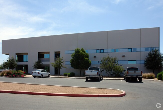
1331 W Houston Ave
302-11-133
EAST VALLEY COMMERCE CENTER 4 MCR 477-42
Industrialgeneral
Maricopa
I-1
Arizona
AE The base floodplain where base flood elevations are provided. AE Zones are now used on new format FIRMs instead of A1-A30 Zones.
1
2025
4.18 AC
2025
Chandler N/Gilbert
422307
Phoenix
29,780 SF
Phoenix-Mesa-Chandler, AZ
NEARBY LISTINGS FOR SALE OR LEASE
DEMOGRAPHICS near 1331 W Houston Ave
1 mile
3 mile
5 mile
2025 Total Population
7,273
144,107
425,656
2030 Population
7,580
148,155
439,387
Pop Growth 2025-2030
+ 4.22%
+ 2.81%
+ 3.23%
Average Age
38
36
38
2025 Total Households
2,512
52,497
158,843
HH Growth 2025-2030
+ 4.30%
+ 2.85%
+ 3.39%
Median Household Inc
$119,943
$80,272
$81,514
Avg Household Size
2.80
2.70
2.60
2025 Avg HH Vehicles
2.00
2.00
2.00
Median Home Value
$549,180
$440,127
$432,357
Median Year Built
1995
1984
1985
Nearby Places
Map Layers
Map Styles
 Street
 Aerial
Layers
 Traffic
 Biking
Places
Listings with unknown addresses are not visible on the map
- Restaurants
- Banks
- Shops
- Fitness
- Groceries
PUBLIC TRANSPORTATION
AIRPORT
Phoenix-Mesa Gateway
Drive
Walk
Distance
Phoenix-Mesa Gateway
24 min
15.1 mi
Phoenix Sky Harbor International
Drive
Walk
Distance
Phoenix Sky Harbor International
24 min
15.7 mi
Freight Ports
Port of San Diego
Drive
Walk
Distance
Port of San Diego
411 min
374.0 mi
Nearby Properties
Address
Land Use
TOTAL SIZE
Lot Size
Zoning
Address
Land Use
TOTAL SIZE
Lot Size
Zoning
439,211 SF
77.92 AC
C-G
Address
Land Use
TOTAL SIZE
Lot Size
Zoning
7.90 AC
Address
Land Use
TOTAL SIZE
Lot Size
Zoning
184,558 SF
6.18 AC
Address
Land Use
TOTAL SIZE
Lot Size
Zoning
127,962 SF
18.60 AC
I-1
Address
Land Use
TOTAL SIZE
Lot Size
Zoning
1,418,890 SF
39 AC
PF
Address
Land Use
TOTAL SIZE
Lot Size
Zoning
5.92 AC
I-1
Address
Land Use
TOTAL SIZE
Lot Size
Zoning
4.96 AC
Address
Land Use
TOTAL SIZE
Lot Size
Zoning
30,075 SF
6.86 AC
I-1
Address
Land Use
TOTAL SIZE
Lot Size
Zoning
301,190 SF
77.17 AC
PF
Address
Land Use
TOTAL SIZE
Lot Size
Zoning
739,944 SF
40.02 AC
MFM
Address
Land Use
TOTAL SIZE
Lot Size
Zoning
9.25 AC
I-1
Address
Land Use
TOTAL SIZE
Lot Size
Zoning
62,328 SF
2.65 AC
Address
Land Use
TOTAL SIZE
Lot Size
Zoning
281,301 SF
19.13 AC
I-1
Address
Land Use
TOTAL SIZE
Lot Size
Zoning
15,050 SF
1.42 AC
C-G
Address
Land Use
TOTAL SIZE
Lot Size
Zoning
13,336 SF
1.98 AC
I-2
Address
Land Use
TOTAL SIZE
Lot Size
Zoning
411,683 SF
15.53 AC
RM3
Address
Land Use
TOTAL SIZE
Lot Size
Zoning
357,952 SF
33.73 AC
LI
Address
Land Use
TOTAL SIZE
Lot Size
Zoning
418,678 SF
18.63 AC
C-G
Address
Land Use
TOTAL SIZE
Lot Size
Zoning
112,628 SF
17.37 AC
I-1
Address
Land Use
TOTAL SIZE
Lot Size
Zoning
309,031 SF
18.55 AC
Address
Land Use
TOTAL SIZE
Lot Size
Zoning
16.57 AC
PF
Address
Land Use
TOTAL SIZE
Lot Size
Zoning
427,210 SF
38.33 AC
PF
Address
Land Use
TOTAL SIZE
Lot Size
Zoning
572,119 SF
22.45 AC
PF
Address
Land Use
TOTAL SIZE
Lot Size
Zoning
344,641 SF
21.43 AC
I-1
Address
Land Use
TOTAL SIZE
Lot Size
Zoning
16,133 SF
1.79 AC
PF
Address
Land Use
TOTAL SIZE
Lot Size
Zoning
348,151 SF
20.69 AC
LI
Address
Land Use
TOTAL SIZE
Lot Size
Zoning
1.46 AC
C-G
Address
Land Use
TOTAL SIZE
Lot Size
Zoning
632,909 SF
5.83 AC
C-G
Address
Land Use
TOTAL SIZE
Lot Size
Zoning
357,691 SF
19.87 AC
PAD
Address
Land Use
TOTAL SIZE
Lot Size
Zoning
7,418 SF
2.37 AC
C-G
The World's #1 Commercial Real Estate Marketplace
Connect with us
© 2026 CoStar Group
The information above has been obtained from sources believed reliable. While we do not doubt its accuracy we have not verified it and make no guarantee, warranty or representation about it. It is your responsibility to independently confirm its accuracy and completeness. Any projections, opinions, assumptions, or estimates used are for example only and do not represent the current or future performance of the property. The value of this transaction to you depends on tax and other factors which should be evaluated by your tax, financial, and legal advisors. You and your advisors should conduct a careful, independent investigation of the property to determine to your satisfaction the suitability of the property for your needs.