Property Record
13319 38Th Ave Ne, Marysville, WA 98271


NEARBY LISTINGS FOR SALE OR LEASE
Property Detail
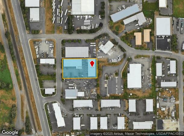
13319 38Th Ave Ne
Seattle-Tacoma-Bellevue, WA
Marysville Industrial Park
006662-000-009-00
MARYSVILLE INDUSTRIAL PARK BLK 000 D-00 - LOT 9 SUBJ ESE PUD 1 & GEN TEL
Warehouse
Snohomish
X
Washington
53061C0710F
9
2024
1.17 AC
2025
N Snohomish County
052803
Seattle/Puget Sound
17,040 SF
DEMOGRAPHICS near 13319 38Th Ave Ne
1 Mile
3 Mile
5 Mile
2024 Total Population
5,824
35,363
88,718
2029 Population
6,064
36,848
92,619
Pop Growth 2024-2029
+ 4.12%
+ 4.20%
+ 4.40%
Average Age
39
39
39
2024 Total Households
2,048
12,626
31,748
HH Growth 2024-2029
+ 4.25%
+ 4.30%
+ 4.50%
Median Household Inc
$91,698
$94,532
$92,829
Avg Household Size
2.70
2.70
2.70
2024 Avg HH Vehicles
2.00
2.00
2.00
Median Home Value
$445,725
$474,129
$483,787
Median Year Built
1982
1991
1991
Nearby Places
Map Layers
Map Styles
 Street
 Aerial
- Restaurants
- Banks
- Shops
- Fitness
- Groceries
PUBLIC TRANSPORTATION
AIRPORT
Seattle Paine Field International
DRIVE
WALK
Distance
Seattle Paine Field International
28 min
19.3 mi
Freight Ports
Port of Everett
DRIVE
WALK
Distance
Port of Everett
19 min
11.7 mi
Nearby Properties
Address
Land Use
TOTAL SIZE
Lot Size
Zoning
Address
Land Use
TOTAL SIZE
Lot Size
Zoning
2,623,172 SF
32.78 AC
Address
Land Use
TOTAL SIZE
Lot Size
Zoning
3.14 AC
IP
Address
Land Use
TOTAL SIZE
Lot Size
Zoning
336,508 SF
23.32 AC
LI
Address
Land Use
TOTAL SIZE
Lot Size
Zoning
113,927 SF
576.83 AC
TRIBES
Address
Land Use
TOTAL SIZE
Lot Size
Zoning
33,140 SF
135.95 AC
BP
Address
Land Use
TOTAL SIZE
Lot Size
Zoning
201,141 SF
7.37 AC
MU
Address
Land Use
TOTAL SIZE
Lot Size
Zoning
229,606 SF
9.28 AC
R18 MFM
Address
Land Use
TOTAL SIZE
Lot Size
Zoning
206,135 SF
4.05 AC
HC
Address
Land Use
TOTAL SIZE
Lot Size
Zoning
1,664 SF
16.93 AC
LI
Address
Land Use
TOTAL SIZE
Lot Size
Zoning
189,663 SF
8.21 AC
MU
Address
Land Use
TOTAL SIZE
Lot Size
Zoning
231,030 SF
18.48 AC
LI
Address
Land Use
TOTAL SIZE
Lot Size
Zoning
83.67 AC
SQ
Address
Land Use
TOTAL SIZE
Lot Size
Zoning
165,762 SF
7.12 AC
MU
Address
Land Use
TOTAL SIZE
Lot Size
Zoning
186,723 SF
5.36 AC
HC
Address
Land Use
TOTAL SIZE
Lot Size
Zoning
131,319 SF
4.72 AC
MU
Address
Land Use
TOTAL SIZE
Lot Size
Zoning
1,128 SF
40 AC
LI
Address
Land Use
TOTAL SIZE
Lot Size
Zoning
82.67 AC
R4.5 SFM
Address
Land Use
TOTAL SIZE
Lot Size
Zoning
9.87 AC
R4.5 SFM
Address
Land Use
TOTAL SIZE
Lot Size
Zoning
117,532 SF
4.72 AC
R18 MFM
Address
Land Use
TOTAL SIZE
Lot Size
Zoning
68,424 SF
2.09 AC
HC
Address
Land Use
TOTAL SIZE
Lot Size
Zoning
174,661 SF
12.98 AC
CB
Address
Land Use
TOTAL SIZE
Lot Size
Zoning
182,316 SF
15.03 AC
HC
Address
Land Use
TOTAL SIZE
Lot Size
Zoning
70,712 SF
4 AC
GC
Address
Land Use
TOTAL SIZE
Lot Size
Zoning
155,543 SF
20.20 AC
HC
Address
Land Use
TOTAL SIZE
Lot Size
Zoning
152,543 SF
15.32 AC
GC
Address
Land Use
TOTAL SIZE
Lot Size
Zoning
176,030 SF
18.67 AC
LI
Address
Land Use
TOTAL SIZE
Lot Size
Zoning
4.13 AC
GC
Address
Land Use
TOTAL SIZE
Lot Size
Zoning
224,324 SF
30.49 AC
LI
The World's #1 Commercial Real Estate Marketplace
Connect with us
© 2025 CoStar Group
The information above has been obtained from sources believed reliable. While we do not doubt its accuracy we have not verified it and make no guarantee, warranty or representation about it. It is your responsibility to independently confirm its accuracy and completeness. Any projections, opinions, assumptions, or estimates used are for example only and do not represent the current or future performance of the property. The value of this transaction to you depends on tax and other factors which should be evaluated by your tax, financial, and legal advisors. You and your advisors should conduct a careful, independent investigation of the property to determine to your satisfaction the suitability of the property for your needs.