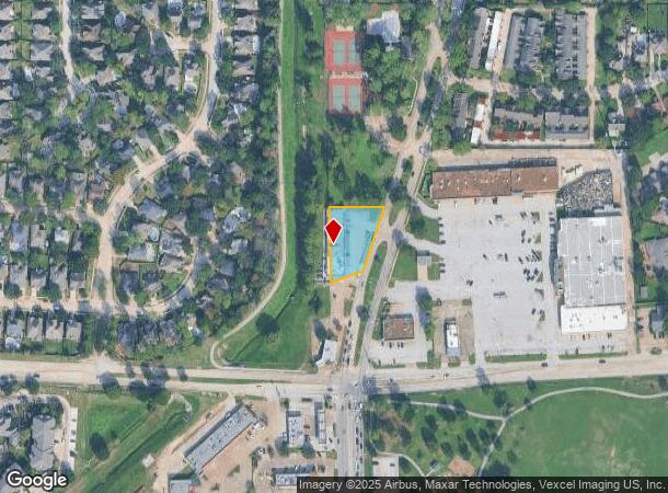
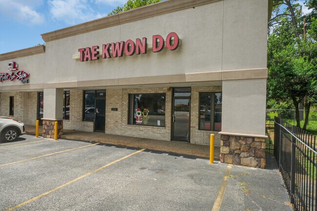
Property Record
13323 Jones Rd, Houston, TX 77070


NEARBY LISTINGS FOR SALE OR LEASE
Property Detail
13323 Jones Rd
1022140000008
Norchester Sec 1
Stripcommercialcenter
RES A3 BLK 1 NORCHESTER SEC 1
X
Harris
48201C0430M
Texas
2024
0.92 AC
2025
Fairfield
552602
Houston
10,450 SF
Houston-The Woodlands-Sugar Land, TX
DEMOGRAPHICS near 13323 Jones Rd
1 Mile
3 Mile
5 Mile
2024 Total Population
14,058
100,664
265,782
2029 Population
14,279
102,385
269,371
Pop Growth 2024-2029
+ 1.57%
+ 1.71%
+ 1.35%
Average Age
37
38
38
2024 Total Households
5,385
38,007
96,895
HH Growth 2024-2029
+ 1.36%
+ 1.72%
+ 1.31%
Median Household Inc
$67,110
$68,680
$83,093
Avg Household Size
2.60
2.60
2.70
2024 Avg HH Vehicles
2.00
2.00
2.00
Median Home Value
$219,059
$244,038
$263,271
Median Year Built
1995
1994
1994
Nearby Places
Map Layers
Map Styles
 Street
 Aerial
- Restaurants
- Banks
- Shops
- Fitness
- Groceries
PUBLIC TRANSPORTATION
AIRPORT
George Bush Intcntl/Houston
DRIVE
WALK
Distance
George Bush Intcntl/Houston
27 min
19.2 mi
William P Hobby
DRIVE
WALK
Distance
William P Hobby
55 min
34.3 mi
Freight Ports
Port of Houston
DRIVE
WALK
Distance
Port of Houston
47 min
29.9 mi
SALE & LEASE HISTORY
LISTING DATE
SALE/LEASE

Sep 25, 2016
For Lease
Jul 26, 2022
For Lease
Jul 25, 2021
For Lease
Feb 05, 2021
For Sale
Aug 30, 2024
For Lease
Apr 23, 2020
For Lease
Nearby Properties
Address
Land Use
TOTAL SIZE
Lot Size
Zoning
Address
Land Use
TOTAL SIZE
Lot Size
Zoning
587,609 SF
42.44 AC
Address
Land Use
TOTAL SIZE
Lot Size
Zoning
1,648,539 SF
28.70 AC
Address
Land Use
TOTAL SIZE
Lot Size
Zoning
339,067 SF
34.40 AC
Address
Land Use
TOTAL SIZE
Lot Size
Zoning
427,317 SF
14.16 AC
Address
Land Use
TOTAL SIZE
Lot Size
Zoning
1,073,104 SF
4.74 AC
Address
Land Use
TOTAL SIZE
Lot Size
Zoning
445,343 SF
37.78 AC
Address
Land Use
TOTAL SIZE
Lot Size
Zoning
660,000 SF
104.88 AC
Address
Land Use
TOTAL SIZE
Lot Size
Zoning
227,400 SF
2.77 AC
Address
Land Use
TOTAL SIZE
Lot Size
Zoning
388,333 SF
41.17 AC
Address
Land Use
TOTAL SIZE
Lot Size
Zoning
386,754 SF
17.99 AC
Address
Land Use
TOTAL SIZE
Lot Size
Zoning
507,035 SF
24.90 AC
Address
Land Use
TOTAL SIZE
Lot Size
Zoning
543,414 SF
22.58 AC
Address
Land Use
TOTAL SIZE
Lot Size
Zoning
263,640 SF
36.62 AC
Address
Land Use
TOTAL SIZE
Lot Size
Zoning
426,203 SF
23.88 AC
Address
Land Use
TOTAL SIZE
Lot Size
Zoning
301,119 SF
9.92 AC
Address
Land Use
TOTAL SIZE
Lot Size
Zoning
551,524 SF
10.06 AC
Address
Land Use
TOTAL SIZE
Lot Size
Zoning
267,094 SF
14.76 AC
Address
Land Use
TOTAL SIZE
Lot Size
Zoning
365,711 SF
26.61 AC
Address
Land Use
TOTAL SIZE
Lot Size
Zoning
486,739 SF
19.92 AC
Address
Land Use
TOTAL SIZE
Lot Size
Zoning
262,163 SF
8.63 AC
Address
Land Use
TOTAL SIZE
Lot Size
Zoning
405,225 SF
18.34 AC
Address
Land Use
TOTAL SIZE
Lot Size
Zoning
469,370 SF
19.39 AC
Address
Land Use
TOTAL SIZE
Lot Size
Zoning
326,807 SF
29.43 AC
Address
Land Use
TOTAL SIZE
Lot Size
Zoning
256,761 SF
8.78 AC
Address
Land Use
TOTAL SIZE
Lot Size
Zoning
433,984 SF
17.82 AC
Address
Land Use
TOTAL SIZE
Lot Size
Zoning
368,361 SF
23.95 AC
Address
Land Use
TOTAL SIZE
Lot Size
Zoning
260,253 SF
7.46 AC
Address
Land Use
TOTAL SIZE
Lot Size
Zoning
377,188 SF
16.80 AC
Address
Land Use
TOTAL SIZE
Lot Size
Zoning
371,761 SF
12.71 AC
Address
Land Use
TOTAL SIZE
Lot Size
Zoning
237,742 SF
13.80 AC
The World's #1 Commercial Real Estate Marketplace
Connect with us
© 2025 CoStar Group
The information above has been obtained from sources believed reliable. While we do not doubt its accuracy we have not verified it and make no guarantee, warranty or representation about it. It is your responsibility to independently confirm its accuracy and completeness. Any projections, opinions, assumptions, or estimates used are for example only and do not represent the current or future performance of the property. The value of this transaction to you depends on tax and other factors which should be evaluated by your tax, financial, and legal advisors. You and your advisors should conduct a careful, independent investigation of the property to determine to your satisfaction the suitability of the property for your needs.