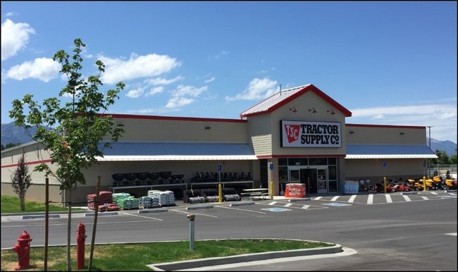
Property Record
13325 E 136Th St N, Collinsville, OK 74021

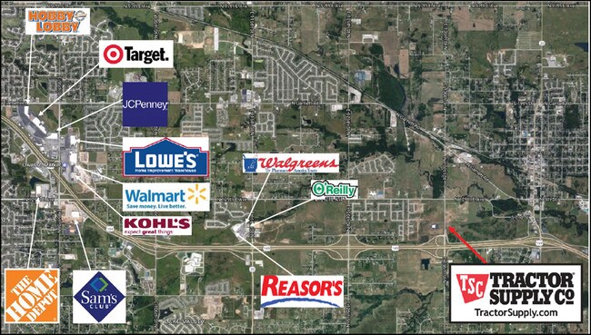
NEARBY LISTINGS FOR SALE OR LEASE
Property Detail
13325 E 136Th St N
Tulsa, OK
Confluence Commercial
56216-24-28-32100
LOT 1 BLOCK 1
Departmentstore
Tulsa
AE
Oklahoma
40131C0250H
1
2025
3.47 AC
2025
Northeast Tulsa
005404
Tulsa
18,681 SF
DEMOGRAPHICS near 13325 E 136Th St N
1 Mile
3 Mile
5 Mile
2024 Total Population
2,950
20,450
48,159
2029 Population
3,067
21,379
50,521
Pop Growth 2024-2029
+ 3.97%
+ 4.54%
+ 4.90%
Average Age
37
37
38
2024 Total Households
1,096
7,519
17,417
HH Growth 2024-2029
+ 3.92%
+ 4.56%
+ 4.93%
Median Household Inc
$77,818
$73,481
$81,283
Avg Household Size
2.70
2.70
2.70
2024 Avg HH Vehicles
2.00
2.00
2.00
Median Home Value
$200,538
$187,347
$216,670
Median Year Built
2000
2000
2001
Nearby Places
Map Layers
Map Styles
 Street
 Aerial
- Restaurants
- Banks
- Shops
- Fitness
- Groceries
PUBLIC TRANSPORTATION
AIRPORT
Tulsa International
DRIVE
WALK
Distance
Tulsa International
19 min
13.4 mi
SALE & LEASE HISTORY
LISTING DATE
SALE/LEASE

Aug 15, 2017
For Sale
Nearby Properties
Address
Land Use
TOTAL SIZE
Lot Size
Zoning
Address
Land Use
TOTAL SIZE
Lot Size
Zoning
299,471 SF
64.32 AC
AG
Address
Land Use
TOTAL SIZE
Lot Size
Zoning
47,798 SF
5.13 AC
CS
Address
Land Use
TOTAL SIZE
Lot Size
Zoning
43,882 SF
10 AC
AG
Address
Land Use
TOTAL SIZE
Lot Size
Zoning
25,603 SF
4.64 AC
RM1
Address
Land Use
TOTAL SIZE
Lot Size
Zoning
22,679 SF
0.77 AC
CBD
Address
Land Use
TOTAL SIZE
Lot Size
Zoning
40,100 SF
4.36 AC
IM
Address
Land Use
TOTAL SIZE
Lot Size
Zoning
22,874 SF
1.29 AC
CBD
Address
Land Use
TOTAL SIZE
Lot Size
Zoning
41,764 SF
17.87 AC
AG
Address
Land Use
TOTAL SIZE
Lot Size
Zoning
40,822 SF
11.39 AC
AG
Address
Land Use
TOTAL SIZE
Lot Size
Zoning
40,206 SF
3.72 AC
RS3
Address
Land Use
TOTAL SIZE
Lot Size
Zoning
28,400 SF
12.66 AC
AG
Address
Land Use
TOTAL SIZE
Lot Size
Zoning
42,211 SF
0.65 AC
RS3
Address
Land Use
TOTAL SIZE
Lot Size
Zoning
20,952 SF
5.01 AC
AG
Address
Land Use
TOTAL SIZE
Lot Size
Zoning
3,679 SF
33.74 AC
AG
Address
Land Use
TOTAL SIZE
Lot Size
Zoning
103,300 SF
13.81 AC
CS
Address
Land Use
TOTAL SIZE
Lot Size
Zoning
61,622 SF
13.96 AC
CG
Address
Land Use
TOTAL SIZE
Lot Size
Zoning
33,157 SF
3.82 AC
AGR
Address
Land Use
TOTAL SIZE
Lot Size
Zoning
14,934 SF
9.15 AC
AG
Address
Land Use
TOTAL SIZE
Lot Size
Zoning
10,701 SF
0.96 AC
CBD
Address
Land Use
TOTAL SIZE
Lot Size
Zoning
143,419 SF
29.73 AC
IM
Address
Land Use
TOTAL SIZE
Lot Size
Zoning
6,035 SF
0.35 AC
CBD
Address
Land Use
TOTAL SIZE
Lot Size
Zoning
17,044 SF
5.28 AC
RD
Address
Land Use
TOTAL SIZE
Lot Size
Zoning
34,568 SF
4.26 AC
RM2
Address
Land Use
TOTAL SIZE
Lot Size
Zoning
36,647 SF
1.93 AC
AGR
Address
Land Use
TOTAL SIZE
Lot Size
Zoning
15,398 SF
19.27 AC
AG
Address
Land Use
TOTAL SIZE
Lot Size
Zoning
32,810 SF
4.61 AC
CS
Address
Land Use
TOTAL SIZE
Lot Size
Zoning
16,942 SF
5.80 AC
AG
Address
Land Use
TOTAL SIZE
Lot Size
Zoning
16,097 SF
6.06 AC
AG
Address
Land Use
TOTAL SIZE
Lot Size
Zoning
1,680 SF
15.37 AC
RMH
Address
Land Use
TOTAL SIZE
Lot Size
Zoning
6,125 SF
17.83 AC
AG
The World's #1 Commercial Real Estate Marketplace
Connect with us
© 2026 CoStar Group
The information above has been obtained from sources believed reliable. While we do not doubt its accuracy we have not verified it and make no guarantee, warranty or representation about it. It is your responsibility to independently confirm its accuracy and completeness. Any projections, opinions, assumptions, or estimates used are for example only and do not represent the current or future performance of the property. The value of this transaction to you depends on tax and other factors which should be evaluated by your tax, financial, and legal advisors. You and your advisors should conduct a careful, independent investigation of the property to determine to your satisfaction the suitability of the property for your needs.