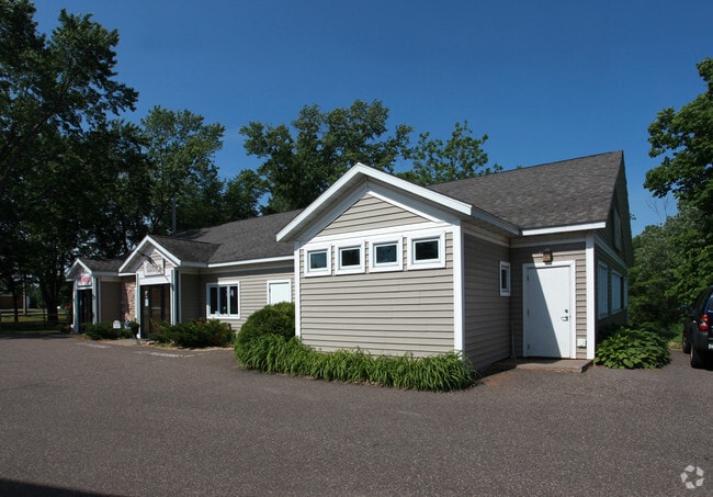
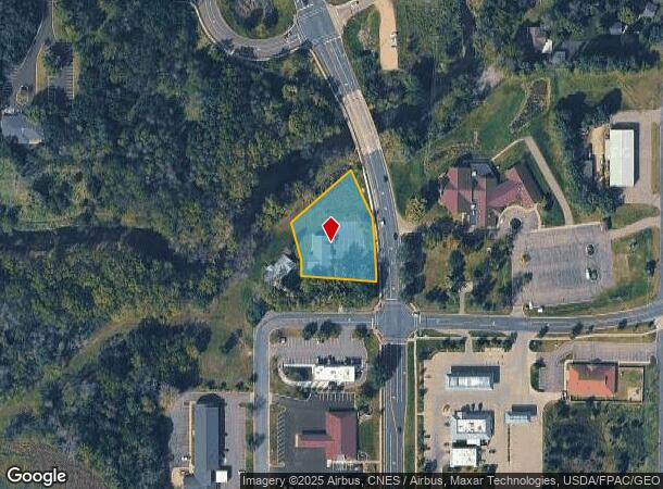
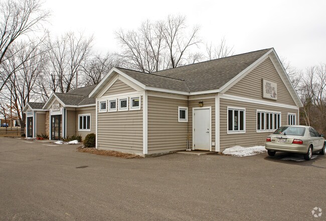
Property Record
1333 N Main St, River Falls, WI 54022
NEARBY LISTINGS FOR SALE OR LEASE
Property Detail
1333 N Main St
276-1043-40-100
SEC 36 T28N R19W PT NE NE (FORMERLY P560B TN TROY) EXC PT TO STATE FOR HWY AS DESC IN 903/05
Commercialnec
St Croix
AE
Wisconsin
55093C0126E
1.42 AC
2025
St Croix County
2024
Minneapolis/St Paul
120901
Minneapolis-St. Paul-Bloomington, MN-WI
DEMOGRAPHICS near 1333 N Main St
1 Mile
3 Mile
5 Mile
2024 Total Population
3,477
21,255
24,073
2029 Population
3,748
22,487
25,530
Pop Growth 2024-2029
+ 7.79%
+ 5.80%
+ 6.05%
Average Age
40
37
37
2024 Total Households
1,458
7,867
8,851
HH Growth 2024-2029
+ 7.96%
+ 6.46%
+ 6.62%
Median Household Inc
$74,581
$75,383
$82,821
Avg Household Size
2.30
2.40
2.40
2024 Avg HH Vehicles
2.00
2.00
2.00
Median Home Value
$239,588
$273,973
$289,680
Median Year Built
1985
1990
1991
Nearby Places
Map Layers
Map Styles
 Street
 Aerial
- Restaurants
- Banks
- Shops
- Fitness
- Groceries
PUBLIC TRANSPORTATION
AIRPORT
Minneapolis-St Paul International/Wold-Chamberlain
DRIVE
WALK
Distance
Minneapolis-St Paul International/Wold-Chamberlain
48 min
37.1 mi
Freight Ports
Port Milwaukee
DRIVE
WALK
Distance
Port Milwaukee
342 min
308.3 mi
Nearby Properties
Address
Land Use
TOTAL SIZE
Lot Size
Zoning
Address
Land Use
TOTAL SIZE
Lot Size
Zoning
Address
Land Use
TOTAL SIZE
Lot Size
Zoning
1.28 AC
Address
Land Use
TOTAL SIZE
Lot Size
Zoning
5.98 AC
Address
Land Use
TOTAL SIZE
Lot Size
Zoning
8.11 AC
Address
Land Use
TOTAL SIZE
Lot Size
Zoning
1.55 AC
Address
Land Use
TOTAL SIZE
Lot Size
Zoning
Address
Land Use
TOTAL SIZE
Lot Size
Zoning
2.22 AC
Address
Land Use
TOTAL SIZE
Lot Size
Zoning
1.18 AC
Address
Land Use
TOTAL SIZE
Lot Size
Zoning
0.93 AC
Address
Land Use
TOTAL SIZE
Lot Size
Zoning
4.68 AC
Address
Land Use
TOTAL SIZE
Lot Size
Zoning
2.42 AC
Address
Land Use
TOTAL SIZE
Lot Size
Zoning
0.83 AC
Address
Land Use
TOTAL SIZE
Lot Size
Zoning
1.21 AC
Address
Land Use
TOTAL SIZE
Lot Size
Zoning
Address
Land Use
TOTAL SIZE
Lot Size
Zoning
Address
Land Use
TOTAL SIZE
Lot Size
Zoning
5.09 AC
Address
Land Use
TOTAL SIZE
Lot Size
Zoning
Address
Land Use
TOTAL SIZE
Lot Size
Zoning
Address
Land Use
TOTAL SIZE
Lot Size
Zoning
Address
Land Use
TOTAL SIZE
Lot Size
Zoning
Address
Land Use
TOTAL SIZE
Lot Size
Zoning
1.55 AC
Address
Land Use
TOTAL SIZE
Lot Size
Zoning
Address
Land Use
TOTAL SIZE
Lot Size
Zoning
Address
Land Use
TOTAL SIZE
Lot Size
Zoning
Address
Land Use
TOTAL SIZE
Lot Size
Zoning
1.14 AC
Address
Land Use
TOTAL SIZE
Lot Size
Zoning
2.79 AC
Address
Land Use
TOTAL SIZE
Lot Size
Zoning
5.63 AC
Address
Land Use
TOTAL SIZE
Lot Size
Zoning
Address
Land Use
TOTAL SIZE
Lot Size
Zoning
2.26 AC
The World's #1 Commercial Real Estate Marketplace
Connect with us
© 2026 CoStar Group
The information above has been obtained from sources believed reliable. While we do not doubt its accuracy we have not verified it and make no guarantee, warranty or representation about it. It is your responsibility to independently confirm its accuracy and completeness. Any projections, opinions, assumptions, or estimates used are for example only and do not represent the current or future performance of the property. The value of this transaction to you depends on tax and other factors which should be evaluated by your tax, financial, and legal advisors. You and your advisors should conduct a careful, independent investigation of the property to determine to your satisfaction the suitability of the property for your needs.