Property Record
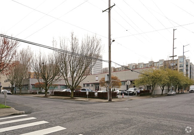
1333 Ne M L King Blvd, Portland, OR 97232


Property Detail
1333 Ne M L King Blvd
R182187
HOLLADAYS ADD, BLOCK 67, LOT 1-8 EXC PT IN ST
Commercialnec
MULTNOMAH
CXD
Oregon
B and X Area of moderate flood hazard, usually the area between the limits of the 100-year and 500-year floods.
1-8
0
0.87 AC
2025
Lloyd District
002303
Portland
26,889 SF
Portland-Vancouver-Hillsboro, OR-WA
NEARBY LISTINGS FOR SALE OR LEASE
DEMOGRAPHICS near 1333 Ne M L King Blvd
1 mile
3 mile
5 mile
2025 Total Population
28,224
232,672
423,641
2030 Population
28,304
231,939
420,410
Pop Growth 2025-2030
+ 0.28%
(0.32%)
(0.76%)
Average Age
42
40
41
2025 Total Households
15,788
117,784
196,195
HH Growth 2025-2030
+ 0.23%
(0.35%)
(0.83%)
Median Household Inc
$61,959
$91,049
$94,061
Avg Household Size
1.60
1.90
2.00
2025 Avg HH Vehicles
1.00
1.00
1.00
Median Home Value
$738,231
$740,126
$694,035
Median Year Built
1993
1961
1959
Nearby Places
Map Layers
Map Styles
 Street
 Aerial
Layers
 Traffic
 Biking
Places
Listings with unknown addresses are not visible on the map
- Restaurants
- Banks
- Shops
- Fitness
- Groceries
PUBLIC TRANSPORTATION
TRANSIT/SUBWAY
Ne Grand & Multnomah (Portland Streetcar - B Loop - Portland Streetcar)
Drive
Walk
Distance
Ne Grand & Multnomah (Portland Streetcar - B Loop - Portland Streetcar)
1 min
2 min
0.2 mi
Ne Weidler & 2Nd (Streetcar) (Portland Streetcar - A Loop - Portland Streetcar)
Drive
Walk
Distance
Ne Weidler & 2Nd (Streetcar) (Portland Streetcar - A Loop - Portland Streetcar)
2 min
3 min
0.2 mi
Ne Broadway & 2Nd (Streetcar) (Portland Streetcar - B Loop - Portland Streetcar)
Drive
Walk
Distance
Ne Broadway & 2Nd (Streetcar) (Portland Streetcar - B Loop - Portland Streetcar)
1 min
3 min
0.2 mi
Convention Center (MAX Blue Line - Tri-County Metropolitan Transportation District of Oregon Rail (TriMet Rail), MAX Green Line - Tri-County Metropolitan Transportation District of Oregon Rail (TriMet Rail), MAX Red Line - Tri-County Metropolitan Transportation District of Oregon Rail (TriMet Rail))
Drive
Walk
Distance
Convention Center (MAX Blue Line - Tri-County Metropolitan Transportation District of Oregon Rail (TriMet Rail), MAX Green Line - Tri-County Metropolitan Transportation District of Oregon Rail (TriMet Rail), MAX Red Line - Tri-County Metropolitan Transportation District of Oregon Rail (TriMet Rail))
1 min
4 min
0.2 mi
Ne Grand & Broadway (Portland Streetcar - A Loop - Portland Streetcar, Portland Streetcar - B Loop - Portland Streetcar)
Drive
Walk
Distance
Ne Grand & Broadway (Portland Streetcar - A Loop - Portland Streetcar, Portland Streetcar - B Loop - Portland Streetcar)
0 min
4 min
0.3 mi
COMMUTER RAIL
Portland (Amtrak Cascades - Amtrak, Coast Starlight - Amtrak, Empire Builder - Amtrak)
Drive
Walk
Distance
Portland (Amtrak Cascades - Amtrak, Coast Starlight - Amtrak, Empire Builder - Amtrak)
4 min
20 min
1.1 mi
Vancouver (Amtrak Cascades - Amtrak, Coast Starlight - Amtrak, Empire Builder - Amtrak)
Drive
Walk
Distance
Vancouver (Amtrak Cascades - Amtrak, Coast Starlight - Amtrak, Empire Builder - Amtrak)
16 min
8.4 mi
AIRPORT
Portland International
Drive
Walk
Distance
Portland International
20 min
11.6 mi
Freight Ports
Port of Portland
Drive
Walk
Distance
Port of Portland
7 min
3.5 mi
SALE & LEASE HISTORY
LISTING DATE
SALE/LEASE

Feb 15, 2017
For Lease
Feb 14, 2022
For Lease
Nearby Properties
Address
Land Use
TOTAL SIZE
Lot Size
Zoning
Address
Land Use
TOTAL SIZE
Lot Size
Zoning
395,815 SF
2.66 AC
IRD
Address
Land Use
TOTAL SIZE
Lot Size
Zoning
27.58 AC
EX
Address
Land Use
TOTAL SIZE
Lot Size
Zoning
627,500 SF
16.60 AC
CX
Address
Land Use
TOTAL SIZE
Lot Size
Zoning
560,000 SF
0.15 AC
CX
Address
Land Use
TOTAL SIZE
Lot Size
Zoning
20.71 AC
OS
Address
Land Use
TOTAL SIZE
Lot Size
Zoning
409,260 SF
7.41 AC
EX
Address
Land Use
TOTAL SIZE
Lot Size
Zoning
1.09 AC
EX
Address
Land Use
TOTAL SIZE
Lot Size
Zoning
2.24 AC
CX
Address
Land Use
TOTAL SIZE
Lot Size
Zoning
326,547 SF
2.42 AC
RH
Address
Land Use
TOTAL SIZE
Lot Size
Zoning
304,836 SF
10.85 AC
CX
Address
Land Use
TOTAL SIZE
Lot Size
Zoning
417,324 SF
0.68 AC
CX
Address
Land Use
TOTAL SIZE
Lot Size
Zoning
598,328 SF
12.32 AC
CX
Address
Land Use
TOTAL SIZE
Lot Size
Zoning
257,700 SF
2.89 AC
EX
Address
Land Use
TOTAL SIZE
Lot Size
Zoning
178,785 SF
10.20 AC
R5
Address
Land Use
TOTAL SIZE
Lot Size
Zoning
128,500 SF
6.95 AC
OS
Address
Land Use
TOTAL SIZE
Lot Size
Zoning
460,000 SF
0.92 AC
CX
Address
Land Use
TOTAL SIZE
Lot Size
Zoning
689,840 SF
0.92 AC
CX
Address
Land Use
TOTAL SIZE
Lot Size
Zoning
125,217 SF
0.23 AC
CX
Address
Land Use
TOTAL SIZE
Lot Size
Zoning
7.78 AC
EX
Address
Land Use
TOTAL SIZE
Lot Size
Zoning
426,742 SF
0.53 AC
RXD
Address
Land Use
TOTAL SIZE
Lot Size
Zoning
243,371 SF
0.67 AC
CI2
Address
Land Use
TOTAL SIZE
Lot Size
Zoning
584,483 SF
0.90 AC
CX
Address
Land Use
TOTAL SIZE
Lot Size
Zoning
645,294 SF
5.64 AC
CO2D
Address
Land Use
TOTAL SIZE
Lot Size
Zoning
247,520 SF
7.74 AC
CX
Address
Land Use
TOTAL SIZE
Lot Size
Zoning
306,000 SF
1.21 AC
NULL
Address
Land Use
TOTAL SIZE
Lot Size
Zoning
596,161 SF
0.92 AC
CX
Address
Land Use
TOTAL SIZE
Lot Size
Zoning
456,760 SF
0.53 AC
EX
Address
Land Use
TOTAL SIZE
Lot Size
Zoning
193,898 SF
2.50 AC
IRD
Address
Land Use
TOTAL SIZE
Lot Size
Zoning
134,398 SF
3.17 AC
CG
Address
Land Use
TOTAL SIZE
Lot Size
Zoning
387,000 SF
0.88 AC
CXD
The World's #1 Commercial Real Estate Marketplace
Connect with us
© 2026 CoStar Group
The information above has been obtained from sources believed reliable. While we do not doubt its accuracy we have not verified it and make no guarantee, warranty or representation about it. It is your responsibility to independently confirm its accuracy and completeness. Any projections, opinions, assumptions, or estimates used are for example only and do not represent the current or future performance of the property. The value of this transaction to you depends on tax and other factors which should be evaluated by your tax, financial, and legal advisors. You and your advisors should conduct a careful, independent investigation of the property to determine to your satisfaction the suitability of the property for your needs.