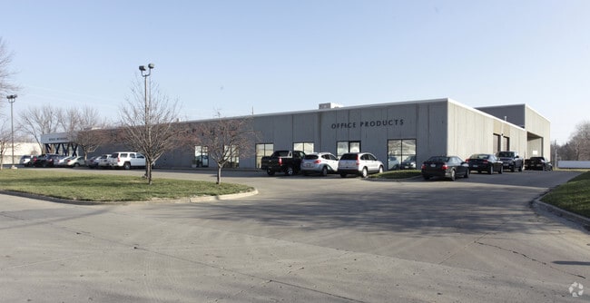
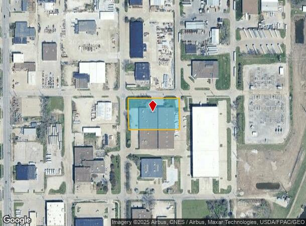
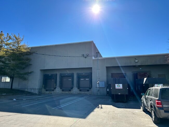
Property Record
1333 Ohio St, Des Moines, IA 50314
NEARBY LISTINGS FOR SALE OR LEASE
Property Detail
1333 Ohio St
Des Moines-West Des Moines, IA
Central Place
080-00971004000
VAC ALLEY W OF & W 1/2 VAC ILL ST E OF & ADJ & LTS 1 THRU 3 & N27F LT 4 & 19 & LTS 20 THRU 22 BLK 15 CENTRAL PLACE
Officebuilding
Polk
X
Iowa
19153C0355F
2
2024
1.25 AC
2025
Northwest
004900
Des Moines
48,552 SF
DEMOGRAPHICS near 1333 Ohio St
1 Mile
3 Mile
5 Mile
2024 Total Population
13,863
102,332
205,778
2029 Population
14,593
107,039
213,878
Pop Growth 2024-2029
+ 5.27%
+ 4.60%
+ 3.94%
Average Age
35
36
38
2024 Total Households
5,514
43,346
85,497
HH Growth 2024-2029
+ 5.97%
+ 4.90%
+ 4.18%
Median Household Inc
$43,929
$51,823
$59,070
Avg Household Size
2.30
2.20
2.30
2024 Avg HH Vehicles
2.00
2.00
2.00
Median Home Value
$124,714
$140,477
$163,770
Median Year Built
1966
1953
1958
Nearby Places
Map Layers
Map Styles
 Street
 Aerial
- Restaurants
- Banks
- Shops
- Fitness
- Groceries
PUBLIC TRANSPORTATION
AIRPORT
Des Moines International
DRIVE
WALK
Distance
Des Moines International
16 min
6.7 mi
Freight Ports
Port Milwaukee
DRIVE
WALK
Distance
Port Milwaukee
415 min
373.3 mi
SALE & LEASE HISTORY
LISTING DATE
SALE/LEASE

Feb 14, 2024
For Sale
Nearby Properties
Address
Land Use
TOTAL SIZE
Lot Size
Zoning
Address
Land Use
TOTAL SIZE
Lot Size
Zoning
936,742 SF
6.85 AC
C-0
Address
Land Use
TOTAL SIZE
Lot Size
Zoning
2,157,357 SF
23.95 AC
PUD
Address
Land Use
TOTAL SIZE
Lot Size
Zoning
594,010 SF
24.40 AC
R1-80
Address
Land Use
TOTAL SIZE
Lot Size
Zoning
839,211 SF
4.93 AC
C-3A
Address
Land Use
TOTAL SIZE
Lot Size
Zoning
428,582 SF
6.87 AC
C-0
Address
Land Use
TOTAL SIZE
Lot Size
Zoning
481,030 SF
31.92 AC
PUD
Address
Land Use
TOTAL SIZE
Lot Size
Zoning
260,284 SF
2.98 AC
Address
Land Use
TOTAL SIZE
Lot Size
Zoning
339,258 SF
9.50 AC
R3
Address
Land Use
TOTAL SIZE
Lot Size
Zoning
972,206 SF
1.23 AC
C-3
Address
Land Use
TOTAL SIZE
Lot Size
Zoning
484,524 SF
2.03 AC
C-3
Address
Land Use
TOTAL SIZE
Lot Size
Zoning
289,527 SF
11.23 AC
PUD
Address
Land Use
TOTAL SIZE
Lot Size
Zoning
798,696 SF
4.04 AC
C-3
Address
Land Use
TOTAL SIZE
Lot Size
Zoning
529,814 SF
3.11 AC
C-3
Address
Land Use
TOTAL SIZE
Lot Size
Zoning
274,736 SF
10.27 AC
R-3
Address
Land Use
TOTAL SIZE
Lot Size
Zoning
311,655 SF
2.38 AC
C3
Address
Land Use
TOTAL SIZE
Lot Size
Zoning
162,578 SF
6.37 AC
Address
Land Use
TOTAL SIZE
Lot Size
Zoning
177,094 SF
24.60 AC
Address
Land Use
TOTAL SIZE
Lot Size
Zoning
300,115 SF
2.48 AC
Address
Land Use
TOTAL SIZE
Lot Size
Zoning
208,955 SF
1.84 AC
Address
Land Use
TOTAL SIZE
Lot Size
Zoning
335,556 SF
0.86 AC
C-3
Address
Land Use
TOTAL SIZE
Lot Size
Zoning
461,246 SF
2.11 AC
C-3
Address
Land Use
TOTAL SIZE
Lot Size
Zoning
254,071 SF
9.17 AC
R3
Address
Land Use
TOTAL SIZE
Lot Size
Zoning
262,833 SF
0.97 AC
C-3
Address
Land Use
TOTAL SIZE
Lot Size
Zoning
402,849 SF
0.83 AC
C-3
Address
Land Use
TOTAL SIZE
Lot Size
Zoning
122,364 SF
0.96 AC
C-0
Address
Land Use
TOTAL SIZE
Lot Size
Zoning
179,663 SF
2.27 AC
PUD
Address
Land Use
TOTAL SIZE
Lot Size
Zoning
244,212 SF
2.20 AC
NPC
Address
Land Use
TOTAL SIZE
Lot Size
Zoning
432,630 SF
0.82 AC
C-3
Address
Land Use
TOTAL SIZE
Lot Size
Zoning
342,000 SF
22.18 AC
The World's #1 Commercial Real Estate Marketplace
Connect with us
© 2025 CoStar Group
The information above has been obtained from sources believed reliable. While we do not doubt its accuracy we have not verified it and make no guarantee, warranty or representation about it. It is your responsibility to independently confirm its accuracy and completeness. Any projections, opinions, assumptions, or estimates used are for example only and do not represent the current or future performance of the property. The value of this transaction to you depends on tax and other factors which should be evaluated by your tax, financial, and legal advisors. You and your advisors should conduct a careful, independent investigation of the property to determine to your satisfaction the suitability of the property for your needs.