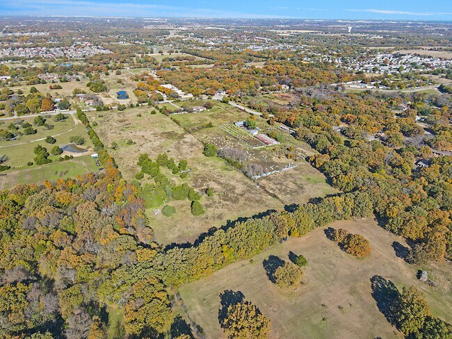
Property Record
1334 E Stark Rd, Dallas, TX 75253

Property Detail
1334 E Stark Rd
65054143010110000
HERMAN HEIDER ABST 541 PG 430 TR 10 ACS 2.76 SEE ACCT 650541430101000HS INT20080333368 DD10062008 CO-DC 0541430101000 4CJ05414301
Privatepreserveopenspacevacantlandforestlandconservation
Dallas
Z05
Texas
B and X Area of moderate flood hazard, usually the area between the limits of the 100-year and 500-year floods.
16.20 AC
2025
Mesquite/Forney/Terrell
2025
Dallas/Ft Worth
017007
Dallas-Fort Worth-Arlington, TX
4,160 SF
NEARBY LISTINGS FOR SALE OR LEASE
DEMOGRAPHICS near 1334 E Stark Rd
1 mile
3 mile
5 mile
2025 Total Population
10,724
53,549
115,680
2030 Population
11,222
55,918
120,048
Pop Growth 2025-2030
+ 4.64%
+ 4.42%
+ 3.78%
Average Age
31
34
35
2025 Total Households
2,860
14,808
33,158
HH Growth 2025-2030
+ 4.65%
+ 4.51%
+ 3.79%
Median Household Inc
$63,683
$65,907
$69,602
Avg Household Size
3.60
3.40
3.40
2025 Avg HH Vehicles
2.00
2.00
2.00
Median Home Value
$193,242
$226,260
$241,670
Median Year Built
2000
1998
1992
Nearby Places
Map Layers
Map Styles
 Street
 Aerial
Layers
 Traffic
 Biking
Places
Listings with unknown addresses are not visible on the map
- Restaurants
- Banks
- Shops
- Fitness
- Groceries
PUBLIC TRANSPORTATION
AIRPORT
Dallas Love Field
Drive
Walk
Distance
Dallas Love Field
34 min
22.4 mi
Freight Ports
Port of Shreveport
Drive
Walk
Distance
Port of Shreveport
199 min
184.8 mi
SALE & LEASE HISTORY
LISTING DATE
SALE/LEASE

Nov 30, 2022
For Sale
Nearby Properties
Address
Land Use
TOTAL SIZE
Lot Size
Zoning
Address
Land Use
TOTAL SIZE
Lot Size
Zoning
263,360 SF
42.98 AC
Z237
Address
Land Use
TOTAL SIZE
Lot Size
Zoning
457,110 SF
100.05 AC
Z293
Address
Land Use
TOTAL SIZE
Lot Size
Zoning
200,000 SF
8.11 AC
Z183
Address
Land Use
TOTAL SIZE
Lot Size
Zoning
200,000 SF
8.11 AC
Address
Land Use
TOTAL SIZE
Lot Size
Zoning
290,916 SF
Address
Land Use
TOTAL SIZE
Lot Size
Zoning
257,696 SF
9.62 AC
Address
Land Use
TOTAL SIZE
Lot Size
Zoning
372,456 SF
17.34 AC
Z116
Address
Land Use
TOTAL SIZE
Lot Size
Zoning
109,472 SF
6.98 AC
Address
Land Use
TOTAL SIZE
Lot Size
Zoning
400 SF
50.76 AC
MFA
Address
Land Use
TOTAL SIZE
Lot Size
Zoning
321 SF
40.51 AC
MFA
Address
Land Use
TOTAL SIZE
Lot Size
Zoning
190,150 SF
13.39 AC
Z236
Address
Land Use
TOTAL SIZE
Lot Size
Zoning
106,462 SF
9.58 AC
Z236
Address
Land Use
TOTAL SIZE
Lot Size
Zoning
215 SF
29.95 AC
A
Address
Land Use
TOTAL SIZE
Lot Size
Zoning
123,790 SF
6.68 AC
Z183
Address
Land Use
TOTAL SIZE
Lot Size
Zoning
248 SF
32.79 AC
MFA
Address
Land Use
TOTAL SIZE
Lot Size
Zoning
208 SF
24.50 AC
Z06
Address
Land Use
TOTAL SIZE
Lot Size
Zoning
122,352 SF
6.05 AC
Z46
Address
Land Use
TOTAL SIZE
Lot Size
Zoning
377,133 SF
16.71 AC
Z131
Address
Land Use
TOTAL SIZE
Lot Size
Zoning
88,320 SF
4.48 AC
Z72
Address
Land Use
TOTAL SIZE
Lot Size
Zoning
183 SF
23.14 AC
Z06
Address
Land Use
TOTAL SIZE
Lot Size
Zoning
70,000 SF
25.26 AC
Z06
Address
Land Use
TOTAL SIZE
Lot Size
Zoning
319 SF
37.74 AC
SUP1
Address
Land Use
TOTAL SIZE
Lot Size
Zoning
216,327 SF
26.31 AC
Address
Land Use
TOTAL SIZE
Lot Size
Zoning
72,341 SF
13 AC
Z236
Address
Land Use
TOTAL SIZE
Lot Size
Zoning
191 SF
23.10 AC
Z05
Address
Land Use
TOTAL SIZE
Lot Size
Zoning
146 SF
18.02 AC
MFA
Address
Land Use
TOTAL SIZE
Lot Size
Zoning
156 SF
17.11 AC
MFA
Address
Land Use
TOTAL SIZE
Lot Size
Zoning
28,126 SF
166.45 AC
Z05
Address
Land Use
TOTAL SIZE
Lot Size
Zoning
96 SF
14.18 AC
I2
Address
Land Use
TOTAL SIZE
Lot Size
Zoning
89,044 SF
5.04 AC
Z163
The World's #1 Commercial Real Estate Marketplace
Connect with us
© 2026 CoStar Group
The information above has been obtained from sources believed reliable. While we do not doubt its accuracy we have not verified it and make no guarantee, warranty or representation about it. It is your responsibility to independently confirm its accuracy and completeness. Any projections, opinions, assumptions, or estimates used are for example only and do not represent the current or future performance of the property. The value of this transaction to you depends on tax and other factors which should be evaluated by your tax, financial, and legal advisors. You and your advisors should conduct a careful, independent investigation of the property to determine to your satisfaction the suitability of the property for your needs.