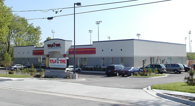
Property Record
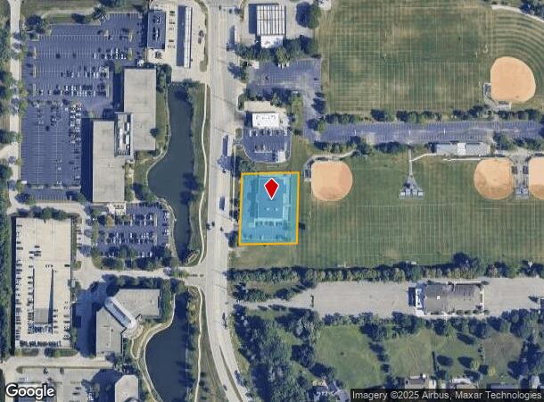
1335 N Arlington Heights Rd, Itasca, IL 60143


NEARBY LISTINGS FOR SALE OR LEASE
Property Detail
1335 N Arlington Heights Rd
Chicago-Naperville-Elgin, IL-IN-WI
Consol Of Prt Of Babbitts Division
03-05-201-056
CONSOL OF PRT OF BABBITTS DIVISION UNNUMBERED LOT
Commercialnec
DuPage
AE
Illinois
17043C0057J
6,7
2024
0.98 AC
2024
North DuPage
840201
Chicago
10,400 SF
DEMOGRAPHICS near 1335 N Arlington Heights Rd
1 Mile
3 Mile
5 Mile
2024 Total Population
7,862
57,978
213,224
2029 Population
7,605
56,053
206,997
Pop Growth 2024-2029
(3.27%)
(3.32%)
(2.92%)
Average Age
45
43
41
2024 Total Households
3,236
22,646
80,914
HH Growth 2024-2029
(3.58%)
(3.65%)
(3.20%)
Median Household Inc
$101,630
$92,479
$80,084
Avg Household Size
2.30
2.50
2.50
2024 Avg HH Vehicles
2.00
2.00
2.00
Median Home Value
$323,043
$305,920
$303,098
Median Year Built
1971
1973
1974
Nearby Places
Map Layers
Map Styles
 Street
 Aerial
- Restaurants
- Banks
- Shops
- Fitness
- Groceries
PUBLIC TRANSPORTATION
COMMUTER RAIL
Itasca Station (Milwaukee District West Line - Northeast Illinois Regional Commuter Railroad (Metra))
DRIVE
WALK
Distance
Itasca Station (Milwaukee District West Line - Northeast Illinois Regional Commuter Railroad (Metra))
5 min
2.1 mi
Wood Dale Station (Milwaukee District West Line - Northeast Illinois Regional Commuter Railroad (Metra))
DRIVE
WALK
Distance
Wood Dale Station (Milwaukee District West Line - Northeast Illinois Regional Commuter Railroad (Metra))
7 min
3.4 mi
AIRPORT
Chicago O'Hare International
DRIVE
WALK
Distance
Chicago O'Hare International
19 min
10.7 mi
Chicago Midway International
DRIVE
WALK
Distance
Chicago Midway International
40 min
27.0 mi
SALE & LEASE HISTORY
LISTING DATE
SALE/LEASE

Feb 01, 2023
For Sale
Nearby Properties
Address
Land Use
TOTAL SIZE
Lot Size
Zoning
Address
Land Use
TOTAL SIZE
Lot Size
Zoning
108,216 SF
7.87 AC
Address
Land Use
TOTAL SIZE
Lot Size
Zoning
Address
Land Use
TOTAL SIZE
Lot Size
Zoning
310,751 SF
15.04 AC
Address
Land Use
TOTAL SIZE
Lot Size
Zoning
333,258 SF
9.48 AC
Address
Land Use
TOTAL SIZE
Lot Size
Zoning
18.91 AC
Address
Land Use
TOTAL SIZE
Lot Size
Zoning
Address
Land Use
TOTAL SIZE
Lot Size
Zoning
179,780 SF
8.12 AC
I
Address
Land Use
TOTAL SIZE
Lot Size
Zoning
457,762 SF
23 AC
M
Address
Land Use
TOTAL SIZE
Lot Size
Zoning
58,373 SF
11.22 AC
Address
Land Use
TOTAL SIZE
Lot Size
Zoning
17.67 AC
Address
Land Use
TOTAL SIZE
Lot Size
Zoning
74,664 SF
3.19 AC
Address
Land Use
TOTAL SIZE
Lot Size
Zoning
Address
Land Use
TOTAL SIZE
Lot Size
Zoning
17.73 AC
Address
Land Use
TOTAL SIZE
Lot Size
Zoning
14.76 AC
Address
Land Use
TOTAL SIZE
Lot Size
Zoning
525,422 SF
8.45 AC
C
Address
Land Use
TOTAL SIZE
Lot Size
Zoning
15.32 AC
Address
Land Use
TOTAL SIZE
Lot Size
Zoning
487,027 SF
8.36 AC
C
Address
Land Use
TOTAL SIZE
Lot Size
Zoning
15.29 AC
Address
Land Use
TOTAL SIZE
Lot Size
Zoning
410,822 SF
14.26 AC
Address
Land Use
TOTAL SIZE
Lot Size
Zoning
450,614 SF
17.97 AC
C
Address
Land Use
TOTAL SIZE
Lot Size
Zoning
24.82 AC
Address
Land Use
TOTAL SIZE
Lot Size
Zoning
24.82 AC
Address
Land Use
TOTAL SIZE
Lot Size
Zoning
Address
Land Use
TOTAL SIZE
Lot Size
Zoning
24.82 AC
Address
Land Use
TOTAL SIZE
Lot Size
Zoning
489,153 SF
18.90 AC
I
Address
Land Use
TOTAL SIZE
Lot Size
Zoning
441,232 SF
34.52 AC
I
Address
Land Use
TOTAL SIZE
Lot Size
Zoning
208,000 SF
10.35 AC
Address
Land Use
TOTAL SIZE
Lot Size
Zoning
132,699 SF
6.74 AC
Address
Land Use
TOTAL SIZE
Lot Size
Zoning
338,816 SF
16.84 AC
I
Address
Land Use
TOTAL SIZE
Lot Size
Zoning
288,000 SF
11.05 AC
C
The World's #1 Commercial Real Estate Marketplace
Connect with us
© 2025 CoStar Group
The information above has been obtained from sources believed reliable. While we do not doubt its accuracy we have not verified it and make no guarantee, warranty or representation about it. It is your responsibility to independently confirm its accuracy and completeness. Any projections, opinions, assumptions, or estimates used are for example only and do not represent the current or future performance of the property. The value of this transaction to you depends on tax and other factors which should be evaluated by your tax, financial, and legal advisors. You and your advisors should conduct a careful, independent investigation of the property to determine to your satisfaction the suitability of the property for your needs.