Property Record
13350 24 Mile Rd, Shelby Township, MI 48315


NEARBY LISTINGS FOR SALE OR LEASE
Property Detail
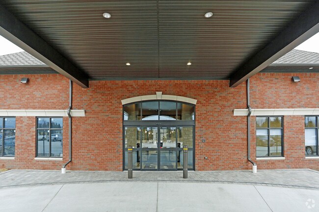
13350 24 Mile Rd
23-07-14-200-041
T3N, R12E, SEC 14; COMM AT THE NE COR OF SEC 14; TH S88*44'00"W 510.61 FT TO POB; TH S88*44'00"W 405.87 FT; TH S00*06'48"E
Medicalbuilding
Macomb
X
Michigan
26099C0236G
5.66 AC
2025
Macomb West
2025
Detroit
226400
Detroit-Warren-Dearborn, MI
27,409 SF
DEMOGRAPHICS near 13350 24 Mile Rd
1 Mile
3 Mile
5 Mile
2024 Total Population
6,290
62,086
172,146
2029 Population
6,288
61,256
169,941
Pop Growth 2024-2029
(0.03%)
(1.34%)
(1.28%)
Average Age
42
42
42
2024 Total Households
2,062
22,351
65,147
HH Growth 2024-2029
(0.10%)
(1.53%)
(1.36%)
Median Household Inc
$130,509
$101,215
$89,920
Avg Household Size
3.00
2.70
2.60
2024 Avg HH Vehicles
2.00
2.00
2.00
Median Home Value
$452,241
$334,207
$314,495
Median Year Built
1995
1994
1992
Nearby Places
Map Layers
Map Styles
 Street
 Aerial
- Restaurants
- Banks
- Shops
- Fitness
- Groceries
PUBLIC TRANSPORTATION
AIRPORT
Windsor International
DRIVE
WALK
Distance
Windsor International
67 min
41.0 mi
Freight Ports
Port of Toledo
DRIVE
WALK
Distance
Port of Toledo
117 min
91.6 mi
SALE & LEASE HISTORY
LISTING DATE
SALE/LEASE

Sep 26, 2016
For Lease
Nearby Properties
Address
Land Use
TOTAL SIZE
Lot Size
Zoning
Address
Land Use
TOTAL SIZE
Lot Size
Zoning
998,316 SF
85.99 AC
CK MAP
Address
Land Use
TOTAL SIZE
Lot Size
Zoning
447,434 SF
23.29 AC
LM
Address
Land Use
TOTAL SIZE
Lot Size
Zoning
332,286 SF
CK MAP
Address
Land Use
TOTAL SIZE
Lot Size
Zoning
371,520 SF
21.91 AC
CK MAP
Address
Land Use
TOTAL SIZE
Lot Size
Zoning
13.61 AC
C-2
Address
Land Use
TOTAL SIZE
Lot Size
Zoning
89,559 SF
44.54 AC
O2
Address
Land Use
TOTAL SIZE
Lot Size
Zoning
190,996 SF
33.80 AC
LM
Address
Land Use
TOTAL SIZE
Lot Size
Zoning
10.29 AC
LM
Address
Land Use
TOTAL SIZE
Lot Size
Zoning
181,725 SF
CK MAP
Address
Land Use
TOTAL SIZE
Lot Size
Zoning
160,104 SF
22.65 AC
CONSENT-R1
Address
Land Use
TOTAL SIZE
Lot Size
Zoning
90,185 SF
14.73 AC
C2
Address
Land Use
TOTAL SIZE
Lot Size
Zoning
224,323 SF
22.15 AC
C-3
Address
Land Use
TOTAL SIZE
Lot Size
Zoning
167,747 SF
CK MAP
Address
Land Use
TOTAL SIZE
Lot Size
Zoning
73.49 AC
CK MAP
Address
Land Use
TOTAL SIZE
Lot Size
Zoning
217,654 SF
26.88 AC
CONSENT-GC
Address
Land Use
TOTAL SIZE
Lot Size
Zoning
117,856 SF
13.51 AC
C-3
Address
Land Use
TOTAL SIZE
Lot Size
Zoning
79,942 SF
4.65 AC
M1
Address
Land Use
TOTAL SIZE
Lot Size
Zoning
120,658 SF
13.97 AC
C-3
Address
Land Use
TOTAL SIZE
Lot Size
Zoning
8.81 AC
C-6
Address
Land Use
TOTAL SIZE
Lot Size
Zoning
121,156 SF
9.40 AC
CK MAP
Address
Land Use
TOTAL SIZE
Lot Size
Zoning
293,800 SF
M1
Address
Land Use
TOTAL SIZE
Lot Size
Zoning
118,844 SF
17.80 AC
C-2
Address
Land Use
TOTAL SIZE
Lot Size
Zoning
134,400 SF
7.55 AC
CK MAP
Address
Land Use
TOTAL SIZE
Lot Size
Zoning
108,799 SF
25.03 AC
CONSENT-R1
Address
Land Use
TOTAL SIZE
Lot Size
Zoning
125,426 SF
11.87 AC
R-1-B
Address
Land Use
TOTAL SIZE
Lot Size
Zoning
122,540 SF
CK MAP
Address
Land Use
TOTAL SIZE
Lot Size
Zoning
214,282 SF
22.26 AC
M1
Address
Land Use
TOTAL SIZE
Lot Size
Zoning
150,854 SF
8.50 AC
LM
Address
Land Use
TOTAL SIZE
Lot Size
Zoning
148,438 SF
4.82 AC
LM
Address
Land Use
TOTAL SIZE
Lot Size
Zoning
99,619 SF
8.24 AC
M1
The World's #1 Commercial Real Estate Marketplace
Connect with us
© 2026 CoStar Group
The information above has been obtained from sources believed reliable. While we do not doubt its accuracy we have not verified it and make no guarantee, warranty or representation about it. It is your responsibility to independently confirm its accuracy and completeness. Any projections, opinions, assumptions, or estimates used are for example only and do not represent the current or future performance of the property. The value of this transaction to you depends on tax and other factors which should be evaluated by your tax, financial, and legal advisors. You and your advisors should conduct a careful, independent investigation of the property to determine to your satisfaction the suitability of the property for your needs.