Property Record
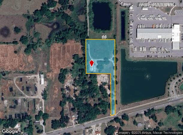
13354 E Us Highway 92, Dover, FL 33527


NEARBY LISTINGS FOR SALE OR LEASE
Property Detail
13354 E Us Highway 92
Tampa-St. Petersburg-Clearwater, FL
Watkins Estates
U-29-28-21-9MZ-000000-00002.0
WATKINS ESTATES LOT 2
Warehouse
Hillsborough
A
Florida
12057C0263H
2
2024
3.57 AC
2024
Eastern Outlying
012401
Tampa/St Petersburg
5,854 SF
DEMOGRAPHICS near 13354 E Us Highway 92
1 Mile
3 Mile
5 Mile
2024 Total Population
1,541
17,429
64,641
2029 Population
1,680
19,032
70,491
Pop Growth 2024-2029
+ 9.02%
+ 9.20%
+ 9.05%
Average Age
39
40
40
2024 Total Households
476
5,790
22,195
HH Growth 2024-2029
+ 9.03%
+ 9.52%
+ 9.34%
Median Household Inc
$64,811
$66,359
$70,937
Avg Household Size
2.80
2.80
2.80
2024 Avg HH Vehicles
2.00
2.00
2.00
Median Home Value
$376,666
$319,290
$283,968
Median Year Built
1984
1986
1986
Nearby Places
Map Layers
Map Styles
 Street
 Aerial
- Restaurants
- Banks
- Shops
- Fitness
- Groceries
PUBLIC TRANSPORTATION
AIRPORT
Tampa International
DRIVE
WALK
Distance
Tampa International
35 min
24.4 mi
St Pete-Clearwater International
DRIVE
WALK
Distance
St Pete-Clearwater International
46 min
32.9 mi
Freight Ports
Port of Tampa Bay
DRIVE
WALK
Distance
Port of Tampa Bay
28 min
17.8 mi
SALE & LEASE HISTORY
LISTING DATE
SALE/LEASE

Aug 22, 2023
For Lease
Nearby Properties
Address
Land Use
TOTAL SIZE
Lot Size
Zoning
Address
Land Use
TOTAL SIZE
Lot Size
Zoning
319,392 SF
105.53 AC
AR
Address
Land Use
TOTAL SIZE
Lot Size
Zoning
55,668 SF
63.68 AC
PD
Address
Land Use
TOTAL SIZE
Lot Size
Zoning
34,385 SF
27.96 AC
PD
Address
Land Use
TOTAL SIZE
Lot Size
Zoning
31,854 SF
26.89 AC
PD
Address
Land Use
TOTAL SIZE
Lot Size
Zoning
95,663 SF
30.03 AC
ASC-1
Address
Land Use
TOTAL SIZE
Lot Size
Zoning
61,585 SF
12.98 AC
AI
Address
Land Use
TOTAL SIZE
Lot Size
Zoning
25,055 SF
70.22 AC
PD
Address
Land Use
TOTAL SIZE
Lot Size
Zoning
275,101 SF
18.93 AC
M
Address
Land Use
TOTAL SIZE
Lot Size
Zoning
115,045 SF
18.82 AC
ASC-1
Address
Land Use
TOTAL SIZE
Lot Size
Zoning
214,110 SF
30.01 AC
M
Address
Land Use
TOTAL SIZE
Lot Size
Zoning
61,886 SF
9.74 AC
PD
Address
Land Use
TOTAL SIZE
Lot Size
Zoning
164,116 SF
33.31 AC
PD
Address
Land Use
TOTAL SIZE
Lot Size
Zoning
21,402 SF
6.05 AC
PD
Address
Land Use
TOTAL SIZE
Lot Size
Zoning
14,991 SF
5.76 AC
PD
Address
Land Use
TOTAL SIZE
Lot Size
Zoning
13,433 SF
59.50 AC
ASC-1
Address
Land Use
TOTAL SIZE
Lot Size
Zoning
21,740 SF
12.31 AC
PD
Address
Land Use
TOTAL SIZE
Lot Size
Zoning
16,982 SF
38.89 AC
ASC-1
Address
Land Use
TOTAL SIZE
Lot Size
Zoning
42,289 SF
5.10 AC
PD
Address
Land Use
TOTAL SIZE
Lot Size
Zoning
37,794 SF
5.68 AC
CG
Address
Land Use
TOTAL SIZE
Lot Size
Zoning
20,493 SF
79.78 AC
AS-1
Address
Land Use
TOTAL SIZE
Lot Size
Zoning
6,278 SF
1.98 AC
CG
Address
Land Use
TOTAL SIZE
Lot Size
Zoning
6,068 SF
26.51 AC
AR
Address
Land Use
TOTAL SIZE
Lot Size
Zoning
57.17 AC
AI
Address
Land Use
TOTAL SIZE
Lot Size
Zoning
13,828 SF
0.52 AC
CG
Address
Land Use
TOTAL SIZE
Lot Size
Zoning
5,636 SF
1.65 AC
CN
Address
Land Use
TOTAL SIZE
Lot Size
Zoning
8,000 SF
6.22 AC
CG
Address
Land Use
TOTAL SIZE
Lot Size
Zoning
952 SF
12.08 AC
CI
Address
Land Use
TOTAL SIZE
Lot Size
Zoning
6,068 SF
25.05 AC
AS-1
Address
Land Use
TOTAL SIZE
Lot Size
Zoning
7,564 SF
2.54 AC
PD
The World's #1 Commercial Real Estate Marketplace
Connect with us
© 2025 CoStar Group
The information above has been obtained from sources believed reliable. While we do not doubt its accuracy we have not verified it and make no guarantee, warranty or representation about it. It is your responsibility to independently confirm its accuracy and completeness. Any projections, opinions, assumptions, or estimates used are for example only and do not represent the current or future performance of the property. The value of this transaction to you depends on tax and other factors which should be evaluated by your tax, financial, and legal advisors. You and your advisors should conduct a careful, independent investigation of the property to determine to your satisfaction the suitability of the property for your needs.