Property Record
13357 Rawls St, Woodbridge, VA 22191


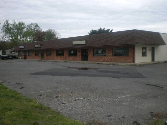
Property Detail
13357 Rawls St
8392-86-4770
BEGINS AT PIPE IN CURVATURE OF N R/W LINE OF HORNER RD--PDB 1214-1241
Storebuilding
PRINCE WILLIAM
B1
Virginia
B and X Area of moderate flood hazard, usually the area between the limits of the 100-year and 500-year floods.
4770
2024
1.58 AC
2025
Woodbridge/I-95 Corridor
900701
Washington, DC
9,552 SF
Washington-Arlington-Alexandria, DC-VA-MD-WV
NEARBY LISTINGS FOR SALE OR LEASE
DEMOGRAPHICS near 13357 Rawls St
1 mile
3 mile
5 mile
2025 Total Population
17,122
72,035
198,331
2030 Population
17,581
73,774
202,803
Pop Growth 2025-2030
+ 2.68%
+ 2.41%
+ 2.25%
Average Age
35
37
38
2025 Total Households
5,662
24,298
65,710
HH Growth 2025-2030
+ 2.86%
+ 2.42%
+ 2.21%
Median Household Inc
$92,015
$106,733
$117,426
Avg Household Size
2.90
2.90
2.90
2025 Avg HH Vehicles
2.00
2.00
2.00
Median Home Value
$402,824
$439,296
$466,574
Median Year Built
1983
1984
1988
Nearby Places
Map Layers
Map Styles
 Street
 Aerial
Transit
 Traffic
 Biking
Places
Listings with unknown addresses are not visible on the map
- Restaurants
- Banks
- Shops
- Fitness
- Groceries
PUBLIC TRANSPORTATION
COMMUTER RAIL
Woodbridge (Fredericksburg Line - Virginia Railway Express)
Drive
Walk
Distance
Woodbridge (Fredericksburg Line - Virginia Railway Express)
2 min
15 min
0.6 mi
Drive
Walk
Distance
9 min
4.5 mi
AIRPORT
Ronald Reagan Washington Ntl
Drive
Walk
Distance
Ronald Reagan Washington Ntl
30 min
20.1 mi
Washington Dulles International
Drive
Walk
Distance
Washington Dulles International
52 min
29.7 mi
Freight Ports
Port of Baltimore
Drive
Walk
Distance
Port of Baltimore
86 min
60.1 mi
Nearby Properties
Address
Land Use
TOTAL SIZE
Lot Size
Zoning
Address
Land Use
TOTAL SIZE
Lot Size
Zoning
1,402,177 SF
104.72 AC
B1
Address
Land Use
TOTAL SIZE
Lot Size
Zoning
570,195 SF
38.70 AC
OH
Address
Land Use
TOTAL SIZE
Lot Size
Zoning
485,714 SF
82.68 AC
MIXED
Address
Land Use
TOTAL SIZE
Lot Size
Zoning
609,447 SF
44.24 AC
R16
Address
Land Use
TOTAL SIZE
Lot Size
Zoning
465,616 SF
6.45 AC
PMR
Address
Land Use
TOTAL SIZE
Lot Size
Zoning
337,789 SF
10.02 AC
PMD
Address
Land Use
TOTAL SIZE
Lot Size
Zoning
568,505 SF
7.19 AC
PMR
Address
Land Use
TOTAL SIZE
Lot Size
Zoning
456,284 SF
70.54 AC
RPC
Address
Land Use
TOTAL SIZE
Lot Size
Zoning
377,248 SF
26.67 AC
R16
Address
Land Use
TOTAL SIZE
Lot Size
Zoning
93,321 SF
26.28 AC
R16
Address
Land Use
TOTAL SIZE
Lot Size
Zoning
175,001 SF
28.60 AC
R16
Address
Land Use
TOTAL SIZE
Lot Size
Zoning
382,173 SF
91.53 AC
A1
Address
Land Use
TOTAL SIZE
Lot Size
Zoning
605,863 SF
14.52 AC
PMD
Address
Land Use
TOTAL SIZE
Lot Size
Zoning
81,628 SF
26.25 AC
R16
Address
Land Use
TOTAL SIZE
Lot Size
Zoning
316,829 SF
8.96 AC
PMR
Address
Land Use
TOTAL SIZE
Lot Size
Zoning
394,404 SF
64.52 AC
RPC
Address
Land Use
TOTAL SIZE
Lot Size
Zoning
354,638 SF
28.32 AC
B1
Address
Land Use
TOTAL SIZE
Lot Size
Zoning
86,869 SF
9.54 AC
PMD
Address
Land Use
TOTAL SIZE
Lot Size
Zoning
376,424 SF
24.48 AC
R16
Address
Land Use
TOTAL SIZE
Lot Size
Zoning
424,533 SF
14.74 AC
R16
Address
Land Use
TOTAL SIZE
Lot Size
Zoning
252,614 SF
21.96 AC
B1
Address
Land Use
TOTAL SIZE
Lot Size
Zoning
434,095 SF
18.64 AC
B1
Address
Land Use
TOTAL SIZE
Lot Size
Zoning
120,620 SF
13.10 AC
596
Address
Land Use
TOTAL SIZE
Lot Size
Zoning
199,448 SF
6.14 AC
R30
Address
Land Use
TOTAL SIZE
Lot Size
Zoning
67,551 SF
12.69 AC
R16
Address
Land Use
TOTAL SIZE
Lot Size
Zoning
223,340 SF
20.64 AC
MIXED
Address
Land Use
TOTAL SIZE
Lot Size
Zoning
170,328 SF
13.21 AC
R16
Address
Land Use
TOTAL SIZE
Lot Size
Zoning
120,203 SF
17.35 AC
MIXED
Address
Land Use
TOTAL SIZE
Lot Size
Zoning
41.11 AC
110
Address
Land Use
TOTAL SIZE
Lot Size
Zoning
174,210 SF
11.45 AC
R16
The World's #1 Commercial Real Estate Marketplace
Connect with us
© 2026 CoStar Group
The information above has been obtained from sources believed reliable. While we do not doubt its accuracy we have not verified it and make no guarantee, warranty or representation about it. It is your responsibility to independently confirm its accuracy and completeness. Any projections, opinions, assumptions, or estimates used are for example only and do not represent the current or future performance of the property. The value of this transaction to you depends on tax and other factors which should be evaluated by your tax, financial, and legal advisors. You and your advisors should conduct a careful, independent investigation of the property to determine to your satisfaction the suitability of the property for your needs.