Property Record
1336 Bristol Pike, Croydon, PA 19021


Save to a Folder
{{folder.Name}}
{{folder.ListingIds.length}} Properties
{{folder.ListingIds.length}} Property
Create a New Folder
Property Detail
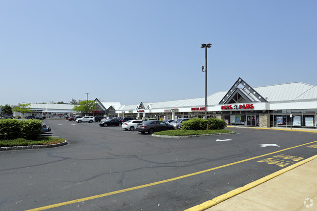
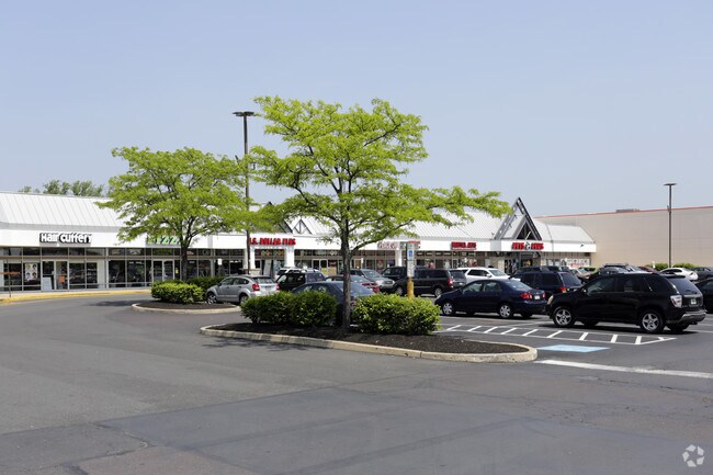
1336 Bristol Pike
02-030-009
29.27 AC NW COR BRISTOL P K & WOODHAVEN RD 519 IB YS13
Storebuilding
BUCKS
HC
Pennsylvania
B and X Area of moderate flood hazard, usually the area between the limits of the 100-year and 500-year floods.
29.27 AC
2025
Lower Bucks County
2026
Philadelphia
100302
Philadelphia-Camden-Wilmington, PA-NJ-DE-MD
318,881 SF
NEARBY LISTINGS FOR SALE OR LEASE
DEMOGRAPHICS near 1336 Bristol Pike
1 mile
3 mile
5 mile
2025 Total Population
13,776
106,717
328,723
2030 Population
13,584
106,408
326,122
Pop Growth 2025-2030
(1.39%)
(0.29%)
(0.79%)
Average Age
43
42
42
2025 Total Households
5,346
42,260
126,574
HH Growth 2025-2030
(1.44%)
(0.47%)
(0.93%)
Median Household Inc
$87,601
$77,966
$75,543
Avg Household Size
2.50
2.50
2.50
2025 Avg HH Vehicles
2.00
2.00
2.00
Median Home Value
$313,353
$280,848
$292,997
Median Year Built
1965
1966
1965
Nearby Places
Map Layers
Map Styles
 Street
 Aerial
Layers
 Traffic
 Biking
Places
Listings with unknown addresses are not visible on the map
- Restaurants
- Banks
- Shops
- Fitness
- Groceries
PUBLIC TRANSPORTATION
COMMUTER RAIL
Cornwells Heights (R7 - Southeastern Pennsylvania Transportation Authority Regional Rail (SEPTA Regional Rail))
Drive
Walk
Distance
Cornwells Heights (R7 - Southeastern Pennsylvania Transportation Authority Regional Rail (SEPTA Regional Rail))
6 min
1.6 mi
Torresdale (R7 - Southeastern Pennsylvania Transportation Authority Regional Rail (SEPTA Regional Rail))
Drive
Walk
Distance
Torresdale (R7 - Southeastern Pennsylvania Transportation Authority Regional Rail (SEPTA Regional Rail))
8 min
2.6 mi
AIRPORT
Trenton Mercer
Drive
Walk
Distance
Trenton Mercer
33 min
18.8 mi
Philadelphia International
Drive
Walk
Distance
Philadelphia International
40 min
25.3 mi
Freight Ports
Port of Philadelphia
Drive
Walk
Distance
Port of Philadelphia
20 min
11.6 mi
SALE & LEASE HISTORY
LISTING DATE
SALE/LEASE

Jun 23, 2017
For Lease
Jan 10, 2019
For Lease
Aug 11, 2017
For Lease
Aug 04, 2017
For Lease
Apr 05, 2017
For Lease
Nearby Properties
Address
Land Use
TOTAL SIZE
Lot Size
Zoning
Address
Land Use
TOTAL SIZE
Lot Size
Zoning
34,350 SF
336 AC
SPPOA
Address
Land Use
TOTAL SIZE
Lot Size
Zoning
6,290 SF
177.73 AC
RSA4
Address
Land Use
TOTAL SIZE
Lot Size
Zoning
1,015,495 SF
70.51 AC
I1
Address
Land Use
TOTAL SIZE
Lot Size
Zoning
1,615,457 SF
119.41 AC
CA2
Address
Land Use
TOTAL SIZE
Lot Size
Zoning
96 AC
SPPOA
Address
Land Use
TOTAL SIZE
Lot Size
Zoning
432,175 SF
16.70 AC
I2
Address
Land Use
TOTAL SIZE
Lot Size
Zoning
464,814 SF
23.90 AC
I1
Address
Land Use
TOTAL SIZE
Lot Size
Zoning
410.98 AC
R2
Address
Land Use
TOTAL SIZE
Lot Size
Zoning
68,850 SF
16.42 AC
I1
Address
Land Use
TOTAL SIZE
Lot Size
Zoning
283,878 SF
63.36 AC
RSA3
Address
Land Use
TOTAL SIZE
Lot Size
Zoning
2,550 SF
63.76 AC
SPPOA
Address
Land Use
TOTAL SIZE
Lot Size
Zoning
438,910 SF
24.42 AC
RSA4
Address
Land Use
TOTAL SIZE
Lot Size
Zoning
282,736 SF
21.32 AC
I1
Address
Land Use
TOTAL SIZE
Lot Size
Zoning
404,000 SF
1.08 AC
RM2
Address
Land Use
TOTAL SIZE
Lot Size
Zoning
358,323 SF
27.42 AC
CA1
Address
Land Use
TOTAL SIZE
Lot Size
Zoning
233,520 SF
14.03 AC
I1
Address
Land Use
TOTAL SIZE
Lot Size
Zoning
459,320 SF
18 AC
RM2
Address
Land Use
TOTAL SIZE
Lot Size
Zoning
453,038 SF
34.79 AC
I1
Address
Land Use
TOTAL SIZE
Lot Size
Zoning
41.25 AC
RSA1
Address
Land Use
TOTAL SIZE
Lot Size
Zoning
5.70 AC
R2
Address
Land Use
TOTAL SIZE
Lot Size
Zoning
300,700 SF
30.41 AC
I1
Address
Land Use
TOTAL SIZE
Lot Size
Zoning
203,573 SF
9.94 AC
I1
Address
Land Use
TOTAL SIZE
Lot Size
Zoning
200.39 AC
SPPOP
Address
Land Use
TOTAL SIZE
Lot Size
Zoning
222,500 SF
14.58 AC
I1
Address
Land Use
TOTAL SIZE
Lot Size
Zoning
237,425 SF
15.30 AC
I1
Address
Land Use
TOTAL SIZE
Lot Size
Zoning
207,500 SF
16.18 AC
I1
Address
Land Use
TOTAL SIZE
Lot Size
Zoning
241,392 SF
24.15 AC
I1
Address
Land Use
TOTAL SIZE
Lot Size
Zoning
179,868 SF
11.70 AC
CA2
Address
Land Use
TOTAL SIZE
Lot Size
Zoning
166,815 SF
23.47 AC
I1
Address
Land Use
TOTAL SIZE
Lot Size
Zoning
386,320 SF
21.41 AC
I1
The World's #1 Commercial Real Estate Marketplace
Connect with us
© 2026 CoStar Group
The information above has been obtained from sources believed reliable. While we do not doubt its accuracy we have not verified it and make no guarantee, warranty or representation about it. It is your responsibility to independently confirm its accuracy and completeness. Any projections, opinions, assumptions, or estimates used are for example only and do not represent the current or future performance of the property. The value of this transaction to you depends on tax and other factors which should be evaluated by your tax, financial, and legal advisors. You and your advisors should conduct a careful, independent investigation of the property to determine to your satisfaction the suitability of the property for your needs.