Property Record
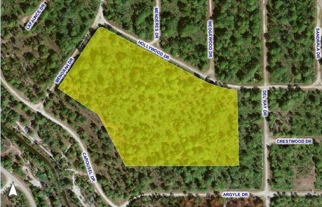
13366 Menorah Dr, Punta Gorda, FL 33955


NEARBY LISTINGS FOR SALE OR LEASE
Property Detail
13366 Menorah Dr
Punta Gorda, FL
Trop G A Un10
422310476001
TROP G A UN10 BLK260 LT 31 10.60 A M/L 636/1785 791/909 841/2083COR883/200 4533/1221 3227972 E3454290 E3454291 E3454292
Residentialacreage
Charlotte
D
Florida
12015C0430G
31
2024
10.60 AC
2025
Charlotte County
010505
Southwest Florida
DEMOGRAPHICS near 13366 Menorah Dr
1 Mile
3 Mile
5 Mile
2024 Total Population
582
4,641
15,019
2029 Population
694
5,631
18,136
Pop Growth 2024-2029
+ 19.24%
+ 21.33%
+ 20.75%
Average Age
45
55
57
2024 Total Households
243
2,220
6,981
HH Growth 2024-2029
+ 19.34%
+ 21.76%
+ 21.33%
Median Household Inc
$54,782
$59,664
$63,055
Avg Household Size
2.40
2.10
2.00
2024 Avg HH Vehicles
2.00
2.00
2.00
Median Home Value
$203,676
$201,007
$252,045
Median Year Built
1989
1994
1999
Nearby Places
Map Layers
Map Styles
 Street
 Aerial
- Restaurants
- Banks
- Shops
- Fitness
- Groceries
PUBLIC TRANSPORTATION
AIRPORT
Punta Gorda
DRIVE
WALK
Distance
Punta Gorda
17 min
8.9 mi
Southwest Florida International
DRIVE
WALK
Distance
Southwest Florida International
45 min
33.4 mi
Freight Ports
Port Manatee
DRIVE
WALK
Distance
Port Manatee
97 min
80.6 mi
SALE & LEASE HISTORY
LISTING DATE
SALE/LEASE

Aug 31, 2017
For Sale
Nearby Properties
Address
Land Use
TOTAL SIZE
Lot Size
Zoning
Address
Land Use
TOTAL SIZE
Lot Size
Zoning
16,364 SF
333.14 AC
PD
Address
Land Use
TOTAL SIZE
Lot Size
Zoning
43,500 SF
9.84 AC
CG
Address
Land Use
TOTAL SIZE
Lot Size
Zoning
21,583 SF
590.79 AC
ES
Address
Land Use
TOTAL SIZE
Lot Size
Zoning
636 AC
ES
Address
Land Use
TOTAL SIZE
Lot Size
Zoning
28,730 SF
11.64 AC
NC
Address
Land Use
TOTAL SIZE
Lot Size
Zoning
0.86 AC
RE1
Address
Land Use
TOTAL SIZE
Lot Size
Zoning
98.41 AC
PD
Address
Land Use
TOTAL SIZE
Lot Size
Zoning
476.14 AC
ES
Address
Land Use
TOTAL SIZE
Lot Size
Zoning
29,003 SF
11.77 AC
PD
Address
Land Use
TOTAL SIZE
Lot Size
Zoning
623 AC
AG
Address
Land Use
TOTAL SIZE
Lot Size
Zoning
117 SF
483.68 AC
ES
Address
Land Use
TOTAL SIZE
Lot Size
Zoning
77.96 AC
PD
Address
Land Use
TOTAL SIZE
Lot Size
Zoning
5,779 SF
362.13 AC
ES
Address
Land Use
TOTAL SIZE
Lot Size
Zoning
12.98 AC
CG
Address
Land Use
TOTAL SIZE
Lot Size
Zoning
8,217 SF
9.57 AC
RE1
Address
Land Use
TOTAL SIZE
Lot Size
Zoning
68.52 AC
PD
Address
Land Use
TOTAL SIZE
Lot Size
Zoning
38.50 AC
MHP
Address
Land Use
TOTAL SIZE
Lot Size
Zoning
10,210 SF
65.43 AC
PD
Address
Land Use
TOTAL SIZE
Lot Size
Zoning
14.14 AC
CG
Address
Land Use
TOTAL SIZE
Lot Size
Zoning
240 SF
244.90 AC
ES
Address
Land Use
TOTAL SIZE
Lot Size
Zoning
13,050 SF
2.07 AC
CG
Address
Land Use
TOTAL SIZE
Lot Size
Zoning
1.04 AC
PD
Address
Land Use
TOTAL SIZE
Lot Size
Zoning
42.16 AC
PD
Address
Land Use
TOTAL SIZE
Lot Size
Zoning
60 AC
RE1
Address
Land Use
TOTAL SIZE
Lot Size
Zoning
996 SF
44.43 AC
PD
Address
Land Use
TOTAL SIZE
Lot Size
Zoning
14,760 SF
141.29 AC
EP
Address
Land Use
TOTAL SIZE
Lot Size
Zoning
228.40 AC
EP
Address
Land Use
TOTAL SIZE
Lot Size
Zoning
4,920 SF
0.68 AC
CG
Address
Land Use
TOTAL SIZE
Lot Size
Zoning
22.26 AC
PD
Address
Land Use
TOTAL SIZE
Lot Size
Zoning
1,619 SF
184.82 AC
ES
The World's #1 Commercial Real Estate Marketplace
Connect with us
© 2026 CoStar Group
The information above has been obtained from sources believed reliable. While we do not doubt its accuracy we have not verified it and make no guarantee, warranty or representation about it. It is your responsibility to independently confirm its accuracy and completeness. Any projections, opinions, assumptions, or estimates used are for example only and do not represent the current or future performance of the property. The value of this transaction to you depends on tax and other factors which should be evaluated by your tax, financial, and legal advisors. You and your advisors should conduct a careful, independent investigation of the property to determine to your satisfaction the suitability of the property for your needs.