Property Record
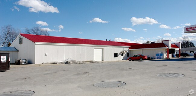
1337 Blachleyville Rd, Wooster, OH 44691


NEARBY LISTINGS FOR SALE OR LEASE
Property Detail
1337 Blachleyville Rd
Commercialnec
13-15-17 MPT NW 7.935A CD 1397
X
Wayne
39169C0214E
Ohio
2024
7.94 AC
2024
Other Market Areas
000600
Wooster, OH
11,402 SF
56-01107-000
DEMOGRAPHICS near 1337 Blachleyville Rd
1 Mile
3 Mile
5 Mile
2024 Total Population
1,526
18,472
36,079
2029 Population
1,532
18,660
36,351
Pop Growth 2024-2029
+ 0.39%
+ 1.02%
+ 0.75%
Average Age
44
39
41
2024 Total Households
622
7,218
14,289
HH Growth 2024-2029
+ 0.16%
+ 0.96%
+ 0.71%
Median Household Inc
$69,487
$51,687
$57,294
Avg Household Size
2.40
2.30
2.20
2024 Avg HH Vehicles
2.00
2.00
2.00
Median Home Value
$244,014
$172,102
$184,306
Median Year Built
1976
1963
1973
Nearby Places
Map Layers
Map Styles
 Street
 Aerial
- Restaurants
- Banks
- Shops
- Fitness
- Groceries
PUBLIC TRANSPORTATION
AIRPORT
Akron-Canton Regional
DRIVE
WALK
Distance
Akron-Canton Regional
56 min
44.5 mi
Nearby Properties
Address
Land Use
TOTAL SIZE
Lot Size
Zoning
Address
Land Use
TOTAL SIZE
Lot Size
Zoning
537,309 SF
43.72 AC
CF
Address
Land Use
TOTAL SIZE
Lot Size
Zoning
2,268 SF
106.60 AC
CF
Address
Land Use
TOTAL SIZE
Lot Size
Zoning
81,133 SF
41.43 AC
CF
Address
Land Use
TOTAL SIZE
Lot Size
Zoning
26,792 SF
64.92 AC
Address
Land Use
TOTAL SIZE
Lot Size
Zoning
7.28 AC
CF
Address
Land Use
TOTAL SIZE
Lot Size
Zoning
2,400 SF
99.04 AC
CF
Address
Land Use
TOTAL SIZE
Lot Size
Zoning
48,096 SF
1.67 AC
C4
Address
Land Use
TOTAL SIZE
Lot Size
Zoning
50,110 SF
19.26 AC
CF
Address
Land Use
TOTAL SIZE
Lot Size
Zoning
25.14 AC
CF
Address
Land Use
TOTAL SIZE
Lot Size
Zoning
47,160 SF
3.22 AC
C4
Address
Land Use
TOTAL SIZE
Lot Size
Zoning
4,486 SF
5.57 AC
CF
Address
Land Use
TOTAL SIZE
Lot Size
Zoning
210,000 SF
20 AC
Address
Land Use
TOTAL SIZE
Lot Size
Zoning
58,600 SF
6.30 AC
CF
Address
Land Use
TOTAL SIZE
Lot Size
Zoning
10.68 AC
M3
Address
Land Use
TOTAL SIZE
Lot Size
Zoning
71,511 SF
9.53 AC
CF
Address
Land Use
TOTAL SIZE
Lot Size
Zoning
6,631 SF
7.18 AC
R4
Address
Land Use
TOTAL SIZE
Lot Size
Zoning
89,980 SF
17.58 AC
M2
Address
Land Use
TOTAL SIZE
Lot Size
Zoning
61,107 SF
2.77 AC
C5
Address
Land Use
TOTAL SIZE
Lot Size
Zoning
25,920 SF
42 AC
CF
Address
Land Use
TOTAL SIZE
Lot Size
Zoning
2,380 SF
10.01 AC
CF
Address
Land Use
TOTAL SIZE
Lot Size
Zoning
72,917 SF
6.96 AC
CF
Address
Land Use
TOTAL SIZE
Lot Size
Zoning
62,707 SF
21.93 AC
M2
Address
Land Use
TOTAL SIZE
Lot Size
Zoning
54,501 SF
3.96 AC
C5
Address
Land Use
TOTAL SIZE
Lot Size
Zoning
17.43 AC
M2
Address
Land Use
TOTAL SIZE
Lot Size
Zoning
69,768 SF
0.74 AC
C4
Address
Land Use
TOTAL SIZE
Lot Size
Zoning
48,573 SF
10 AC
Address
Land Use
TOTAL SIZE
Lot Size
Zoning
39,287 SF
2.93 AC
C2
Address
Land Use
TOTAL SIZE
Lot Size
Zoning
3,057 SF
163.13 AC
CF
Address
Land Use
TOTAL SIZE
Lot Size
Zoning
8,080 SF
15.01 AC
CF
Address
Land Use
TOTAL SIZE
Lot Size
Zoning
80,000 SF
20.75 AC
M2
The World's #1 Commercial Real Estate Marketplace
Connect with us
© 2026 CoStar Group
The information above has been obtained from sources believed reliable. While we do not doubt its accuracy we have not verified it and make no guarantee, warranty or representation about it. It is your responsibility to independently confirm its accuracy and completeness. Any projections, opinions, assumptions, or estimates used are for example only and do not represent the current or future performance of the property. The value of this transaction to you depends on tax and other factors which should be evaluated by your tax, financial, and legal advisors. You and your advisors should conduct a careful, independent investigation of the property to determine to your satisfaction the suitability of the property for your needs.