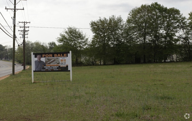
Property Record
1335 Cedar Lane Rd, Greenville, SC 29617


NEARBY LISTINGS FOR SALE OR LEASE
Property Detail
1335 Cedar Lane Rd
Greenville-Anderson-Mauldin, SC
Closing Survey For Betty J Lee
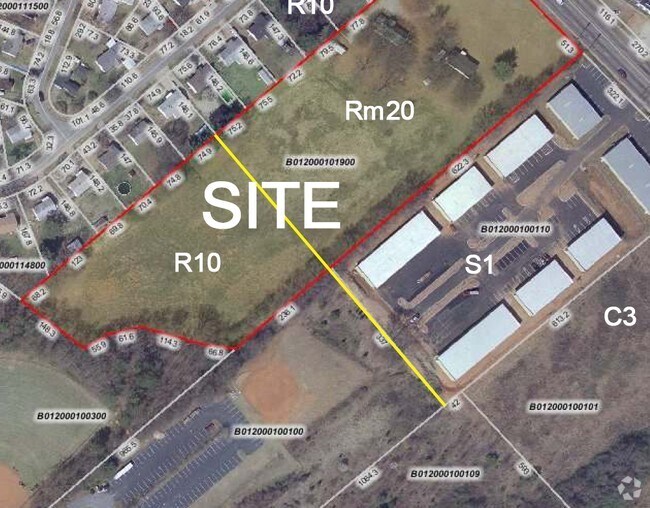
B012.00-01-019.00
MAP B012.00
Conveniencestore
Greenville
X
South Carolina
45045C0314E
019.00
2024
7.64 AC
2024
West Side Greenville
003704
Greenville/Spartanburg
1,542 SF
DEMOGRAPHICS near 1335 Cedar Lane Rd
1 Mile
3 Mile
5 Mile
2024 Total Population
9,156
66,844
139,228
2029 Population
10,118
74,405
154,313
Pop Growth 2024-2029
+ 10.51%
+ 11.31%
+ 10.83%
Average Age
36
38
38
2024 Total Households
3,237
27,327
56,848
HH Growth 2024-2029
+ 10.60%
+ 11.45%
+ 11.18%
Median Household Inc
$35,451
$43,403
$51,004
Avg Household Size
2.60
2.30
2.30
2024 Avg HH Vehicles
2.00
2.00
2.00
Median Home Value
$109,333
$172,494
$226,699
Median Year Built
1975
1980
1980
Nearby Places
- Restaurants
- Banks
- Shops
- Fitness
- Groceries
PUBLIC TRANSPORTATION
COMMUTER RAIL
Greenville Amtrak Station (Crescent - Amtrak)
DRIVE
WALK
Distance
Greenville Amtrak Station (Crescent - Amtrak)
6 min
2.6 mi
AIRPORT
Greenville Spartanburg International
DRIVE
WALK
Distance
Greenville Spartanburg International
28 min
17.1 mi
Freight Ports
North Charleston Terminal
DRIVE
WALK
Distance
North Charleston Terminal
236 min
207.7 mi
Nearby Properties
Address
Land Use
TOTAL SIZE
Lot Size
Zoning
Address
Land Use
TOTAL SIZE
Lot Size
Zoning
22.97 AC
R12
Address
Land Use
TOTAL SIZE
Lot Size
Zoning
1.01 AC
C4
Address
Land Use
TOTAL SIZE
Lot Size
Zoning
28.88 AC
RM
Address
Land Use
TOTAL SIZE
Lot Size
Zoning
14.41 AC
R15
Address
Land Use
TOTAL SIZE
Lot Size
Zoning
20.04 AC
RM
Address
Land Use
TOTAL SIZE
Lot Size
Zoning
0.53 AC
C4
Address
Land Use
TOTAL SIZE
Lot Size
Zoning
1.62 AC
C3
Address
Land Use
TOTAL SIZE
Lot Size
Zoning
9.57 AC
C3
Address
Land Use
TOTAL SIZE
Lot Size
Zoning
10.10 AC
RM
Address
Land Use
TOTAL SIZE
Lot Size
Zoning
3 AC
C4
Address
Land Use
TOTAL SIZE
Lot Size
Zoning
5.07 AC
S1
Address
Land Use
TOTAL SIZE
Lot Size
Zoning
14.85 AC
S1
Address
Land Use
TOTAL SIZE
Lot Size
Zoning
954 SF
7.83 AC
S1
Address
Land Use
TOTAL SIZE
Lot Size
Zoning
2.71 AC
RM2
Address
Land Use
TOTAL SIZE
Lot Size
Zoning
27.38 AC
R75
Address
Land Use
TOTAL SIZE
Lot Size
Zoning
5.40 AC
OD
Address
Land Use
TOTAL SIZE
Lot Size
Zoning
3.43 AC
CBD
Address
Land Use
TOTAL SIZE
Lot Size
Zoning
2.14 AC
RM
Address
Land Use
TOTAL SIZE
Lot Size
Zoning
2.12 AC
S1
Address
Land Use
TOTAL SIZE
Lot Size
Zoning
2.21 AC
RMA
Address
Land Use
TOTAL SIZE
Lot Size
Zoning
1.90 AC
C3
Address
Land Use
TOTAL SIZE
Lot Size
Zoning
2,945 SF
1.83 AC
S1
Address
Land Use
TOTAL SIZE
Lot Size
Zoning
50.95 AC
R75
Address
Land Use
TOTAL SIZE
Lot Size
Zoning
0.66 AC
C4
Address
Land Use
TOTAL SIZE
Lot Size
Zoning
3.07 AC
C3
Address
Land Use
TOTAL SIZE
Lot Size
Zoning
7.29 AC
S1
Address
Land Use
TOTAL SIZE
Lot Size
Zoning
8.29 AC
I1
Address
Land Use
TOTAL SIZE
Lot Size
Zoning
4.97 AC
RM20
Address
Land Use
TOTAL SIZE
Lot Size
Zoning
9.87 AC
S1
Address
Land Use
TOTAL SIZE
Lot Size
Zoning
1.46 AC
C-3
The World's #1 Commercial Real Estate Marketplace
Connect with us
© 2025 CoStar Group
The information above has been obtained from sources believed reliable. While we do not doubt its accuracy we have not verified it and make no guarantee, warranty or representation about it. It is your responsibility to independently confirm its accuracy and completeness. Any projections, opinions, assumptions, or estimates used are for example only and do not represent the current or future performance of the property. The value of this transaction to you depends on tax and other factors which should be evaluated by your tax, financial, and legal advisors. You and your advisors should conduct a careful, independent investigation of the property to determine to your satisfaction the suitability of the property for your needs.