Property Record
13379 Force St, Houston, TX 77015


Current Lease Availabilities
NEARBY LISTINGS FOR SALE OR LEASE
Property Detail
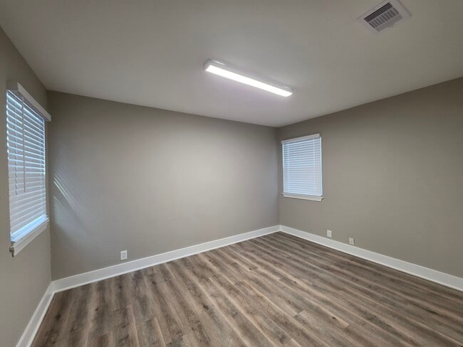
13379 Force St
Houston-Pasadena-The Woodlands, TX
Home Owned Estates Sec 2
0750860270771
LT 771 BLK 27 HOME OWNED ESTATES SEC 2
Sfr
Harris
X
Texas
48201C0720M
771
2024
0.22 AC
2025
I-10 East
233200
Houston
1,258 SF
DEMOGRAPHICS near 13379 Force St
1 mile
3 mile
5 mile
2024 Total Population
26,515
113,938
181,803
2029 Population
28,117
121,111
193,585
Pop Growth 2024-2029
+ 6.04%
+ 6.30%
+ 6.48%
Average Age
35
35
35
2024 Total Households
8,639
35,387
55,564
HH Growth 2024-2029
+ 6.23%
+ 6.51%
+ 6.68%
Median Household Inc
$57,371
$60,960
$60,607
Avg Household Size
3.00
3.10
3.20
2024 Avg HH Vehicles
2.00
2.00
2.00
Median Home Value
$184,303
$200,297
$194,531
Median Year Built
1978
1983
1983
Nearby Places
Map Layers
Map Styles
 Street
 Aerial
Transit
 Traffic
 Biking
Places
Listings with unknown addresses are not visible on the map
- Restaurants
- Banks
- Shops
- Fitness
- Groceries
PUBLIC TRANSPORTATION
AIRPORT
William P Hobby
Drive
Walk
Distance
William P Hobby
31 min
17.7 mi
George Bush Intcntl/Houston
Drive
Walk
Distance
George Bush Intcntl/Houston
29 min
22.7 mi
Freight Ports
Port of Houston
Drive
Walk
Distance
Port of Houston
17 min
9.7 mi
Nearby Properties
Address
Land Use
TOTAL SIZE
Lot Size
Zoning
Address
Land Use
TOTAL SIZE
Lot Size
Zoning
337,331 SF
56.09 AC
Address
Land Use
TOTAL SIZE
Lot Size
Zoning
699,448 SF
46.40 AC
Address
Land Use
TOTAL SIZE
Lot Size
Zoning
671,363 SF
61.27 AC
Address
Land Use
TOTAL SIZE
Lot Size
Zoning
331,284 SF
15.15 AC
Address
Land Use
TOTAL SIZE
Lot Size
Zoning
2,124,914 SF
243.08 AC
Address
Land Use
TOTAL SIZE
Lot Size
Zoning
520,866 SF
23.25 AC
Address
Land Use
TOTAL SIZE
Lot Size
Zoning
398,995 SF
27.39 AC
Address
Land Use
TOTAL SIZE
Lot Size
Zoning
271,428 SF
10.57 AC
Address
Land Use
TOTAL SIZE
Lot Size
Zoning
422,526 SF
27.45 AC
Address
Land Use
TOTAL SIZE
Lot Size
Zoning
351,250 SF
23.84 AC
Address
Land Use
TOTAL SIZE
Lot Size
Zoning
450,084 SF
15.13 AC
Address
Land Use
TOTAL SIZE
Lot Size
Zoning
202,544 SF
4.06 AC
Address
Land Use
TOTAL SIZE
Lot Size
Zoning
248,293 SF
13.20 AC
Address
Land Use
TOTAL SIZE
Lot Size
Zoning
187,726 SF
32.24 AC
Address
Land Use
TOTAL SIZE
Lot Size
Zoning
526,975 SF
21.08 AC
Address
Land Use
TOTAL SIZE
Lot Size
Zoning
889,587 SF
137.68 AC
Address
Land Use
TOTAL SIZE
Lot Size
Zoning
227,679 SF
13.31 AC
Address
Land Use
TOTAL SIZE
Lot Size
Zoning
49,384 SF
69.01 AC
Address
Land Use
TOTAL SIZE
Lot Size
Zoning
235,624 SF
10.06 AC
Address
Land Use
TOTAL SIZE
Lot Size
Zoning
110,900 SF
18.01 AC
Address
Land Use
TOTAL SIZE
Lot Size
Zoning
208,648 SF
8.99 AC
Address
Land Use
TOTAL SIZE
Lot Size
Zoning
377,109 SF
17.36 AC
Address
Land Use
TOTAL SIZE
Lot Size
Zoning
197,953 SF
8.29 AC
Address
Land Use
TOTAL SIZE
Lot Size
Zoning
246,277 SF
10.91 AC
Address
Land Use
TOTAL SIZE
Lot Size
Zoning
104,829 SF
26.14 AC
Address
Land Use
TOTAL SIZE
Lot Size
Zoning
451,243 SF
20.10 AC
Address
Land Use
TOTAL SIZE
Lot Size
Zoning
141,017 SF
11.90 AC
Address
Land Use
TOTAL SIZE
Lot Size
Zoning
174,112 SF
6.97 AC
Address
Land Use
TOTAL SIZE
Lot Size
Zoning
245,916 SF
12.24 AC
Address
Land Use
TOTAL SIZE
Lot Size
Zoning
202,747 SF
15.93 AC
The World's #1 Commercial Real Estate Marketplace
Connect with us
© 2026 CoStar Group
The information above has been obtained from sources believed reliable. While we do not doubt its accuracy we have not verified it and make no guarantee, warranty or representation about it. It is your responsibility to independently confirm its accuracy and completeness. Any projections, opinions, assumptions, or estimates used are for example only and do not represent the current or future performance of the property. The value of this transaction to you depends on tax and other factors which should be evaluated by your tax, financial, and legal advisors. You and your advisors should conduct a careful, independent investigation of the property to determine to your satisfaction the suitability of the property for your needs.