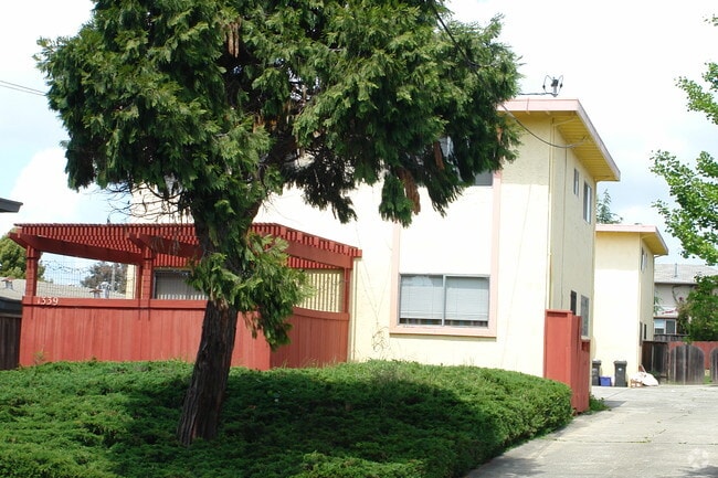
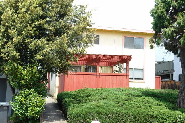
Property Record
1339 Rose St, Berkeley, CA 94702

NEARBY LISTINGS FOR SALE OR LEASE
Property Detail
1339 Rose St
060-2423-093-02
Parcel Map 354
Quadruplex
LOT: 0000A BLK: PM: 0058 PAGE: 0040
X
Alameda
06001C0018H
California
2024
0.22 AC
2025
Northwest Berkeley
421900
East Bay/Oakland
3,136 SF
Oakland-Fremont-Berkeley, CA
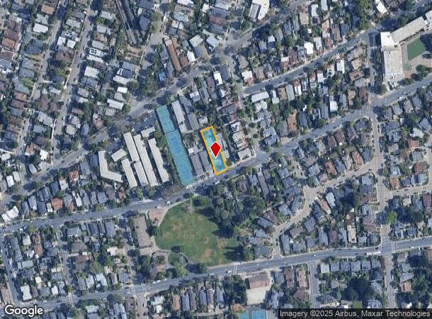
DEMOGRAPHICS near 1339 Rose St
1 mile
3 mile
5 mile
2024 Total Population
40,937
197,015
358,366
2029 Population
39,873
191,911
350,178
Pop Growth 2024-2029
(2.60%)
(2.59%)
(2.28%)
Average Age
41
39
40
2024 Total Households
16,649
78,366
146,203
HH Growth 2024-2029
(2.77%)
(2.71%)
(2.39%)
Median Household Inc
$103,407
$105,201
$104,007
Avg Household Size
2.20
2.20
2.20
2024 Avg HH Vehicles
1.00
1.00
1.00
Median Home Value
$1,082,701
$1,075,676
$1,045,123
Median Year Built
1949
1949
1955
Nearby Places
Map Layers
Map Styles
 Street
 Aerial
Transit
 Traffic
 Biking
Places
Listings with unknown addresses are not visible on the map
- Restaurants
- Banks
- Shops
- Fitness
- Groceries
PUBLIC TRANSPORTATION
TRANSIT/SUBWAY
North Berkeley Station (Fremont - Richmond - Bay Area Rapid Transit (BART), Richmond - Millbrae - Bay Area Rapid Transit (BART))
Drive
Walk
Distance
North Berkeley Station (Fremont - Richmond - Bay Area Rapid Transit (BART), Richmond - Millbrae - Bay Area Rapid Transit (BART))
2 min
9 min
0.5 mi
COMMUTER RAIL
Drive
Walk
Distance
4 min
1.3 mi
Drive
Walk
Distance
9 min
3.2 mi
AIRPORT
Metro Oakland International
Drive
Walk
Distance
Metro Oakland International
27 min
17.0 mi
San Francisco International
Drive
Walk
Distance
San Francisco International
39 min
24.6 mi
Nearby Properties
Address
Land Use
TOTAL SIZE
Lot Size
Zoning
Address
Land Use
TOTAL SIZE
Lot Size
Zoning
354,263 SF
4.06 AC
Address
Land Use
TOTAL SIZE
Lot Size
Zoning
358,014 SF
5.03 AC
Address
Land Use
TOTAL SIZE
Lot Size
Zoning
167,071 SF
0.70 AC
Address
Land Use
TOTAL SIZE
Lot Size
Zoning
540,434 SF
14.37 AC
Address
Land Use
TOTAL SIZE
Lot Size
Zoning
395,549 SF
17.05 AC
Address
Land Use
TOTAL SIZE
Lot Size
Zoning
250,642 SF
17.05 AC
Address
Land Use
TOTAL SIZE
Lot Size
Zoning
197,135 SF
0.67 AC
Address
Land Use
TOTAL SIZE
Lot Size
Zoning
120,308 SF
1.52 AC
Address
Land Use
TOTAL SIZE
Lot Size
Zoning
240,633 SF
1.59 AC
Address
Land Use
TOTAL SIZE
Lot Size
Zoning
261,134 SF
2.23 AC
Address
Land Use
TOTAL SIZE
Lot Size
Zoning
169,157 SF
10.20 AC
Address
Land Use
TOTAL SIZE
Lot Size
Zoning
224,160 SF
5.03 AC
Address
Land Use
TOTAL SIZE
Lot Size
Zoning
226,800 SF
4.63 AC
Address
Land Use
TOTAL SIZE
Lot Size
Zoning
370,806 SF
2.24 AC
Address
Land Use
TOTAL SIZE
Lot Size
Zoning
4.77 AC
Address
Land Use
TOTAL SIZE
Lot Size
Zoning
292,430 SF
2.09 AC
Address
Land Use
TOTAL SIZE
Lot Size
Zoning
397,378 SF
4.52 AC
Address
Land Use
TOTAL SIZE
Lot Size
Zoning
309,451 SF
0.87 AC
Address
Land Use
TOTAL SIZE
Lot Size
Zoning
2.29 AC
Address
Land Use
TOTAL SIZE
Lot Size
Zoning
238,118 SF
2.14 AC
Address
Land Use
TOTAL SIZE
Lot Size
Zoning
60,196 SF
0.43 AC
Address
Land Use
TOTAL SIZE
Lot Size
Zoning
60,670 SF
1.57 AC
Address
Land Use
TOTAL SIZE
Lot Size
Zoning
196,209 SF
3.14 AC
Address
Land Use
TOTAL SIZE
Lot Size
Zoning
123,750 SF
0.81 AC
Address
Land Use
TOTAL SIZE
Lot Size
Zoning
270,667 SF
2.76 AC
Address
Land Use
TOTAL SIZE
Lot Size
Zoning
254,000 SF
1.71 AC
Address
Land Use
TOTAL SIZE
Lot Size
Zoning
127,260 SF
5 AC
I
Address
Land Use
TOTAL SIZE
Lot Size
Zoning
2.65 AC
Address
Land Use
TOTAL SIZE
Lot Size
Zoning
203,859 SF
2.35 AC
Address
Land Use
TOTAL SIZE
Lot Size
Zoning
18,147 SF
0.40 AC
The World's #1 Commercial Real Estate Marketplace
Connect with us
© 2026 CoStar Group
The information above has been obtained from sources believed reliable. While we do not doubt its accuracy we have not verified it and make no guarantee, warranty or representation about it. It is your responsibility to independently confirm its accuracy and completeness. Any projections, opinions, assumptions, or estimates used are for example only and do not represent the current or future performance of the property. The value of this transaction to you depends on tax and other factors which should be evaluated by your tax, financial, and legal advisors. You and your advisors should conduct a careful, independent investigation of the property to determine to your satisfaction the suitability of the property for your needs.