Property Record
13393 S Us Highway 27, Dewitt, MI 48820


Save to a Folder
{{folder.Name}}
{{folder.ListingIds.length}} Properties
{{folder.ListingIds.length}} Property
Create a New Folder
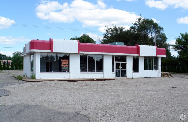
Property Detail
13393 S Us Highway 27
050-015-200-020-00
COM 1322 FT N OF W 1/4 POST SEC 15 T5NR2W TH N 200 FT E 311 FT S 200 FT W 311 FT TO POB, EXC US-27 HWY R/W.
Autorepair
Clinton
BC
Michigan
B and X Area of moderate flood hazard, usually the area between the limits of the 100-year and 500-year floods.
1.43 AC
2025
Outlying Clinton County
2026
West Michigan
010104
Lansing-East Lansing, MI
13,558 SF
NEARBY LISTINGS FOR SALE OR LEASE
DEMOGRAPHICS near 13393 S Us Highway 27
1 mile
3 mile
5 mile
2025 Total Population
3,267
17,213
42,826
2030 Population
3,310
17,368
43,333
Pop Growth 2025-2030
+ 1.32%
+ 0.90%
+ 1.18%
Average Age
43
42
40
2025 Total Households
1,290
6,759
17,665
HH Growth 2025-2030
+ 1.32%
+ 0.89%
+ 1.21%
Median Household Inc
$105,156
$108,665
$84,059
Avg Household Size
2.50
2.50
2.40
2025 Avg HH Vehicles
2.00
2.00
2.00
Median Home Value
$323,179
$322,360
$268,860
Median Year Built
1990
1985
1982
Nearby Places
Map Layers
Map Styles
 Street
 Aerial
Layers
 Traffic
 Biking
Places
Listings with unknown addresses are not visible on the map
- Restaurants
- Banks
- Shops
- Fitness
- Groceries
PUBLIC TRANSPORTATION
COMMUTER RAIL
Drive
Walk
Distance
15 min
9.7 mi
AIRPORT
Capital Region International
Drive
Walk
Distance
Capital Region International
13 min
7.7 mi
Nearby Properties
Address
Land Use
TOTAL SIZE
Lot Size
Zoning
Address
Land Use
TOTAL SIZE
Lot Size
Zoning
4,312 SF
30.47 AC
M3 COND
Address
Land Use
TOTAL SIZE
Lot Size
Zoning
5,180 SF
16.94 AC
M2
Address
Land Use
TOTAL SIZE
Lot Size
Zoning
3,252 SF
10.16 AC
M3
Address
Land Use
TOTAL SIZE
Lot Size
Zoning
2,092 SF
152.25 AC
MHP
Address
Land Use
TOTAL SIZE
Lot Size
Zoning
71,152 SF
6.23 AC
MF-N
Address
Land Use
TOTAL SIZE
Lot Size
Zoning
8,270 SF
13.15 AC
M3
Address
Land Use
TOTAL SIZE
Lot Size
Zoning
20,000 SF
25.53 AC
BC
Address
Land Use
TOTAL SIZE
Lot Size
Zoning
85,656 SF
6.42 AC
M3
Address
Land Use
TOTAL SIZE
Lot Size
Zoning
10,992 SF
10.43 AC
M3
Address
Land Use
TOTAL SIZE
Lot Size
Zoning
207,565 SF
11.50 AC
BC
Address
Land Use
TOTAL SIZE
Lot Size
Zoning
15,000 SF
44.67 AC
A/BC
Address
Land Use
TOTAL SIZE
Lot Size
Zoning
90,342 SF
8.48 AC
BSC
Address
Land Use
TOTAL SIZE
Lot Size
Zoning
34,176 SF
8.29 AC
MF
Address
Land Use
TOTAL SIZE
Lot Size
Zoning
86,211 SF
32.56 AC
BC
Address
Land Use
TOTAL SIZE
Lot Size
Zoning
39,372 SF
5.86 AC
BSC
Address
Land Use
TOTAL SIZE
Lot Size
Zoning
19,000 SF
CB
Address
Land Use
TOTAL SIZE
Lot Size
Zoning
77,880 SF
5.75 AC
M3
Address
Land Use
TOTAL SIZE
Lot Size
Zoning
22,413 SF
3.32 AC
M4
Address
Land Use
TOTAL SIZE
Lot Size
Zoning
17,490 SF
3.48 AC
BC
Address
Land Use
TOTAL SIZE
Lot Size
Zoning
5,536 SF
95.10 AC
PQ
Address
Land Use
TOTAL SIZE
Lot Size
Zoning
2,640 SF
7.20 AC
BC
Address
Land Use
TOTAL SIZE
Lot Size
Zoning
24,012 SF
2.31 AC
BC
Address
Land Use
TOTAL SIZE
Lot Size
Zoning
3,900 SF
2.75 AC
BC
Address
Land Use
TOTAL SIZE
Lot Size
Zoning
32,906 SF
4.72 AC
BC
Address
Land Use
TOTAL SIZE
Lot Size
Zoning
51,827 SF
6.61 AC
M3
Address
Land Use
TOTAL SIZE
Lot Size
Zoning
12,915 SF
0.95 AC
BL
Address
Land Use
TOTAL SIZE
Lot Size
Zoning
6,155 SF
4.19 AC
PO
Address
Land Use
TOTAL SIZE
Lot Size
Zoning
10,582 SF
1.43 AC
BC
Address
Land Use
TOTAL SIZE
Lot Size
Zoning
792 SF
70.50 AC
A
Address
Land Use
TOTAL SIZE
Lot Size
Zoning
6,144 SF
15.50 AC
BC
The World's #1 Commercial Real Estate Marketplace
Connect with us
© 2026 CoStar Group
The information above has been obtained from sources believed reliable. While we do not doubt its accuracy we have not verified it and make no guarantee, warranty or representation about it. It is your responsibility to independently confirm its accuracy and completeness. Any projections, opinions, assumptions, or estimates used are for example only and do not represent the current or future performance of the property. The value of this transaction to you depends on tax and other factors which should be evaluated by your tax, financial, and legal advisors. You and your advisors should conduct a careful, independent investigation of the property to determine to your satisfaction the suitability of the property for your needs.