Property Record
3006 N Kenwood Ave, Indianapolis, IN 46208
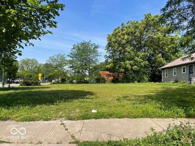
This Property Is For Sale
NEARBY LISTINGS FOR SALE OR LEASE
Property Detail
3006 N Kenwood Ave
Indianapolis-Carmel-Anderson, IN
Hyde Park Pt
49-06-26-170-015.000-101
HYDE PARK PT L18 NE COR P.O.B. S35 W90 N35 E90 TO BEG
Recreationalacreage
Marion
X
Indiana
18097C0141G
18
2023
0.07 AC
2024
Midtown
351000
Indianapolis
DEMOGRAPHICS near 3006 N Kenwood Ave
1 Mile
3 Mile
5 Mile
2024 Total Population
17,031
120,766
296,378
2029 Population
17,476
122,745
298,863
Pop Growth 2024-2029
+ 2.61%
+ 1.64%
+ 0.84%
Average Age
36
35
36
2024 Total Households
7,701
53,983
126,429
HH Growth 2024-2029
+ 2.45%
+ 1.65%
+ 0.81%
Median Household Inc
$42,745
$55,658
$54,364
Avg Household Size
2.10
2.00
2.20
2024 Avg HH Vehicles
1.00
1.00
2.00
Median Home Value
$229,098
$237,033
$195,335
Median Year Built
1947
1953
1954
Nearby Places
Map Layers
Map Styles
 Street
 Aerial
- Restaurants
- Banks
- Shops
- Fitness
- Groceries
PUBLIC TRANSPORTATION
COMMUTER RAIL
Indianapolis (Cardinal - Amtrak)
DRIVE
WALK
Distance
Indianapolis (Cardinal - Amtrak)
8 min
4.0 mi
AIRPORT
Indianapolis International
DRIVE
WALK
Distance
Indianapolis International
30 min
16.6 mi
Freight Ports
Port of Toledo
DRIVE
WALK
Distance
Port of Toledo
265 min
222.7 mi
Nearby Properties
Address
Land Use
TOTAL SIZE
Lot Size
Zoning
Address
Land Use
TOTAL SIZE
Lot Size
Zoning
23,200 SF
1.71 AC
Address
Land Use
TOTAL SIZE
Lot Size
Zoning
302,187 SF
1.97 AC
ZO01
Address
Land Use
TOTAL SIZE
Lot Size
Zoning
19,176 SF
28.36 AC
ZO01
Address
Land Use
TOTAL SIZE
Lot Size
Zoning
19,536 SF
4.05 AC
ZO01
Address
Land Use
TOTAL SIZE
Lot Size
Zoning
12,392 SF
0.99 AC
ZO01
Address
Land Use
TOTAL SIZE
Lot Size
Zoning
170,000 SF
4.05 AC
ZO01
Address
Land Use
TOTAL SIZE
Lot Size
Zoning
20,422 SF
0.42 AC
ZO01
Address
Land Use
TOTAL SIZE
Lot Size
Zoning
384,520 SF
1.93 AC
ZO01
Address
Land Use
TOTAL SIZE
Lot Size
Zoning
123,373 SF
2.14 AC
ZO01
Address
Land Use
TOTAL SIZE
Lot Size
Zoning
5,200 SF
2.43 AC
ZO01
Address
Land Use
TOTAL SIZE
Lot Size
Zoning
21,809 SF
1.57 AC
ZO01
Address
Land Use
TOTAL SIZE
Lot Size
Zoning
36,000 SF
0.94 AC
ZO01
Address
Land Use
TOTAL SIZE
Lot Size
Zoning
40,205 SF
1.58 AC
Address
Land Use
TOTAL SIZE
Lot Size
Zoning
11,775 SF
0.44 AC
ZO01
Address
Land Use
TOTAL SIZE
Lot Size
Zoning
309,006 SF
1.48 AC
ZO01
Address
Land Use
TOTAL SIZE
Lot Size
Zoning
2,674 SF
3.05 AC
ZO01
Address
Land Use
TOTAL SIZE
Lot Size
Zoning
245,608 SF
0.90 AC
Address
Land Use
TOTAL SIZE
Lot Size
Zoning
11,230 SF
0.53 AC
ZO02
Address
Land Use
TOTAL SIZE
Lot Size
Zoning
73,803 SF
0.93 AC
Address
Land Use
TOTAL SIZE
Lot Size
Zoning
179,381 SF
2.11 AC
ZO01
Address
Land Use
TOTAL SIZE
Lot Size
Zoning
17,250 SF
0.29 AC
ZO01
Address
Land Use
TOTAL SIZE
Lot Size
Zoning
4,761 SF
3.65 AC
ZO01
Address
Land Use
TOTAL SIZE
Lot Size
Zoning
176,017 SF
3.92 AC
ZO01
Address
Land Use
TOTAL SIZE
Lot Size
Zoning
271,411 SF
3 AC
ZO01
Address
Land Use
TOTAL SIZE
Lot Size
Zoning
1,260 SF
3.92 AC
ZO01
Address
Land Use
TOTAL SIZE
Lot Size
Zoning
31,920 SF
0.80 AC
Address
Land Use
TOTAL SIZE
Lot Size
Zoning
3,013 SF
10.80 AC
ZO01
Address
Land Use
TOTAL SIZE
Lot Size
Zoning
700 SF
1.50 AC
ZO01
Address
Land Use
TOTAL SIZE
Lot Size
Zoning
18,320 SF
2.05 AC
ZO01
Address
Land Use
TOTAL SIZE
Lot Size
Zoning
22,656 SF
4.05 AC
ZO01
The World's #1 Commercial Real Estate Marketplace
Connect with us
© 2025 CoStar Group
The information above has been obtained from sources believed reliable. While we do not doubt its accuracy we have not verified it and make no guarantee, warranty or representation about it. It is your responsibility to independently confirm its accuracy and completeness. Any projections, opinions, assumptions, or estimates used are for example only and do not represent the current or future performance of the property. The value of this transaction to you depends on tax and other factors which should be evaluated by your tax, financial, and legal advisors. You and your advisors should conduct a careful, independent investigation of the property to determine to your satisfaction the suitability of the property for your needs.