Property Record
134 Andrew Ln, Reno, NV 89521
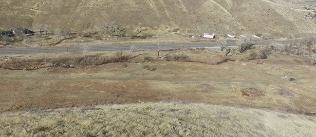

Property Detail
134 Andrew Ln
Reno, NV
PM 878 LT 4
017-430-01
Washoe
Residentialacreage
Nevada
GR
4
AE The base floodplain where base flood elevations are provided. AE Zones are now used on new format FIRMs instead of A1-A30 Zones.
35.90 AC
2025
S Outlying Washoe County
2026
Reno/Sparks
003205
NEARBY LISTINGS FOR SALE OR LEASE
DEMOGRAPHICS near 134 Andrew Ln
1 mile
3 mile
5 mile
2025 Total Population
653
11,897
45,665
2030 Population
673
12,599
47,673
Pop Growth 2025-2030
+ 3.06%
+ 5.90%
+ 4.40%
Average Age
44
43
44
2025 Total Households
230
4,613
18,172
HH Growth 2025-2030
+ 3.48%
+ 6.07%
+ 4.39%
Median Household Inc
$95,282
$88,475
$122,209
Avg Household Size
2.70
2.60
2.50
2025 Avg HH Vehicles
3.00
2.00
2.00
Median Home Value
$656,818
$714,741
$794,949
Median Year Built
1980
1998
2004
Nearby Places
Map Layers
Map Styles
 Street
 Aerial
Transit
 Traffic
 Biking
Places
Listings with unknown addresses are not visible on the map
- Restaurants
- Banks
- Shops
- Fitness
- Groceries
PUBLIC TRANSPORTATION
AIRPORT
Reno/Tahoe International
Drive
Walk
Distance
Reno/Tahoe International
34 min
14.5 mi
Freight Ports
Port of Stockton
Drive
Walk
Distance
Port of Stockton
226 min
193.7 mi
SALE & LEASE HISTORY
LISTING DATE
SALE/LEASE

Mar 28, 2018
For Sale
Nearby Properties
Address
Land Use
TOTAL SIZE
Lot Size
Zoning
Address
Land Use
TOTAL SIZE
Lot Size
Zoning
430,526 SF
14.79 AC
MS
Address
Land Use
TOTAL SIZE
Lot Size
Zoning
410,834 SF
11.58 AC
MS
Address
Land Use
TOTAL SIZE
Lot Size
Zoning
379,347 SF
18.42 AC
MS
Address
Land Use
TOTAL SIZE
Lot Size
Zoning
110,100 SF
22.88 AC
MS
Address
Land Use
TOTAL SIZE
Lot Size
Zoning
167,612 SF
7.88 AC
PD
Address
Land Use
TOTAL SIZE
Lot Size
Zoning
225,634 SF
66.85 AC
PSP
Address
Land Use
TOTAL SIZE
Lot Size
Zoning
25.52 AC
MS
Address
Land Use
TOTAL SIZE
Lot Size
Zoning
47,743 SF
7.27 AC
MS
Address
Land Use
TOTAL SIZE
Lot Size
Zoning
60,947 SF
47.04 AC
MS
Address
Land Use
TOTAL SIZE
Lot Size
Zoning
79,736 SF
1.57 AC
MS
Address
Land Use
TOTAL SIZE
Lot Size
Zoning
55,197 SF
5.50 AC
MDS 79% /
Address
Land Use
TOTAL SIZE
Lot Size
Zoning
98,588 SF
5.60 AC
GC
Address
Land Use
TOTAL SIZE
Lot Size
Zoning
497.01 AC
OS
Address
Land Use
TOTAL SIZE
Lot Size
Zoning
61,554 SF
7.74 AC
GC
Address
Land Use
TOTAL SIZE
Lot Size
Zoning
196,560 SF
10.58 AC
MS
Address
Land Use
TOTAL SIZE
Lot Size
Zoning
190,063 SF
11.94 AC
MS
Address
Land Use
TOTAL SIZE
Lot Size
Zoning
26,650 SF
2.96 AC
GC
Address
Land Use
TOTAL SIZE
Lot Size
Zoning
145,600 SF
14.06 AC
MS
Address
Land Use
TOTAL SIZE
Lot Size
Zoning
32.24 AC
MS
Address
Land Use
TOTAL SIZE
Lot Size
Zoning
275.82 AC
OS
Address
Land Use
TOTAL SIZE
Lot Size
Zoning
94,594 SF
8.30 AC
MS
Address
Land Use
TOTAL SIZE
Lot Size
Zoning
28.61 AC
PD
Address
Land Use
TOTAL SIZE
Lot Size
Zoning
21,911 SF
4.51 AC
MDS
Address
Land Use
TOTAL SIZE
Lot Size
Zoning
19,969 SF
0.65 AC
MS
Address
Land Use
TOTAL SIZE
Lot Size
Zoning
26,869 SF
4.29 AC
MS
Address
Land Use
TOTAL SIZE
Lot Size
Zoning
14.48 AC
MS
Address
Land Use
TOTAL SIZE
Lot Size
Zoning
11.66 AC
MS
Address
Land Use
TOTAL SIZE
Lot Size
Zoning
19.67 AC
MS
Address
Land Use
TOTAL SIZE
Lot Size
Zoning
16,326 SF
3.80 AC
MDS
Address
Land Use
TOTAL SIZE
Lot Size
Zoning
199.65 AC
GR
The World's #1 Commercial Real Estate Marketplace
Connect with us
© 2026 CoStar Group
The information above has been obtained from sources believed reliable. While we do not doubt its accuracy we have not verified it and make no guarantee, warranty or representation about it. It is your responsibility to independently confirm its accuracy and completeness. Any projections, opinions, assumptions, or estimates used are for example only and do not represent the current or future performance of the property. The value of this transaction to you depends on tax and other factors which should be evaluated by your tax, financial, and legal advisors. You and your advisors should conduct a careful, independent investigation of the property to determine to your satisfaction the suitability of the property for your needs.