Property Record
134 E Woodgate Dr E, Bowling Green, OH 43402


Property Detail
134 E Woodgate Dr E
B07-511-210000008000
NE SW LESS SE PT LESS 4.55A PT FOR RD & LESS 6.50A PT & LESS 6A PT
Warehouse
WOOD
B and X Area of moderate flood hazard, usually the area between the limits of the 100-year and 500-year floods.
Ohio
2025
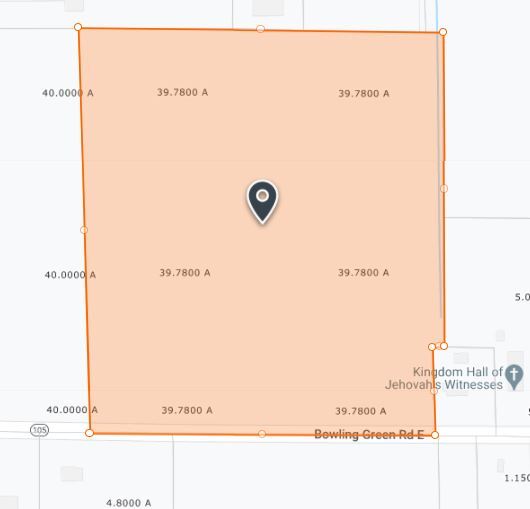
22.73 AC
2025
Perrysburg/Northwood
022500
Toledo
106,432 SF
Toledo, OH
NEARBY LISTINGS FOR SALE OR LEASE
-
-
View all Bowling Green listings for sale on LoopNet.com
DEMOGRAPHICS near 134 E Woodgate Dr E
1 mile
3 mile
5 mile
2025 Total Population
1,136
22,645
34,361
2030 Population
1,116
22,863
34,690
Pop Growth 2025-2030
(1.76%)
+ 0.96%
+ 0.96%
Average Age
33
30
34
2025 Total Households
414
8,850
13,515
HH Growth 2025-2030
(1.69%)
+ 1.28%
+ 1.18%
Median Household Inc
$52,778
$41,881
$53,373
Avg Household Size
2.40
1.90
2.10
2025 Avg HH Vehicles
2.00
2.00
2.00
Median Home Value
$278,333
$190,616
$244,194
Median Year Built
1993
1976
1979
Nearby Places
Map Layers
Map Styles
 Street
 Aerial
Layers
 Traffic
 Biking
Places
Listings with unknown addresses are not visible on the map
- Restaurants
- Banks
- Shops
- Fitness
- Groceries
PUBLIC TRANSPORTATION
AIRPORT
Eugene F Kranz Toledo Express
Drive
Walk
Distance
Eugene F Kranz Toledo Express
42 min
25.6 mi
Freight Ports
Port of Toledo
Drive
Walk
Distance
Port of Toledo
39 min
26.2 mi
SALE & LEASE HISTORY
LISTING DATE
SALE/LEASE

Nov 30, 2018
For Sale
Nearby Properties
Address
Land Use
TOTAL SIZE
Lot Size
Zoning
Address
Land Use
TOTAL SIZE
Lot Size
Zoning
4,510,710 SF
81.52 AC
Address
Land Use
TOTAL SIZE
Lot Size
Zoning
Address
Land Use
TOTAL SIZE
Lot Size
Zoning
550,847 SF
20.56 AC
Address
Land Use
TOTAL SIZE
Lot Size
Zoning
284,057 SF
38.74 AC
Address
Land Use
TOTAL SIZE
Lot Size
Zoning
250,600 SF
39.01 AC
Address
Land Use
TOTAL SIZE
Lot Size
Zoning
Address
Land Use
TOTAL SIZE
Lot Size
Zoning
17.64 AC
Address
Land Use
TOTAL SIZE
Lot Size
Zoning
429,859 SF
21.79 AC
Address
Land Use
TOTAL SIZE
Lot Size
Zoning
123,985 SF
19.30 AC
Address
Land Use
TOTAL SIZE
Lot Size
Zoning
19,404 SF
0.55 AC
Address
Land Use
TOTAL SIZE
Lot Size
Zoning
171,102 SF
2.39 AC
Address
Land Use
TOTAL SIZE
Lot Size
Zoning
88,890 SF
57.70 AC
Address
Land Use
TOTAL SIZE
Lot Size
Zoning
89,961 SF
7.90 AC
Address
Land Use
TOTAL SIZE
Lot Size
Zoning
128,630 SF
10.19 AC
Address
Land Use
TOTAL SIZE
Lot Size
Zoning
28,901 SF
11.36 AC
Address
Land Use
TOTAL SIZE
Lot Size
Zoning
201,980 SF
14.36 AC
Address
Land Use
TOTAL SIZE
Lot Size
Zoning
124,161 SF
19.35 AC
Address
Land Use
TOTAL SIZE
Lot Size
Zoning
40.10 AC
Address
Land Use
TOTAL SIZE
Lot Size
Zoning
93,336 SF
8.69 AC
Address
Land Use
TOTAL SIZE
Lot Size
Zoning
85,358 SF
17.78 AC
Address
Land Use
TOTAL SIZE
Lot Size
Zoning
136,154 SF
11.85 AC
Address
Land Use
TOTAL SIZE
Lot Size
Zoning
217,995 SF
27.23 AC
Address
Land Use
TOTAL SIZE
Lot Size
Zoning
28,269 SF
15.85 AC
Address
Land Use
TOTAL SIZE
Lot Size
Zoning
21,445 SF
12 AC
Address
Land Use
TOTAL SIZE
Lot Size
Zoning
67,848 SF
0.39 AC
Address
Land Use
TOTAL SIZE
Lot Size
Zoning
15,840 SF
0.45 AC
Address
Land Use
TOTAL SIZE
Lot Size
Zoning
90,300 SF
5.77 AC
Address
Land Use
TOTAL SIZE
Lot Size
Zoning
Address
Land Use
TOTAL SIZE
Lot Size
Zoning
182,682 SF
40 AC
The World's #1 Commercial Real Estate Marketplace
Connect with us
© 2026 CoStar Group
The information above has been obtained from sources believed reliable. While we do not doubt its accuracy we have not verified it and make no guarantee, warranty or representation about it. It is your responsibility to independently confirm its accuracy and completeness. Any projections, opinions, assumptions, or estimates used are for example only and do not represent the current or future performance of the property. The value of this transaction to you depends on tax and other factors which should be evaluated by your tax, financial, and legal advisors. You and your advisors should conduct a careful, independent investigation of the property to determine to your satisfaction the suitability of the property for your needs.