Property Record
134 Parker Dr, Beaufort, SC 29906


NEARBY LISTINGS FOR SALE OR LEASE
-
-
View all Beaufort listings for sale on LoopNet.com
Property Detail
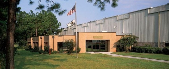
134 Parker Dr
Other Market Areas
Laurel Bay Commercial & Mixed
Hilton Head Island-Bluffton-Beaufort, SC
LOTS 30-35 SEC 21 1N2W ASSESSED BY DOR 607 00082 PRECISION TOOL CO PB27 P140 *S
R100-020-000-0158-0000
Beaufort
Manufacturinglight
South Carolina
2025
30-35
2024
27.75 AC
000200
Hilton Head/Beaufort
41,439 SF
DEMOGRAPHICS near 134 Parker Dr
1 Mile
3 Mile
5 Mile
2024 Total Population
974
10,412
25,282
2029 Population
1,076
11,292
27,755
Pop Growth 2024-2029
+ 10.47%
+ 8.45%
+ 9.78%
Average Age
35
33
36
2024 Total Households
343
3,104
8,952
HH Growth 2024-2029
+ 9.91%
+ 9.57%
+ 10.08%
Median Household Inc
$29,285
$51,172
$51,534
Avg Household Size
2.60
2.60
2.50
2024 Avg HH Vehicles
2.00
2.00
2.00
Median Home Value
$145,348
$163,741
$233,754
Median Year Built
1995
1992
1992
Nearby Places
Map Layers
Map Styles
 Street
 Aerial
- Restaurants
- Banks
- Shops
- Fitness
- Groceries
PUBLIC TRANSPORTATION
AIRPORT
Hilton Head
DRIVE
WALK
Distance
Hilton Head
54 min
39.7 mi
Freight Ports
Georgia Ports - Savannah
DRIVE
WALK
Distance
Georgia Ports - Savannah
64 min
49.2 mi
SALE & LEASE HISTORY
LISTING DATE
SALE/LEASE

Sep 25, 2016
For Lease
Sep 24, 2016
For Sale
Sep 23, 2016
For Sale
Jan 30, 2024
For Sale
Nearby Properties
Address
Land Use
TOTAL SIZE
Lot Size
Zoning
Address
Land Use
TOTAL SIZE
Lot Size
Zoning
4,613 AC
6601
Address
Land Use
TOTAL SIZE
Lot Size
Zoning
944.23 AC
6601
Address
Land Use
TOTAL SIZE
Lot Size
Zoning
60,814 SF
3 AC
Address
Land Use
TOTAL SIZE
Lot Size
Zoning
44,312 SF
1.87 AC
Address
Land Use
TOTAL SIZE
Lot Size
Zoning
71,965 SF
20 AC
6611
Address
Land Use
TOTAL SIZE
Lot Size
Zoning
64,000 SF
5.92 AC
Address
Land Use
TOTAL SIZE
Lot Size
Zoning
192 SF
368 AC
6111
Address
Land Use
TOTAL SIZE
Lot Size
Zoning
85,127 SF
35.70 AC
6611
Address
Land Use
TOTAL SIZE
Lot Size
Zoning
17,432 SF
7.15 AC
6611
Address
Land Use
TOTAL SIZE
Lot Size
Zoning
5,990 SF
2 AC
Address
Land Use
TOTAL SIZE
Lot Size
Zoning
49,216 SF
7.06 AC
6611
Address
Land Use
TOTAL SIZE
Lot Size
Zoning
9,609 SF
1.49 AC
Address
Land Use
TOTAL SIZE
Lot Size
Zoning
59,100 SF
5.13 AC
6611
Address
Land Use
TOTAL SIZE
Lot Size
Zoning
12,444 SF
2.59 AC
6611
Address
Land Use
TOTAL SIZE
Lot Size
Zoning
117.17 AC
9999
Address
Land Use
TOTAL SIZE
Lot Size
Zoning
16,002 SF
10.30 AC
6611
Address
Land Use
TOTAL SIZE
Lot Size
Zoning
4,302 SF
7.50 AC
6611
Address
Land Use
TOTAL SIZE
Lot Size
Zoning
2,358 SF
28.58 AC
Address
Land Use
TOTAL SIZE
Lot Size
Zoning
34,124 SF
8.30 AC
6611
Address
Land Use
TOTAL SIZE
Lot Size
Zoning
10,040 SF
20.53 AC
6611
Address
Land Use
TOTAL SIZE
Lot Size
Zoning
10,043 SF
3 AC
Address
Land Use
TOTAL SIZE
Lot Size
Zoning
34,450 SF
10.07 AC
6601
Address
Land Use
TOTAL SIZE
Lot Size
Zoning
2,250 SF
1.59 AC
6611
Address
Land Use
TOTAL SIZE
Lot Size
Zoning
113 SF
16.85 AC
6611
Address
Land Use
TOTAL SIZE
Lot Size
Zoning
12,000 SF
13.88 AC
6611
Address
Land Use
TOTAL SIZE
Lot Size
Zoning
64,722 SF
14.24 AC
6611
Address
Land Use
TOTAL SIZE
Lot Size
Zoning
1,104 SF
1.90 AC
6611
Address
Land Use
TOTAL SIZE
Lot Size
Zoning
8,566 SF
66.43 AC
6611
Address
Land Use
TOTAL SIZE
Lot Size
Zoning
48,960 SF
13.29 AC
6611
The World's #1 Commercial Real Estate Marketplace
Connect with us
© 2025 CoStar Group
The information above has been obtained from sources believed reliable. While we do not doubt its accuracy we have not verified it and make no guarantee, warranty or representation about it. It is your responsibility to independently confirm its accuracy and completeness. Any projections, opinions, assumptions, or estimates used are for example only and do not represent the current or future performance of the property. The value of this transaction to you depends on tax and other factors which should be evaluated by your tax, financial, and legal advisors. You and your advisors should conduct a careful, independent investigation of the property to determine to your satisfaction the suitability of the property for your needs.