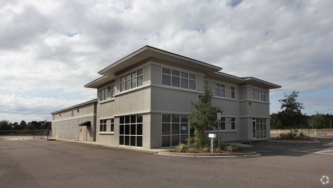
Property Record
15 Poole Blvd, Saint Augustine, FL 32095


Property Detail
15 Poole Blvd
072470-0070
2-7 PT LYING S OF INTERNATION- AL GOLF PKWY & W OF LANDFILL RD - 221.46 X 150FT & PT LYING W & SLY (EX PT IN OR6213/1039) OR2187/1314 & 2193/1524
Commercialacreage
ST. JOHNS
IW
Florida
A Areas with a 1% annual chance of flooding and a 26% chance of flooding over the life of a 30-year mortgage.
2-7
2025
1.05 AC
2026
St Johns
020904
Jacksonville (Florida)
11,060 SF
Jacksonville, FL
NEARBY LISTINGS FOR SALE OR LEASE
-
-
View all Saint Augustine listings for lease on LoopNet.com
DEMOGRAPHICS near 15 Poole Blvd
1 mile
3 mile
5 mile
2025 Total Population
1,095
13,080
26,929
2030 Population
1,261
15,193
31,629
Pop Growth 2025-2030
+ 15.16%
+ 16.15%
+ 17.45%
Average Age
43
42
44
2025 Total Households
389
4,623
10,136
HH Growth 2025-2030
+ 15.42%
+ 16.59%
+ 17.87%
Median Household Inc
$118,589
$130,677
$125,316
Avg Household Size
2.80
2.80
2.60
2025 Avg HH Vehicles
2.00
2.00
2.00
Median Home Value
$789,634
$610,389
$609,213
Median Year Built
2008
2010
2011
Nearby Places
Map Layers
Map Styles
 Street
 Aerial
Layers
 Traffic
 Biking
Places
Listings with unknown addresses are not visible on the map
- Restaurants
- Banks
- Shops
- Fitness
- Groceries
PUBLIC TRANSPORTATION
AIRPORT
Jacksonville International
Drive
Walk
Distance
Jacksonville International
57 min
42.6 mi
Freight Ports
Jacksonville Port
Drive
Walk
Distance
Jacksonville Port
46 min
31.7 mi
SALE & LEASE HISTORY
LISTING DATE
SALE/LEASE

Mar 13, 2025
For Lease
Mar 13, 2025
For Sale
Nearby Properties
Address
Land Use
TOTAL SIZE
Lot Size
Zoning
Address
Land Use
TOTAL SIZE
Lot Size
Zoning
190,574 SF
25 AC
Address
Land Use
TOTAL SIZE
Lot Size
Zoning
102,311 SF
7.21 AC
PUD
Address
Land Use
TOTAL SIZE
Lot Size
Zoning
67,311 SF
7.28 AC
PUD
Address
Land Use
TOTAL SIZE
Lot Size
Zoning
15,250 SF
22.47 AC
Address
Land Use
TOTAL SIZE
Lot Size
Zoning
Address
Land Use
TOTAL SIZE
Lot Size
Zoning
268.05 AC
Address
Land Use
TOTAL SIZE
Lot Size
Zoning
24,167 SF
12.90 AC
IW/OR
Address
Land Use
TOTAL SIZE
Lot Size
Zoning
3,356 SF
1.20 AC
Address
Land Use
TOTAL SIZE
Lot Size
Zoning
703 SF
4.41 AC
Address
Land Use
TOTAL SIZE
Lot Size
Zoning
21,579 SF
3.96 AC
PUD
Address
Land Use
TOTAL SIZE
Lot Size
Zoning
8,018 SF
5.26 AC
IW
Address
Land Use
TOTAL SIZE
Lot Size
Zoning
Address
Land Use
TOTAL SIZE
Lot Size
Zoning
19,450 SF
6 AC
IW
Address
Land Use
TOTAL SIZE
Lot Size
Zoning
27,644 SF
3.34 AC
PUD
Address
Land Use
TOTAL SIZE
Lot Size
Zoning
3,060 SF
134.21 AC
PUD
Address
Land Use
TOTAL SIZE
Lot Size
Zoning
Address
Land Use
TOTAL SIZE
Lot Size
Zoning
Address
Land Use
TOTAL SIZE
Lot Size
Zoning
14,024 SF
1.82 AC
Address
Land Use
TOTAL SIZE
Lot Size
Zoning
9,350 SF
4.92 AC
IW
Address
Land Use
TOTAL SIZE
Lot Size
Zoning
12,868 SF
1.58 AC
DRI
Address
Land Use
TOTAL SIZE
Lot Size
Zoning
33.46 AC
OR
Address
Land Use
TOTAL SIZE
Lot Size
Zoning
9,706 SF
0.69 AC
PUD
Address
Land Use
TOTAL SIZE
Lot Size
Zoning
Address
Land Use
TOTAL SIZE
Lot Size
Zoning
3.49 AC
IW
Address
Land Use
TOTAL SIZE
Lot Size
Zoning
Address
Land Use
TOTAL SIZE
Lot Size
Zoning
5,346 SF
1.92 AC
PUD
Address
Land Use
TOTAL SIZE
Lot Size
Zoning
Address
Land Use
TOTAL SIZE
Lot Size
Zoning
6,340 SF
1.88 AC
DRI
Address
Land Use
TOTAL SIZE
Lot Size
Zoning
1,544 SF
285.70 AC
OR
Address
Land Use
TOTAL SIZE
Lot Size
Zoning
3,000 SF
13.99 AC
IW
The World's #1 Commercial Real Estate Marketplace
Connect with us
© 2026 CoStar Group
The information above has been obtained from sources believed reliable. While we do not doubt its accuracy we have not verified it and make no guarantee, warranty or representation about it. It is your responsibility to independently confirm its accuracy and completeness. Any projections, opinions, assumptions, or estimates used are for example only and do not represent the current or future performance of the property. The value of this transaction to you depends on tax and other factors which should be evaluated by your tax, financial, and legal advisors. You and your advisors should conduct a careful, independent investigation of the property to determine to your satisfaction the suitability of the property for your needs.