Property Record
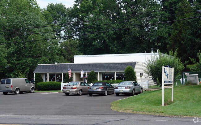
134 Us Highway 46, Hackettstown, NJ 07840


NEARBY LISTINGS FOR SALE OR LEASE
Property Detail
134 Us Highway 46
12-00011-0000-00021
INCL BLK 11 LOT 21 & BLK 6-1 LOT 13
Vacantlandnec
Warren
X
New Jersey
34041C0251E
21
2024
2.54 AC
2025
Warren County
031301
Northern New Jersey
672 SF
Allentown-Bethlehem-Easton, PA-NJ
DEMOGRAPHICS near 134 Us Highway 46
1 Mile
3 Mile
5 Mile
2024 Total Population
1,347
19,183
38,161
2029 Population
1,358
19,461
38,548
Pop Growth 2024-2029
+ 0.82%
+ 1.45%
+ 1.01%
Average Age
43
42
43
2024 Total Households
486
7,744
14,888
HH Growth 2024-2029
+ 0.82%
+ 1.65%
+ 1.21%
Median Household Inc
$89,843
$80,894
$104,034
Avg Household Size
2.70
2.40
2.50
2024 Avg HH Vehicles
3.00
2.00
2.00
Median Home Value
$369,938
$317,353
$364,204
Median Year Built
1968
1972
1980
Nearby Places
Map Layers
Map Styles
 Street
 Aerial
- Restaurants
- Banks
- Shops
- Fitness
- Groceries
PUBLIC TRANSPORTATION
COMMUTER RAIL
Hackettstown (Montclair-Boonton Line - NJ Transit Commuter Rail (NJ Transit), Morris & Essex Morristown Line - NJ Transit Commuter Rail (NJ Transit))
DRIVE
WALK
Distance
Hackettstown (Montclair-Boonton Line - NJ Transit Commuter Rail (NJ Transit), Morris & Essex Morristown Line - NJ Transit Commuter Rail (NJ Transit))
5 min
2.6 mi
Freight Ports
Maher Terminal
DRIVE
WALK
Distance
Maher Terminal
68 min
49.9 mi
Nearby Properties
Address
Land Use
TOTAL SIZE
Lot Size
Zoning
Address
Land Use
TOTAL SIZE
Lot Size
Zoning
521,918 SF
61.60 AC
LM
Address
Land Use
TOTAL SIZE
Lot Size
Zoning
16,916 SF
39.96 AC
R30
Address
Land Use
TOTAL SIZE
Lot Size
Zoning
Address
Land Use
TOTAL SIZE
Lot Size
Zoning
255,000 SF
39.57 AC
Address
Land Use
TOTAL SIZE
Lot Size
Zoning
187,660 SF
15 AC
HF
Address
Land Use
TOTAL SIZE
Lot Size
Zoning
Address
Land Use
TOTAL SIZE
Lot Size
Zoning
Address
Land Use
TOTAL SIZE
Lot Size
Zoning
24.62 AC
Address
Land Use
TOTAL SIZE
Lot Size
Zoning
1,352 SF
166.25 AC
C
Address
Land Use
TOTAL SIZE
Lot Size
Zoning
49,430 SF
5 AC
HF
Address
Land Use
TOTAL SIZE
Lot Size
Zoning
116,386 SF
33.90 AC
R125
Address
Land Use
TOTAL SIZE
Lot Size
Zoning
15,760 SF
5.47 AC
APT
Address
Land Use
TOTAL SIZE
Lot Size
Zoning
1,908 SF
6.35 AC
HC
Address
Land Use
TOTAL SIZE
Lot Size
Zoning
41,361 SF
8.86 AC
HF
Address
Land Use
TOTAL SIZE
Lot Size
Zoning
45,090 SF
4.78 AC
LM
Address
Land Use
TOTAL SIZE
Lot Size
Zoning
8,008 SF
6.94 AC
APT
Address
Land Use
TOTAL SIZE
Lot Size
Zoning
40,630 SF
14.10 AC
HF
Address
Land Use
TOTAL SIZE
Lot Size
Zoning
40,021 SF
3.40 AC
HC
Address
Land Use
TOTAL SIZE
Lot Size
Zoning
90.90 AC
R125
Address
Land Use
TOTAL SIZE
Lot Size
Zoning
27,993 SF
3.81 AC
HC
Address
Land Use
TOTAL SIZE
Lot Size
Zoning
94,420 SF
2.49 AC
R125
Address
Land Use
TOTAL SIZE
Lot Size
Zoning
1,512 SF
1.85 AC
CC
Address
Land Use
TOTAL SIZE
Lot Size
Zoning
3.20 AC
Address
Land Use
TOTAL SIZE
Lot Size
Zoning
13,488 SF
0.31 AC
APT
Address
Land Use
TOTAL SIZE
Lot Size
Zoning
38,211 SF
14.60 AC
R30
Address
Land Use
TOTAL SIZE
Lot Size
Zoning
3,600 SF
43.10 AC
LM
Address
Land Use
TOTAL SIZE
Lot Size
Zoning
8,736 SF
12.33 AC
C-2
Address
Land Use
TOTAL SIZE
Lot Size
Zoning
18,248 SF
2.78 AC
APT
Address
Land Use
TOTAL SIZE
Lot Size
Zoning
20,946 SF
4.20 AC
LM
Address
Land Use
TOTAL SIZE
Lot Size
Zoning
5,585 SF
1.81 AC
The World's #1 Commercial Real Estate Marketplace
Connect with us
© 2025 CoStar Group
The information above has been obtained from sources believed reliable. While we do not doubt its accuracy we have not verified it and make no guarantee, warranty or representation about it. It is your responsibility to independently confirm its accuracy and completeness. Any projections, opinions, assumptions, or estimates used are for example only and do not represent the current or future performance of the property. The value of this transaction to you depends on tax and other factors which should be evaluated by your tax, financial, and legal advisors. You and your advisors should conduct a careful, independent investigation of the property to determine to your satisfaction the suitability of the property for your needs.