Property Record
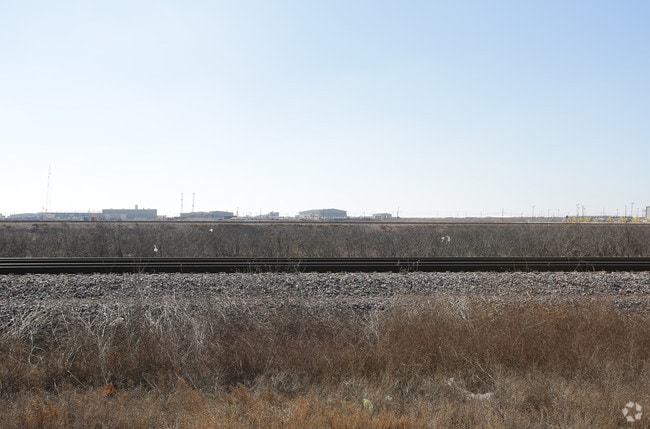
W Highway 80, Midland, TX 79706

Property Detail
W Highway 80
Midland, TX
ACRES: 9.400 SEC: 22 BLK: 41-T2S
R000203-732
MIDLAND
Realpropertynec
Texas
2025
9.40 AC
2025
Midland & Odessa
010127
Other Market Areas
NEARBY LISTINGS FOR SALE OR LEASE
-
-
View all Midland listings for sale on LoopNet.com
DEMOGRAPHICS near W Highway 80
1 mile
3 mile
5 mile
2025 Total Population
1,590
17,565
40,933
2030 Population
1,778
19,402
44,575
Pop Growth 2025-2030
+ 11.82%
+ 10.46%
+ 8.90%
Average Age
37
36
36
2025 Total Households
710
7,335
16,105
HH Growth 2025-2030
+ 13.10%
+ 11.72%
+ 10.13%
Median Household Inc
$96,976
$92,693
$85,236
Avg Household Size
2.20
2.40
2.40
2025 Avg HH Vehicles
3.00
2.00
2.00
Median Home Value
$324,100
$369,469
$321,475
Median Year Built
2002
2010
1992
Nearby Places
Map Layers
Map Styles
 Street
 Aerial
Transit
 Traffic
 Biking
Places
Listings with unknown addresses are not visible on the map
- Restaurants
- Banks
- Shops
- Fitness
- Groceries
PUBLIC TRANSPORTATION
AIRPORT
Midland International Air And Space Port
Drive
Walk
Distance
Midland International Air And Space Port
13 min
6.5 mi
Freight Ports
Port of Corpus Christi
Drive
Walk
Distance
Port of Corpus Christi
512 min
490.0 mi
SALE & LEASE HISTORY
LISTING DATE
SALE/LEASE

Jun 29, 2018
For Lease
Jul 18, 2018
For Sale
Dec 01, 2017
For Lease
Nearby Properties
Address
Land Use
TOTAL SIZE
Lot Size
Zoning
Address
Land Use
TOTAL SIZE
Lot Size
Zoning
388,320 SF
17.47 AC
Address
Land Use
TOTAL SIZE
Lot Size
Zoning
350,512 SF
15.01 AC
Address
Land Use
TOTAL SIZE
Lot Size
Zoning
531,600 SF
15.73 AC
EF8
Address
Land Use
TOTAL SIZE
Lot Size
Zoning
3,120 SF
15.08 AC
Address
Land Use
TOTAL SIZE
Lot Size
Zoning
329,854 SF
16.69 AC
EF8
Address
Land Use
TOTAL SIZE
Lot Size
Zoning
2,580 SF
13.74 AC
Address
Land Use
TOTAL SIZE
Lot Size
Zoning
2,601 SF
11 AC
Address
Land Use
TOTAL SIZE
Lot Size
Zoning
319,056 SF
11.75 AC
EF3
Address
Land Use
TOTAL SIZE
Lot Size
Zoning
102,996 SF
22.37 AC
Address
Land Use
TOTAL SIZE
Lot Size
Zoning
336,677 SF
14.14 AC
EF8
Address
Land Use
TOTAL SIZE
Lot Size
Zoning
19,527 SF
14.75 AC
EF8
Address
Land Use
TOTAL SIZE
Lot Size
Zoning
103,571 SF
23.59 AC
EF3
Address
Land Use
TOTAL SIZE
Lot Size
Zoning
3,336 SF
11.21 AC
EF5
Address
Land Use
TOTAL SIZE
Lot Size
Zoning
36,084 SF
18.99 AC
EF3
Address
Land Use
TOTAL SIZE
Lot Size
Zoning
2,688 SF
12.06 AC
EF5
Address
Land Use
TOTAL SIZE
Lot Size
Zoning
11,000 SF
72.24 AC
Address
Land Use
TOTAL SIZE
Lot Size
Zoning
2,287 SF
8.15 AC
Address
Land Use
TOTAL SIZE
Lot Size
Zoning
156,000 SF
8.68 AC
EF5
Address
Land Use
TOTAL SIZE
Lot Size
Zoning
322,000 SF
11.58 AC
Address
Land Use
TOTAL SIZE
Lot Size
Zoning
13,615 SF
22.42 AC
Address
Land Use
TOTAL SIZE
Lot Size
Zoning
69,192 SF
7.40 AC
EF8
Address
Land Use
TOTAL SIZE
Lot Size
Zoning
1,176 SF
9.55 AC
EF5
Address
Land Use
TOTAL SIZE
Lot Size
Zoning
71,412 SF
8.63 AC
EF5
Address
Land Use
TOTAL SIZE
Lot Size
Zoning
84,800 SF
40 AC
Address
Land Use
TOTAL SIZE
Lot Size
Zoning
80,884 SF
2.54 AC
EF5
Address
Land Use
TOTAL SIZE
Lot Size
Zoning
86,204 SF
2.33 AC
EF8
Address
Land Use
TOTAL SIZE
Lot Size
Zoning
23,688 SF
2.50 AC
EF8
Address
Land Use
TOTAL SIZE
Lot Size
Zoning
26,000 SF
24.55 AC
Address
Land Use
TOTAL SIZE
Lot Size
Zoning
26,703 SF
37.23 AC
Address
Land Use
TOTAL SIZE
Lot Size
Zoning
18,450 SF
19.83 AC
The World's #1 Commercial Real Estate Marketplace
Connect with us
© 2026 CoStar Group
The information above has been obtained from sources believed reliable. While we do not doubt its accuracy we have not verified it and make no guarantee, warranty or representation about it. It is your responsibility to independently confirm its accuracy and completeness. Any projections, opinions, assumptions, or estimates used are for example only and do not represent the current or future performance of the property. The value of this transaction to you depends on tax and other factors which should be evaluated by your tax, financial, and legal advisors. You and your advisors should conduct a careful, independent investigation of the property to determine to your satisfaction the suitability of the property for your needs.