Property Record
1341 Crystal Ln, Connelly Springs, NC 28612
NEARBY LISTINGS FOR SALE OR LEASE
Property Detail
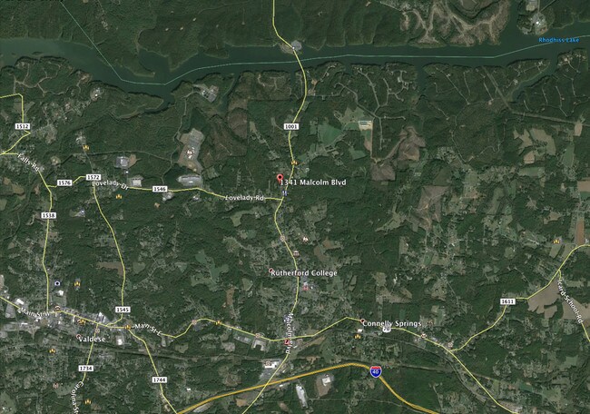
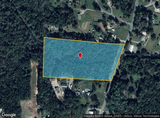
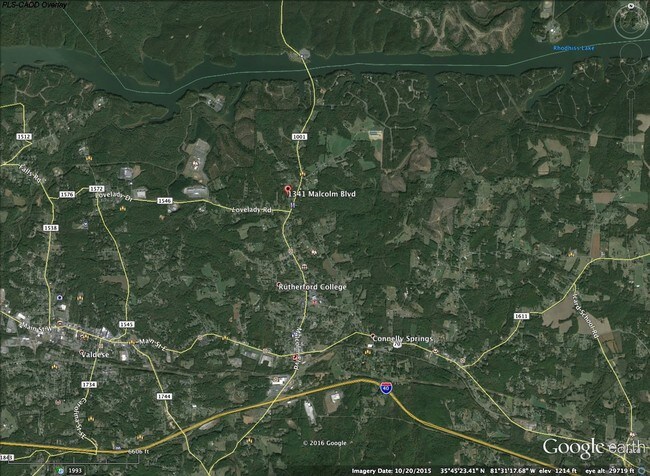
1341 Crystal Ln
Hickory-Lenoir-Morganton, NC
Janice B And Rogers S Heavner
10412
1341 CRYSTAL LN CONNELLY SPRINGS, NC 28612
Vacantlandnec
Burke
AE
North Carolina
3710275400K
9.72 AC
2025
Burke County
2025
Charlotte
021202
DEMOGRAPHICS near 1341 Crystal Ln
1 Mile
3 Mile
5 Mile
2024 Total Population
632
9,591
25,479
2029 Population
615
9,558
25,338
Pop Growth 2024-2029
(2.69%)
(0.34%)
(0.55%)
Average Age
50
46
45
2024 Total Households
235
3,946
10,479
HH Growth 2024-2029
(2.98%)
(0.35%)
(0.54%)
Median Household Inc
$67,279
$62,804
$61,004
Avg Household Size
2.40
2.40
2.40
2024 Avg HH Vehicles
2.00
2.00
2.00
Median Home Value
$215,753
$172,079
$161,385
Median Year Built
1966
1974
1978
Nearby Places
Map Layers
Map Styles
 Street
 Aerial
- Restaurants
- Banks
- Shops
- Fitness
- Groceries
SALE & LEASE HISTORY
LISTING DATE
SALE/LEASE

Feb 07, 2017
For Sale
Nearby Properties
Address
Land Use
TOTAL SIZE
Lot Size
Zoning
Address
Land Use
TOTAL SIZE
Lot Size
Zoning
GENERAL BU
Address
Land Use
TOTAL SIZE
Lot Size
Zoning
GENERAL MA
Address
Land Use
TOTAL SIZE
Lot Size
Zoning
R-12 RESID
Address
Land Use
TOTAL SIZE
Lot Size
Zoning
5,868 SF
15.83 AC
GENERAL MA
Address
Land Use
TOTAL SIZE
Lot Size
Zoning
74,326 SF
7.47 AC
Address
Land Use
TOTAL SIZE
Lot Size
Zoning
128 SF
R-12 RESID
Address
Land Use
TOTAL SIZE
Lot Size
Zoning
42,565 SF
5.10 AC
GENERAL BU
Address
Land Use
TOTAL SIZE
Lot Size
Zoning
51,742 SF
R-8 RESIDE
Address
Land Use
TOTAL SIZE
Lot Size
Zoning
1,668 SF
R-8 RESIDE
Address
Land Use
TOTAL SIZE
Lot Size
Zoning
194,159 SF
41.19 AC
GENERAL MA
Address
Land Use
TOTAL SIZE
Lot Size
Zoning
205,525 SF
11.79 AC
GENERAL MA
Address
Land Use
TOTAL SIZE
Lot Size
Zoning
7,200 SF
OFFICE-INS
Address
Land Use
TOTAL SIZE
Lot Size
Zoning
7,416 SF
RES LOW DE
Address
Land Use
TOTAL SIZE
Lot Size
Zoning
14,550 SF
1.56 AC
HIGHWAY BU
Address
Land Use
TOTAL SIZE
Lot Size
Zoning
76.07 AC
GENERAL MA
Address
Land Use
TOTAL SIZE
Lot Size
Zoning
163,919 SF
16.96 AC
GENERAL MA
Address
Land Use
TOTAL SIZE
Lot Size
Zoning
10,125 SF
1.38 AC
HIGHWAY BU
Address
Land Use
TOTAL SIZE
Lot Size
Zoning
6,576 SF
6.06 AC
R-8 RESIDE
Address
Land Use
TOTAL SIZE
Lot Size
Zoning
37,974 SF
7.27 AC
GENERAL BU
Address
Land Use
TOTAL SIZE
Lot Size
Zoning
119,915 SF
26.49 AC
GENERAL MA
Address
Land Use
TOTAL SIZE
Lot Size
Zoning
56,633 SF
17.91 AC
GENERAL MA
Address
Land Use
TOTAL SIZE
Lot Size
Zoning
13,437 SF
OFFICE-INS
Address
Land Use
TOTAL SIZE
Lot Size
Zoning
11,654 SF
OFFICE-INS
Address
Land Use
TOTAL SIZE
Lot Size
Zoning
87,061 SF
25.12 AC
GENERAL MA
Address
Land Use
TOTAL SIZE
Lot Size
Zoning
29,812 SF
R-12 RESID
Address
Land Use
TOTAL SIZE
Lot Size
Zoning
5,256 SF
4.13 AC
R-8 RESIDE
Address
Land Use
TOTAL SIZE
Lot Size
Zoning
31,872 SF
CENTRAL BU
Address
Land Use
TOTAL SIZE
Lot Size
Zoning
2,836 SF
0.80 AC
CENTRAL BU
Address
Land Use
TOTAL SIZE
Lot Size
Zoning
27,028 SF
0.88 AC
R-8 RESIDE
Address
Land Use
TOTAL SIZE
Lot Size
Zoning
22,608 SF
OFFICE-INS
The World's #1 Commercial Real Estate Marketplace
Connect with us
© 2025 CoStar Group
The information above has been obtained from sources believed reliable. While we do not doubt its accuracy we have not verified it and make no guarantee, warranty or representation about it. It is your responsibility to independently confirm its accuracy and completeness. Any projections, opinions, assumptions, or estimates used are for example only and do not represent the current or future performance of the property. The value of this transaction to you depends on tax and other factors which should be evaluated by your tax, financial, and legal advisors. You and your advisors should conduct a careful, independent investigation of the property to determine to your satisfaction the suitability of the property for your needs.