Property Record
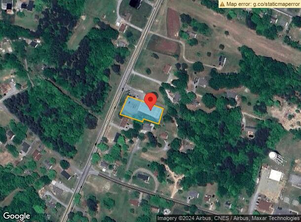
1341 N Nc Highway 49, Burlington, NC 27217


NEARBY LISTINGS FOR SALE OR LEASE
-
-
View all Burlington listings for sale on LoopNet.com
Property Detail
1341 N Nc Highway 49
154648
N NC 49 LT 2 13-21-83
Storebuilding
Alamance
X
North Carolina
3710889600K
2
2025
0.79 AC
2025
NE Alamance County
021201
Greensboro/Winston-Salem
9,012 SF
Burlington, NC
DEMOGRAPHICS near 1341 N Nc Highway 49
1 Mile
3 Mile
5 Mile
2024 Total Population
2,629
12,894
57,551
2029 Population
2,868
13,979
62,464
Pop Growth 2024-2029
+ 9.09%
+ 8.41%
+ 8.54%
Average Age
39
39
39
2024 Total Households
998
4,937
22,889
HH Growth 2024-2029
+ 9.32%
+ 8.63%
+ 8.76%
Median Household Inc
$43,269
$50,710
$48,162
Avg Household Size
2.60
2.60
2.40
2024 Avg HH Vehicles
2.00
2.00
2.00
Median Home Value
$132,056
$132,157
$155,548
Median Year Built
1983
1980
1981
Nearby Places
Map Layers
Map Styles
 Street
 Aerial
- Restaurants
- Banks
- Shops
- Fitness
- Groceries
PUBLIC TRANSPORTATION
COMMUTER RAIL
Burlington Station (Piedmont - North Carolina by Train (NC Train))
DRIVE
WALK
Distance
Burlington Station (Piedmont - North Carolina by Train (NC Train))
13 min
7.3 mi
Freight Ports
Virginia Port Authority - Richmond
DRIVE
WALK
Distance
Virginia Port Authority - Richmond
203 min
174.7 mi
SALE & LEASE HISTORY
LISTING DATE
SALE/LEASE

Jul 22, 2019
For Sale
Nearby Properties
Address
Land Use
TOTAL SIZE
Lot Size
Zoning
Address
Land Use
TOTAL SIZE
Lot Size
Zoning
33,280 SF
9.07 AC
I2
Address
Land Use
TOTAL SIZE
Lot Size
Zoning
3,534 SF
45.96 AC
Address
Land Use
TOTAL SIZE
Lot Size
Zoning
91,995 SF
25.44 AC
Address
Land Use
TOTAL SIZE
Lot Size
Zoning
41,787 SF
8.07 AC
COI
Address
Land Use
TOTAL SIZE
Lot Size
Zoning
8,970 SF
11.57 AC
I&C
Address
Land Use
TOTAL SIZE
Lot Size
Zoning
13,968 SF
10.04 AC
R 18
Address
Land Use
TOTAL SIZE
Lot Size
Zoning
213,665 SF
53.52 AC
I 2
Address
Land Use
TOTAL SIZE
Lot Size
Zoning
5,984 SF
19.75 AC
Address
Land Use
TOTAL SIZE
Lot Size
Zoning
61.79 AC
I2
Address
Land Use
TOTAL SIZE
Lot Size
Zoning
27,940 SF
4.40 AC
I 2
Address
Land Use
TOTAL SIZE
Lot Size
Zoning
74,372 SF
8.83 AC
B 2
Address
Land Use
TOTAL SIZE
Lot Size
Zoning
28,574 SF
4.89 AC
Address
Land Use
TOTAL SIZE
Lot Size
Zoning
4,626 SF
6.58 AC
RMF
Address
Land Use
TOTAL SIZE
Lot Size
Zoning
10,800 SF
6.16 AC
Address
Land Use
TOTAL SIZE
Lot Size
Zoning
80,000 SF
53.20 AC
Address
Land Use
TOTAL SIZE
Lot Size
Zoning
6,240 SF
75.65 AC
Address
Land Use
TOTAL SIZE
Lot Size
Zoning
22,690 SF
3.13 AC
R 9
Address
Land Use
TOTAL SIZE
Lot Size
Zoning
6,196 SF
5.82 AC
Address
Land Use
TOTAL SIZE
Lot Size
Zoning
2,295 SF
6.19 AC
Address
Land Use
TOTAL SIZE
Lot Size
Zoning
45,400 SF
4.32 AC
I 2B 2
Address
Land Use
TOTAL SIZE
Lot Size
Zoning
10,499 SF
1.24 AC
B 2
Address
Land Use
TOTAL SIZE
Lot Size
Zoning
3,834 SF
5 AC
R G
Address
Land Use
TOTAL SIZE
Lot Size
Zoning
3,116 SF
143.72 AC
R 18
Address
Land Use
TOTAL SIZE
Lot Size
Zoning
3,700 SF
3.72 AC
R 40
Address
Land Use
TOTAL SIZE
Lot Size
Zoning
2,566 SF
0.94 AC
B 2
Address
Land Use
TOTAL SIZE
Lot Size
Zoning
11,898 SF
23.62 AC
Address
Land Use
TOTAL SIZE
Lot Size
Zoning
16,000 SF
2.45 AC
B 2 MF
Address
Land Use
TOTAL SIZE
Lot Size
Zoning
2,000 SF
15.64 AC
Address
Land Use
TOTAL SIZE
Lot Size
Zoning
34,304 SF
2.73 AC
B 1
Address
Land Use
TOTAL SIZE
Lot Size
Zoning
612 SF
1.89 AC
B 2
The World's #1 Commercial Real Estate Marketplace
Connect with us
© 2026 CoStar Group
The information above has been obtained from sources believed reliable. While we do not doubt its accuracy we have not verified it and make no guarantee, warranty or representation about it. It is your responsibility to independently confirm its accuracy and completeness. Any projections, opinions, assumptions, or estimates used are for example only and do not represent the current or future performance of the property. The value of this transaction to you depends on tax and other factors which should be evaluated by your tax, financial, and legal advisors. You and your advisors should conduct a careful, independent investigation of the property to determine to your satisfaction the suitability of the property for your needs.