Property Record
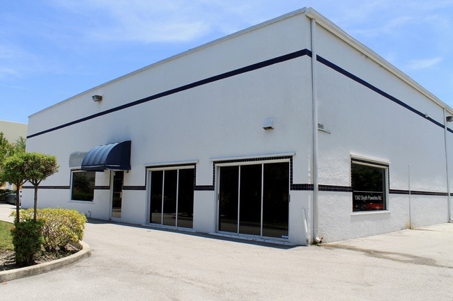
1342 S Powerline Rd, Deerfield Beach, FL 33442


Property Detail
1342 S Powerline Rd
48-42-10-12-0020
AUGIEVILLE 136-18 B POR OF TR A DESC AS:THE W 163 OF SAID TR A,LESS N 209.60 THEREOF
Warehouse
Broward
I
Florida
AH Areas with a 1% annual chance of shallow flooding, usually in the form of a pond, withan average depth ranging from 1 to 3 feet. These areas have a 26% chance of flooding over the life of a 30-year mortgage.
0.60 AC
2025
Northeast Broward
2026
South Florida
010407
Fort Lauderdale-Pompano Beach-Sunrise, FL
9,188 SF
NEARBY LISTINGS FOR SALE OR LEASE
DEMOGRAPHICS near 1342 S Powerline Rd
1 mile
3 mile
5 mile
2025 Total Population
12,609
132,740
373,090
2030 Population
13,571
140,454
395,495
Pop Growth 2025-2030
+ 7.63%
+ 5.81%
+ 6.01%
Average Age
51
44
43
2025 Total Households
6,240
55,934
152,287
HH Growth 2025-2030
+ 8.51%
+ 6.02%
+ 6.04%
Median Household Inc
$55,756
$64,110
$72,715
Avg Household Size
2.00
2.20
2.30
2025 Avg HH Vehicles
1.00
2.00
2.00
Median Home Value
$215,949
$347,877
$433,789
Median Year Built
1979
1983
1981
Nearby Places
Map Layers
Map Styles
 Street
 Aerial
Transit
 Traffic
 Biking
Places
Listings with unknown addresses are not visible on the map
- Restaurants
- Banks
- Shops
- Fitness
- Groceries
PUBLIC TRANSPORTATION
COMMUTER RAIL
Deerfield Beach (Tri-County Commuter - South Florida Regional Transportation Authority (Tri-Rail))
Drive
Walk
Distance
Deerfield Beach (Tri-County Commuter - South Florida Regional Transportation Authority (Tri-Rail))
7 min
3.3 mi
Pompano Beach (Tri-County Commuter - South Florida Regional Transportation Authority (Tri-Rail))
Drive
Walk
Distance
Pompano Beach (Tri-County Commuter - South Florida Regional Transportation Authority (Tri-Rail))
8 min
3.6 mi
AIRPORT
Fort Lauderdale/Hollywood International
Drive
Walk
Distance
Fort Lauderdale/Hollywood International
30 min
21.5 mi
Palm Beach International
Drive
Walk
Distance
Palm Beach International
43 min
32.3 mi
Miami International
Drive
Walk
Distance
Miami International
63 min
50.0 mi
Freight Ports
Port Everglades
Drive
Walk
Distance
Port Everglades
28 min
20.5 mi
SALE & LEASE HISTORY
LISTING DATE
SALE/LEASE

Sep 24, 2016
For Sale
Sep 24, 2016
For Sale
Nearby Properties
Address
Land Use
TOTAL SIZE
Lot Size
Zoning
Address
Land Use
TOTAL SIZE
Lot Size
Zoning
605,126 SF
39.63 AC
I
Address
Land Use
TOTAL SIZE
Lot Size
Zoning
680,226 SF
42.13 AC
RM-15
Address
Land Use
TOTAL SIZE
Lot Size
Zoning
696,020 SF
31.74 AC
OPC
Address
Land Use
TOTAL SIZE
Lot Size
Zoning
823,639 SF
60.73 AC
PID
Address
Land Use
TOTAL SIZE
Lot Size
Zoning
1,166,083 SF
74.07 AC
I
Address
Land Use
TOTAL SIZE
Lot Size
Zoning
32,538 SF
331.51 AC
P
Address
Land Use
TOTAL SIZE
Lot Size
Zoning
405,715 SF
20.11 AC
PUD
Address
Land Use
TOTAL SIZE
Lot Size
Zoning
396,020 SF
70.57 AC
A-1
Address
Land Use
TOTAL SIZE
Lot Size
Zoning
377,588 SF
44.94 AC
RM-10
Address
Land Use
TOTAL SIZE
Lot Size
Zoning
390,795 SF
16.83 AC
PUD
Address
Land Use
TOTAL SIZE
Lot Size
Zoning
340,604 SF
31.31 AC
B-2
Address
Land Use
TOTAL SIZE
Lot Size
Zoning
246,122 SF
6.92 AC
TOD
Address
Land Use
TOTAL SIZE
Lot Size
Zoning
272,750 SF
19.59 AC
AR
Address
Land Use
TOTAL SIZE
Lot Size
Zoning
533,078 SF
14.83 AC
RS
Address
Land Use
TOTAL SIZE
Lot Size
Zoning
307,641 SF
20 AC
PUD
Address
Land Use
TOTAL SIZE
Lot Size
Zoning
311,680 SF
15.84 AC
PUD
Address
Land Use
TOTAL SIZE
Lot Size
Zoning
447,948 SF
20.33 AC
RS
Address
Land Use
TOTAL SIZE
Lot Size
Zoning
440,709 SF
22.39 AC
I
Address
Land Use
TOTAL SIZE
Lot Size
Zoning
374,776 SF
23.52 AC
I-1
Address
Land Use
TOTAL SIZE
Lot Size
Zoning
384,131 SF
17.84 AC
PMDD
Address
Land Use
TOTAL SIZE
Lot Size
Zoning
435,201 SF
23.78 AC
I-1
Address
Land Use
TOTAL SIZE
Lot Size
Zoning
283,330 SF
27.02 AC
I-1/PCI
Address
Land Use
TOTAL SIZE
Lot Size
Zoning
269,508 SF
38.46 AC
A-1
Address
Land Use
TOTAL SIZE
Lot Size
Zoning
206,194 SF
20.06 AC
RM-10
Address
Land Use
TOTAL SIZE
Lot Size
Zoning
313,030 SF
37.22 AC
CF
Address
Land Use
TOTAL SIZE
Lot Size
Zoning
214,164 SF
11.31 AC
PUD
Address
Land Use
TOTAL SIZE
Lot Size
Zoning
224,769 SF
15.48 AC
I-1
Address
Land Use
TOTAL SIZE
Lot Size
Zoning
248,274 SF
13.10 AC
RM-20
Address
Land Use
TOTAL SIZE
Lot Size
Zoning
249,657 SF
17.49 AC
I-1/PCD
Address
Land Use
TOTAL SIZE
Lot Size
Zoning
260,464 SF
14.82 AC
PUD
The World's #1 Commercial Real Estate Marketplace
Connect with us
© 2026 CoStar Group
The information above has been obtained from sources believed reliable. While we do not doubt its accuracy we have not verified it and make no guarantee, warranty or representation about it. It is your responsibility to independently confirm its accuracy and completeness. Any projections, opinions, assumptions, or estimates used are for example only and do not represent the current or future performance of the property. The value of this transaction to you depends on tax and other factors which should be evaluated by your tax, financial, and legal advisors. You and your advisors should conduct a careful, independent investigation of the property to determine to your satisfaction the suitability of the property for your needs.