Property Record
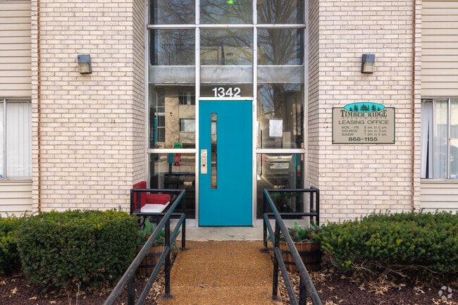
1342 N Garden Dr, Saint Louis, MO 63138


NEARBY LISTINGS FOR SALE OR LEASE
Property Detail
1342 N Garden Dr
St. Louis, MO-IL
North Gardens Apartments
10E-53-0073
St. Louis
Condominium
Missouri
X
0.88 AC
29183C0350G
Spanish Lake
6,336 SF
St. Louis
DEMOGRAPHICS near 1342 N Garden Dr
1 Mile
3 Mile
5 Mile
2024 Total Population
8,570
64,100
135,507
2029 Population
8,583
64,017
134,703
Pop Growth 2024-2029
+ 0.15%
(0.13%)
(0.59%)
Average Age
36
38
39
2024 Total Households
3,442
24,815
54,285
HH Growth 2024-2029
+ 0.23%
(0.21%)
(0.68%)
Median Household Inc
$38,629
$44,669
$43,232
Avg Household Size
2.40
2.50
2.40
2024 Avg HH Vehicles
1.00
2.00
1.00
Median Home Value
$96,570
$105,092
$106,857
Median Year Built
1966
1964
1962
Nearby Places
Map Layers
Map Styles
 Street
 Aerial
- Restaurants
- Banks
- Shops
- Fitness
- Groceries
PUBLIC TRANSPORTATION
COMMUTER RAIL
Um St. Louis North (Lambert Airport Shiloh-Scott - St. Louis MetroLink (MetroLink))
DRIVE
WALK
Distance
Um St. Louis North (Lambert Airport Shiloh-Scott - St. Louis MetroLink (MetroLink))
17 min
9.4 mi
AIRPORT
St Louis Lambert International
DRIVE
WALK
Distance
St Louis Lambert International
15 min
9.6 mi
Scott AFB/Midamerica St Louis
DRIVE
WALK
Distance
Scott AFB/Midamerica St Louis
55 min
34.9 mi
Freight Ports
Port Milwaukee
DRIVE
WALK
Distance
Port Milwaukee
416 min
367.7 mi
SALE & LEASE HISTORY
LISTING DATE
SALE/LEASE

Jun 09, 2023
For Sale
Nearby Properties
Address
Land Use
TOTAL SIZE
Lot Size
Zoning
Address
Land Use
TOTAL SIZE
Lot Size
Zoning
1,925 SF
21.27 AC
C-8
Address
Land Use
TOTAL SIZE
Lot Size
Zoning
75.13 AC
R3
Address
Land Use
TOTAL SIZE
Lot Size
Zoning
205,268 SF
36.09 AC
88R-1
Address
Land Use
TOTAL SIZE
Lot Size
Zoning
48.23 AC
R3
Address
Land Use
TOTAL SIZE
Lot Size
Zoning
643,294 SF
32.09 AC
R7
Address
Land Use
TOTAL SIZE
Lot Size
Zoning
39.86 AC
A
Address
Land Use
TOTAL SIZE
Lot Size
Zoning
293,117 SF
26 AC
R3
Address
Land Use
TOTAL SIZE
Lot Size
Zoning
58,818 SF
8.02 AC
22C-1
Address
Land Use
TOTAL SIZE
Lot Size
Zoning
47,184 SF
119.33 AC
PS
Address
Land Use
TOTAL SIZE
Lot Size
Zoning
77,616 SF
10.56 AC
C-8
Address
Land Use
TOTAL SIZE
Lot Size
Zoning
148,974 SF
17.04 AC
C-8
Address
Land Use
TOTAL SIZE
Lot Size
Zoning
20.62 AC
R3
Address
Land Use
TOTAL SIZE
Lot Size
Zoning
18.86 AC
R3
Address
Land Use
TOTAL SIZE
Lot Size
Zoning
218,822 SF
15.94 AC
R6
Address
Land Use
TOTAL SIZE
Lot Size
Zoning
10,362 SF
19.03 AC
81R-2
Address
Land Use
TOTAL SIZE
Lot Size
Zoning
179,262 SF
9.58 AC
R2
Address
Land Use
TOTAL SIZE
Lot Size
Zoning
92,740 SF
27.63 AC
NU
Address
Land Use
TOTAL SIZE
Lot Size
Zoning
10 AC
R3
Address
Land Use
TOTAL SIZE
Lot Size
Zoning
120.20 AC
PS
Address
Land Use
TOTAL SIZE
Lot Size
Zoning
64,372 SF
4.95 AC
C-8
Address
Land Use
TOTAL SIZE
Lot Size
Zoning
8.66 AC
R3
Address
Land Use
TOTAL SIZE
Lot Size
Zoning
10.24 AC
R-4
Address
Land Use
TOTAL SIZE
Lot Size
Zoning
3,256 SF
38.63 AC
88R-3
Address
Land Use
TOTAL SIZE
Lot Size
Zoning
217,644 SF
12.07 AC
R6
Address
Land Use
TOTAL SIZE
Lot Size
Zoning
30.81 AC
R3
Address
Land Use
TOTAL SIZE
Lot Size
Zoning
31,800 SF
17.34 AC
C-8
Address
Land Use
TOTAL SIZE
Lot Size
Zoning
8.64 AC
R-4
Address
Land Use
TOTAL SIZE
Lot Size
Zoning
90,985 SF
7.77 AC
C-8
Address
Land Use
TOTAL SIZE
Lot Size
Zoning
171,193 SF
11.63 AC
R6
Address
Land Use
TOTAL SIZE
Lot Size
Zoning
111,847 SF
10.71 AC
22C-1
The World's #1 Commercial Real Estate Marketplace
Connect with us
© 2026 CoStar Group
The information above has been obtained from sources believed reliable. While we do not doubt its accuracy we have not verified it and make no guarantee, warranty or representation about it. It is your responsibility to independently confirm its accuracy and completeness. Any projections, opinions, assumptions, or estimates used are for example only and do not represent the current or future performance of the property. The value of this transaction to you depends on tax and other factors which should be evaluated by your tax, financial, and legal advisors. You and your advisors should conduct a careful, independent investigation of the property to determine to your satisfaction the suitability of the property for your needs.