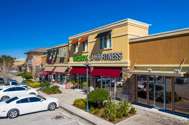
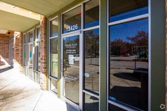
Property Record
13420 Boyette Rd, Lithia, FL 33547

Save to a Folder
{{folder.Name}}
{{folder.ListingIds.length}} Properties
{{folder.ListingIds.length}} Property
Create a New Folder
Property Detail
13420 Boyette Rd
U-24-30-20-A3G-000000-00002.0
RIVER SPRINGS LOTS 1 AND 2
Stripcommercialcenter
HILLSBOROUGH
PD
Florida
B and X Area of moderate flood hazard, usually the area between the limits of the 100-year and 500-year floods.
2
2024
11.30 AC
2025
Eastern Outlying
013926
Tampa/St Petersburg
60,984 SF
Tampa-St. Petersburg-Clearwater, FL
NEARBY LISTINGS FOR SALE OR LEASE
DEMOGRAPHICS near 13420 Boyette Rd
1 mile
3 mile
5 mile
2025 Total Population
7,865
60,910
184,471
2030 Population
8,443
65,627
199,012
Pop Growth 2025-2030
+ 7.35%
+ 7.74%
+ 7.88%
Average Age
38
39
39
2025 Total Households
2,451
20,288
63,132
HH Growth 2025-2030
+ 7.51%
+ 7.86%
+ 8.01%
Median Household Inc
$115,492
$112,095
$105,374
Avg Household Size
3.20
3.00
2.90
2025 Avg HH Vehicles
2.00
2.00
2.00
Median Home Value
$471,044
$451,096
$430,577
Median Year Built
2003
1999
2002
Nearby Places
Map Layers
Map Styles
 Street
 Aerial
Layers
 Traffic
 Biking
Places
Listings with unknown addresses are not visible on the map
- Restaurants
- Banks
- Shops
- Fitness
- Groceries
PUBLIC TRANSPORTATION
AIRPORT
Tampa International
Drive
Walk
Distance
Tampa International
41 min
25.5 mi
St Pete-Clearwater International
Drive
Walk
Distance
St Pete-Clearwater International
58 min
34.8 mi
Freight Ports
Port of Tampa Bay
Drive
Walk
Distance
Port of Tampa Bay
28 min
15.5 mi
SALE & LEASE HISTORY
LISTING DATE
SALE/LEASE

Sep 25, 2016
For Lease
Sep 25, 2016
For Lease
Sep 19, 2018
For Lease
Aug 16, 2017
For Lease
Nearby Properties
Address
Land Use
TOTAL SIZE
Lot Size
Zoning
Address
Land Use
TOTAL SIZE
Lot Size
Zoning
361,294 SF
10.35 AC
PD
Address
Land Use
TOTAL SIZE
Lot Size
Zoning
231,811 SF
26.54 AC
PD
Address
Land Use
TOTAL SIZE
Lot Size
Zoning
289,109 SF
75.56 AC
AR
Address
Land Use
TOTAL SIZE
Lot Size
Zoning
182,688 SF
14.69 AC
PD
Address
Land Use
TOTAL SIZE
Lot Size
Zoning
190,080 SF
22.45 AC
PD
Address
Land Use
TOTAL SIZE
Lot Size
Zoning
113,134 SF
7.96 AC
PD
Address
Land Use
TOTAL SIZE
Lot Size
Zoning
870.14 AC
AR
Address
Land Use
TOTAL SIZE
Lot Size
Zoning
190.14 AC
PD
Address
Land Use
TOTAL SIZE
Lot Size
Zoning
73,541 SF
10.22 AC
AR
Address
Land Use
TOTAL SIZE
Lot Size
Zoning
57,438 SF
12.28 AC
PD
Address
Land Use
TOTAL SIZE
Lot Size
Zoning
163,701 SF
87.66 AC
PD
Address
Land Use
TOTAL SIZE
Lot Size
Zoning
97,039 SF
35.42 AC
PD
Address
Land Use
TOTAL SIZE
Lot Size
Zoning
104,130 SF
19.71 AC
PD
Address
Land Use
TOTAL SIZE
Lot Size
Zoning
96,158 SF
11.98 AC
PD
Address
Land Use
TOTAL SIZE
Lot Size
Zoning
110,461 SF
5.72 AC
PD
Address
Land Use
TOTAL SIZE
Lot Size
Zoning
61,120 SF
7.10 AC
PD
Address
Land Use
TOTAL SIZE
Lot Size
Zoning
97,587 SF
24.06 AC
PD
Address
Land Use
TOTAL SIZE
Lot Size
Zoning
89,725 SF
23.64 AC
PD
Address
Land Use
TOTAL SIZE
Lot Size
Zoning
82,340 SF
11.12 AC
PD
Address
Land Use
TOTAL SIZE
Lot Size
Zoning
69,591 SF
38.33 AC
PD
Address
Land Use
TOTAL SIZE
Lot Size
Zoning
71,818 SF
13.94 AC
PD
Address
Land Use
TOTAL SIZE
Lot Size
Zoning
68,422 SF
9.14 AC
PD
Address
Land Use
TOTAL SIZE
Lot Size
Zoning
76,308 SF
5.80 AC
PD
Address
Land Use
TOTAL SIZE
Lot Size
Zoning
36,254 SF
3.48 AC
PD
Address
Land Use
TOTAL SIZE
Lot Size
Zoning
54,698 SF
7.30 AC
PD
Address
Land Use
TOTAL SIZE
Lot Size
Zoning
93,043 SF
9.46 AC
PD
Address
Land Use
TOTAL SIZE
Lot Size
Zoning
73,245 SF
4.37 AC
PD
Address
Land Use
TOTAL SIZE
Lot Size
Zoning
33,867 SF
5.56 AC
PD
Address
Land Use
TOTAL SIZE
Lot Size
Zoning
63,107 SF
4.36 AC
PD
The World's #1 Commercial Real Estate Marketplace
Connect with us
© 2026 CoStar Group
The information above has been obtained from sources believed reliable. While we do not doubt its accuracy we have not verified it and make no guarantee, warranty or representation about it. It is your responsibility to independently confirm its accuracy and completeness. Any projections, opinions, assumptions, or estimates used are for example only and do not represent the current or future performance of the property. The value of this transaction to you depends on tax and other factors which should be evaluated by your tax, financial, and legal advisors. You and your advisors should conduct a careful, independent investigation of the property to determine to your satisfaction the suitability of the property for your needs.